Old Street (stacja kolejowa)
 Peron kolejowy w kierunku północnym | |
| Państwo | |
|---|---|
| Miejscowość | |
| Lokalizacja | |
| Zarządca | |
| Dane techniczne | |
| Liczba peronów | 4 |
| Linie kolejowe | |
| |
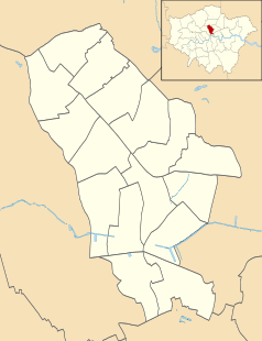
Położenie na mapie gminy Islington Contains Ordnance Survey data © Crown copyright and database right, CC BY-SA 3.0 | |
Położenie na mapie Wielkiej Brytanii (c) Karte: NordNordWest, Lizenz: Creative Commons by-sa-3.0 de | |
Położenie na mapie Wielkiego Londynu Contains Ordnance Survey data © Crown copyright and database right, CC BY-SA 3.0 | |
| Portal | |
Old Street – podziemna stacja kolejowa położona w dzielnicy Islington w Londynie. Powstała w 1901 jako stacja metra[1], w 1904 włączono ją również do sieci kolejowej. Leży na trasie linii metra Northern Line oraz linii kolejowej Northern City Line, aktualnie obsługiwanej przez przewoźnika First Capital Connect[2][3]. Rocznie korzysta z niej ok. 20 mln pasażerów, w tym ok. 19,2 mln z części obsługiwanej przez metro[4] i ok. 828 tysięcy z części kolejowej[5]. W systemie londyńskiej komunikacji miejskiej, należy do pierwszej strefy biletowej[6].
Przypisy
- ↑ Northern Line w serwisie Clive's UndergrounD Line Guides [dostęp 2010-11-26]
- ↑ Old Street w bazie National Rail [dostęp 2010-11-26]
- ↑ Schemat sieci First Capital Connect. firstcapitalconnect.co.uk. [zarchiwizowane z tego adresu (2014-10-08)]. [dostęp 2010-11-26]
- ↑ Statystyki Transport for London [dostęp 2010-11-26]
- ↑ Statystyki Office of Rail Regulation. orr.gov.uk. [zarchiwizowane z tego adresu (2019-12-12)]. [dostęp 2010-11-26]
- ↑ Lista stacji i stref biletowych metra londyńskiego [dostęp 2010-11-26]
| Old Street | ||
| Linia Northern City Line | ||
Media użyte na tej stronie
(c) Karte: NordNordWest, Lizenz: Creative Commons by-sa-3.0 de
Location map of the United Kingdom
head station, track to the left
head station, track to the left
Straight line aqross (according to naming convention, name + modifier)
station at track aqross
head station, track to the right
head station, track to the right
Autor: Sunil060902, Licencja: CC-BY-SA-3.0
Old Street station Great Northern (First Capital Connect) northbound platform looking north. Ahead can be seen the large 16 ft (mainline) diameter tube tunnel built between Moorgate and Finsbury Park in 1904.
Contains Ordnance Survey data © Crown copyright and database right, CC BY-SA 3.0
Blank map of the London Borough of Islington, showing electoral wards.
Equirectangular map projection on WGS 84 datum, with N/S stretched 160%
Geographic limits:
- West: 0.15W
- East: 0.07W
- North: 51.58N
- South: 51.515N
Contains Ordnance Survey data © Crown copyright and database right, CC BY-SA 3.0
Map of Greater London, UK with the following information shown:
- Administrative borders
- Coastline, lakes and rivers
- Roads and railways
- Urban areas
The data includes both primary routes and railway lines.
Equirectangular map projection on WGS 84 datum, with N/S stretched 160%
Geographic limits:
- West: 0.57W
- East: 0.37E
- North: 51.72N
- South: 51.25N


