Oldambt
 | |||||
| Państwo | |||||
|---|---|---|---|---|---|
| Prowincja | Groningen | ||||
| Burmistrz | Cora-Yfke Sikkema↗ | ||||
| Powierzchnia | 295,96 km² | ||||
| Populacja • liczba ludności | 39 452 | ||||
| Kod pocztowy | 9670–9682 | ||||
| Strona internetowa | |||||
Oldambt – gmina w Holandii, w prowincji Groningen, powstała po połączeniu gmin Reiderland, Scheemda oraz Winschoten.
Gmina składa się z 8 miejscowości: Blauwestad, Bad Nieuweschans, Beerta, Drieborg, Finsterwolde, Nieuw-Beerta, Heiligerlee, Midwolda, Nieuw Scheemda, Nieuwolda, Oostwold, Westerlee oraz Winschoten.
Bibliografia
- Ad van der Meer, Onno Boonstra: Repertorium van Nederlandse gemeenten vanaf 1812 waaraan toegevoegd de Amsterdamse code.. 2011. ISBN 90-6984-501-6. [dostęp 2015-12-12].
- [1]
Przypisy
Media użyte na tej stronie
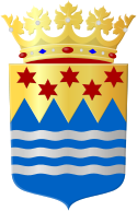
COA of the Dutch municipality of Oldambt.
Flag of the Province of Groningen, Netherlands. See for a photo of the flag. For colour conversions for Pantone were used coated instead of uncoated colours. The chart used was Commons:Pantone color chart.
Autor: Hardscarf, Licencja: CC BY-SA 3.0
Ennemaborg (schuin van achteren) aan de Hoofdweg 96 van Midwolda (Groningen, Nederland).
Flag of the Dutch municipality of Oldambt
Autor: Erik Frohne, Licencja: CC BY-SA 3.0
Location map of province Groningen in the Netherlands
Equirectangular projection, N/S stretching 167 %. Geographic limits of the map:
- N: 53.60° N
- S: 52.80° N
- W: 6.10° E
- E: 7.30° E


