Oldenzaal
 | |||||
| Państwo | |||||
|---|---|---|---|---|---|
| Prowincja | |||||
| Burmistrz | Theo Schouten (2014)[1] | ||||
| Powierzchnia | 21,98 km² | ||||
| Populacja (2012) • liczba ludności • gęstość | 32 600 1483 os./km² | ||||
| Nr kierunkowy | 053 | ||||
| Kod pocztowy | 7570 | ||||
 | |||||
| Strona internetowa | |||||
Oldenzaal – miasto we wschodniej Holandii, w prowincji Overijssel. Według danych na dzień 2012 liczy 32 600 mieszkańców.
Przypisy
- ↑ oldenzaal.nl: Samenstelling (niderl.). [dostęp 2014-07-26].
Media użyte na tej stronie
Hanseatic Flag
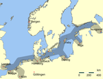
Main trading routes of the Hanseatic League in northern Europe.
Autor: Tatiana Yagunova / Татьяна Ягунова, Licencja: CC BY-SA 4.0
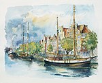
Lubeka (Akwarela Tatiany Yagunovej) — główne miejsce Ligi Hanzeatyckiej. Związek Hanzeatycki — organizację kupiecką pod kierownictwem doświadczonego racjonalnego ośrodka kupieckiego — Wolnego Miasta Lubeki. Opublikowano:
- Nikolay Yagunov, Tatiana Yagunova. Hanza po wiekach. Niemcy. Polska. Rosja. Litwa: album fotografii = Hanse centuries later. Germany. Poland. Russia. Lithuania: the album of photos. — Kaliningrad: Drukarina Bernardinum, 2014. — Pierwszy album.— 208 s. — 2000 egz. — ISBN 978-83-7823-473-9. — S.1 (tytuł książki).
Flag of the Dutch municipality of Oldenzaal
Autor: Erik Frohne, Licencja: CC BY-SA 3.0
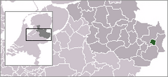
Location map of province Overijssel in the Netherlands
Equirectangular projection, N/S stretching 164 %. Geographic limits of the map:
- N: 52.90° N
- S: 52.00° N
- W: 5.70° E
- E: 7.10° E
Coat of arms of the Dutch municipality of Oldenzaal.
Autor: Simpleness, Licencja: CC BY-SA 2.5
Oldenzaal:
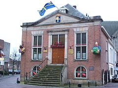
Old town hall of Oldenzaal


