Oldham
(c) Stanley Walker, CC BY-SA 2.0 Neoklasycystyczny Stary Ratusz w Oldham | |||
| |||
| Państwo | |||
|---|---|---|---|
| Kraj | |||
| Region | |||
| Hrabstwo ceremonialne | |||
| Unitary authority | |||
| Populacja (2001) • liczba ludności |
| ||
| Nr kierunkowy | 0161 | ||
 | |||
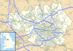
Położenie na mapie Wielkiego Manchesteru Contains Ordnance Survey data © Crown copyright and database right, CC BY-SA 3.0 | |||
Położenie na mapie Wielkiej Brytanii (c) Karte: NordNordWest, Lizenz: Creative Commons by-sa-3.0 de | |||
| Portal | |||
Oldham – miasto w północno-zachodniej Anglii, w hrabstwie Wielki Manchester, położone na północno-wschodnim skraju konurbacji Manchesteru. Ośrodek administracyjny dystryktu metropolitalnego o tej samej nazwie. W 2001 roku miasto liczyło 103 544 mieszkańców[1] Miasto zamieszkane jest przez liczącą około 26 tysięcy ludzi mniejszość azjatycką, zwłaszcza z Bangladeszu, Pakistanu i Indii. Pierwsze wzmianki o mieście pochodzą z XI wieku. W mieście ważną rolę odgrywa przemysł tekstylny. Oldham położone jest około 5 kilometrów od autostrady krajowej M62. Obecnie w mieście funkcjonują dwie stacje kolejowe. Miasto jest połączone z siecią tramwajową Metrolink, obsługującą transport publiczny w konurbacji Manchesteru.
W mieście rozwinął się przemysł maszynowy, elektroniczny, metalowy oraz włókienniczy[2].
Zobacz też
- Oldham Werneth - przystanek kolejowy
Miasta partnerskie
Przypisy
- ↑ KS01 Usual resident population: Census 2001, Key Statistics for urban areas (ang.). Office for National Statistics. [dostęp 2015-12-15]. [zarchiwizowane z tego adresu (2004-07-23)].
- ↑ Oldham, [w:] Encyklopedia PWN [online] [dostęp 2021-08-03].
Media użyte na tej stronie
(c) Karte: NordNordWest, Lizenz: Creative Commons by-sa-3.0 de
Location map of the United Kingdom
Flag of England. Saint George's cross (a red cross on a white background), used as the Flag of England, the Italian city of Genoa and various other places.
Contains Ordnance Survey data © Crown copyright and database right, CC BY-SA 3.0
Map of Greater Manchester, UK with the following information shown:
- Administrative borders
- Coastline, lakes and rivers
- Roads and railways
- Urban areas
The data includes both primary routes and railway lines.
Equirectangular map projection on WGS 84 datum, with N/S stretched 165%
Geographic limits:
- West: 2.80W
- East: 1.90W
- North: 53.70N
- South: 53.32N
(c) Stanley Walker, CC BY-SA 2.0
The Old Town Hall, in Oldham, Greater Manchester, England.
A map of Oldham, Greater Manchester with Key. Made in Adobe Illustrator with Adobe Photoshop.
Autor: Ta PNG grafika rastrowa została stworzona za pomocą Inkscape ., Licencja: CC BY-SA 3.0
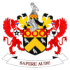
The Coat of arms of Oldham Metropolitan Borough Council, the local government authority for the Metropolitan Borough of Oldham, in Greater Manchester, England. The blazon is:
ARMS: Sable a Chevron invected Or between three Owls Argent on a Chief engrailed Or as many Annulets Gules.
CREST: On a Wreath of the Colours issuant from a Circlet Or charged with six Annulets Gules a Rock proper thereon an Owl Argent.
SUPPORTERS: On either side a Griffin Gules each gorged with a Collar engrailed Argent charged with six Bendlets Gules pendant therefrom a Heptagon Argent that on the dexter charged with a pierced Mullet that on the sinister with a Saddle both Sable.


