Olvera Street
| Downtown Los Angeles | |
 Olvera Street Market | |
| Państwo | |
|---|---|
| Miejscowość | |
| Długość | 175 m |
Olvera Street – ulica w najstarszej części Downtown Los Angeles w Kalifornii; jest częścią Los Angeles Plaza Historic District. Wiele zabytków z tej historycznej dzielnicy Los Angeles znajduje się właśnie na Olvera Street, m.in. Avila Adobe (1818), Pelanconi House (1857) i Sepulveda House (1887).
Ulica to zacieniony drzewami deptak, na którym znajdują się sklepy z rękodzielnictwem i restauracje; jest bardzo popularnym miejscem odwiedzanym przez turystów[1].
Przypisy
- ↑ L.A.'s Olvera Street recognized as a top 'Great Street' in America. [dostęp 2015-10-31]. (ang.).
Linki zewnętrzne
- Ginette Rondeau, Olvera Street
- El Pueblo de Los Angeles Historical Monument
Media użyte na tej stronie
Autor: Uwe Dedering, Licencja: CC BY-SA 3.0
Location map of the USA (without Hawaii and Alaska).
EquiDistantConicProjection:
Central parallel:
* N: 37.0° N
Central meridian:
* E: 96.0° W
Standard parallels:
* 1: 32.0° N
* 2: 42.0° N
Made with Natural Earth. Free vector and raster map data @ naturalearthdata.com.
Formulas for x and y:
x = 50.0 + 124.03149777329222 * ((1.9694462586094064-({{{2}}}* pi / 180))
      * sin(0.6010514667026994 * ({{{3}}} + 96) * pi / 180))
y = 50.0 + 1.6155950752393982 * 124.03149777329222 * 0.02613325650382181
      - 1.6155950752393982  * 124.03149777329222 *
     (1.3236744353715044  - (1.9694462586094064-({{{2}}}* pi / 180))
      * cos(0.6010514667026994 * ({{{3}}} + 96) * pi / 180))
Autor: NordNordWest, Licencja: CC BY 3.0
Location map of California, USA
The flag of Navassa Island is simply the United States flag. It does not have a "local" flag or "unofficial" flag; it is an uninhabited island. The version with a profile view was based on Flags of the World and as a fictional design has no status warranting a place on any Wiki. It was made up by a random person with no connection to the island, it has never flown on the island, and it has never received any sort of recognition or validation by any authority. The person quoted on that page has no authority to bestow a flag, "unofficial" or otherwise, on the island.
Crossroads with a major road ahead.
Autor: Alexrk2, Licencja: CC BY 3.0
Ta mapa została stworzona za pomocą GeoTools.
Autor: Oryginalnym przesyłającym był Magi Media z angielskiej Wikipedii, Licencja: CC BY-SA 2.5
Photo taken by David Moore for the Wikipedia article on Olvera Street. Downloaded ehanced and uploaded by User:Magi Media
Autor: Brion VIBBER, Licencja: CC-BY-SA-3.0
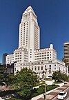
West facade of the Los Angeles City Hall — in Downtown Los Angeles, California.
- In process of seismic upgrading, this 1928 high-rise building was placed atop a mechanical system of isolators, sliders, and dampers called "base isolation technology".
- It is the tallest base-isolated structure in the world.


