Oppland
| okręg | |||||
| |||||
| Państwo | |||||
|---|---|---|---|---|---|
| Region | |||||
| Siedziba | |||||
| Kod ISO 3166-2 | NO-05 | ||||
| Powierzchnia | 25 192 km² | ||||
| Populacja (2019) • liczba ludności |
| ||||
| • gęstość | 7,52 os./km² | ||||
Położenie na mapie Norwegii | |||||
| Portal | |||||
Oppland – dawny okręg, jednostka podziału administracyjnego Norwegii. Przestał istnieć 1 stycznia 2020, gdy na podstawie reformy z 2017 został włączony, wraz z okręgiem Hedmark do nowo utworzonego okręgu Innlandet[1].
Położony był w południowej części kraju; graniczył z norweskimi okręgami Akershus, Buskerud, Hedmark, Møre og Romsdal, Oslo, Sogn og Fjordane oraz Sør-Trøndelag. Zajmował powierzchnię 25 192 km², która zamieszkiwana była przez 189 545 osób (2019). Ośrodkiem administracyjnym okręgu było miasto Lillehammer[2].
Największymi miastami okręgi były: Lillehammer, Gjøvik i Otta. Na obszarze zajomanym przez okręg znajdują się: najwyższy szczyt Norwegii Galdhøpiggen (2469 m n.p.m.) oraz drugi co do wielkości szyczyt Glittertind (2452 m n.p.m.), a także ośrodek sportów zimowych Beitostølen[2].
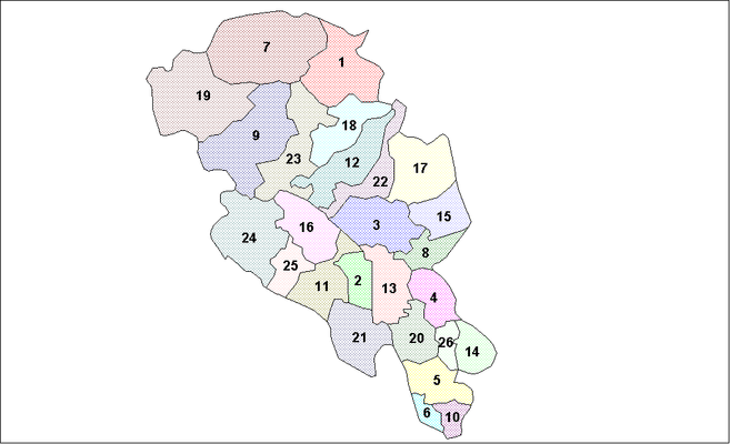
Gminy
Okręg podzielony był na 26 gmin[2].
Przypisy
- ↑ Ole T. Berg i inni, Fylke, [w:] Store Norske leksikon [online] [dostęp 2022-03-20] (norw. bokmål).
- ↑ a b c Geir Thorsnæs, Oppland (tidligere fylke), [w:] Store Norske leksikon [online] [dostęp 2022-03-20] (norw. bokmål).
Media użyte na tej stronie
Autor: TUBS
Location of county/ region xy (see filename) in Norway.
Coat of arms for Oppland county (fylke), Norway.
The flag of the former county of Oppland, Norway. Its design is shared with the county arms, and shows a spring pasqueflower. This distinctive plant is prevalent in the mountainous parts of Oppland, a county with 80% of its area situated above 600 m.a.s.l. The lush, lower‐lying parts of the county are included by the green background. Oppland's traditional districts are represented by the different parts of the plant: the two flowers stand for the Valdres and Gudbrand valleys, while the three leaves stand for the lowland districts of Land, Hadeland, and Toten. The flag was decided upon by the county council 1989‐03‐13, and approved by royal resolution 1989‐06‐23.


