Osage (rzeka)
 Zapora Bagnell Dam na rzece Osage; za nią jezioro Lake of the Ozarks | |
| Kontynent | |
|---|---|
| Państwo | |
| Stan | |
| Długość | 444 km |
| Źródło | |
| Miejsce | zbieg rzek Marais des Cygnes i Little Osage, koło Rich Hill |
| Wysokość | 220 m n.p.m. |
| Współrzędne | |
| Ujście | |
| Recypient | rzeka Missouri |
| Miejsce | koło Jefferson City |
| Wysokość | 158 m n.p.m. |
| Współrzędne | |
| Mapa | |
 Mapa dorzecza | |
Osage (ang. Osage River) – rzeka w Stanach Zjednoczonych, w stanie Missouri, dopływ rzeki Missouri[1].
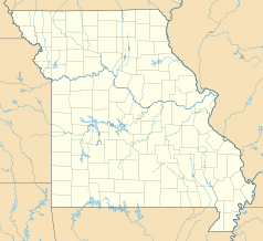
Osage powstaje z połączenia rzek Marais des Cygnes i Little Osage, na pograniczu hrabstw Bates i Vernon, w pobliżu miasta Rich Hill, na wysokości 220 m n.p.m. Płynie w kierunku wschodnim, przez wyżynę Ozark[1][2]. Rzekę przegradzają dwie zapory wodne, tworzące rozległe sztuczne jeziora – Harry S. Truman Reservoir (utworzone 1964–1979) oraz Lake of the Ozarks (1931)[1][3]. W końcowym biegu rzeka skręca na północny wschód. Do rzeki Missouri uchodzi na wschód od Jefferson City, u styku hrabstw Cole, Osage i Callaway, na wysokości 158 m n.p.m.[1][2] Nad rzeką położone są miasta Osceola i Warsaw[2].
Długość rzeki wynosi 444 km[4] (około 800 km licząc od źródła Marais des Cygnes[1]). Nazwa rzeki pochodzi od indiańskiego plemienia Osedżów[1].
Przypisy
- ↑ a b c d e f Osage River, [w:] Encyclopædia Britannica [online] [dostęp 2019-01-05] (ang.).
- ↑ a b c TopoView. U.S. Geological Survey. [dostęp 2019-01-05]. (ang.).
- ↑ Truman Dam / Visitors Center. Warsaw, Missouri. [dostęp 2019-01-05]. [zarchiwizowane z tego adresu (2019-01-06)]. (ang.).
- ↑ Osage River. Geographic Names Information System (GNIS). [dostęp 2019-01-05]. (ang.).
Media użyte na tej stronie
The flag of Navassa Island is simply the United States flag. It does not have a "local" flag or "unofficial" flag; it is an uninhabited island. The version with a profile view was based on Flags of the World and as a fictional design has no status warranting a place on any Wiki. It was made up by a random person with no connection to the island, it has never flown on the island, and it has never received any sort of recognition or validation by any authority. The person quoted on that page has no authority to bestow a flag, "unofficial" or otherwise, on the island.
Autor: KTrimble (talk), Licencja: CC0
Aerial Photograph of Bagnell Dam, Lake of the Ozarks-Osage River, Missouri
Autor: Kmusser, Licencja: CC BY-SA 3.0
Map of the Osage River watershed — in Kansas and Missouri.
Autor: Uwe Dedering, Licencja: CC BY-SA 3.0
Relief location map of the USA (without Hawaii and Alaska).
EquiDistantConicProjection : Central parallel :
* N: 37.0° N
Central meridian :
* E: 96.0° W
Standard parallels:
* 1: 32.0° N
* 2: 42.0° N
Made with Natural Earth. Free vector and raster map data @ naturalearthdata.com.
Formulas for x and y:
x = 50.0 + 124.03149777329222 * ((1.9694462586094064-({{{2}}}* pi / 180))
      * sin(0.6010514667026994 * ({{{3}}} + 96) * pi / 180))
y = 50.0 + 1.6155950752393982 * 124.03149777329222 * 0.02613325650382181
      - 1.6155950752393982  * 124.03149777329222 *
     (1.3236744353715044  - (1.9694462586094064-({{{2}}}* pi / 180))
      * cos(0.6010514667026994 * ({{{3}}} + 96) * pi / 180))
Autor: Alexrk2, Licencja: CC BY 3.0
Ta mapa została stworzona za pomocą GeoTools.


