Ostřetín
| gmina | |||||
(c) Zp, CC-BY-SA-3.0 | |||||
| |||||
| Państwo | |||||
|---|---|---|---|---|---|
| Kraj | |||||
| Powiat | Pardubice | ||||
| Kraina | Czechy | ||||
| Powierzchnia | 18,49 km²[1] | ||||
| Populacja (2014) • liczba ludności | 946[2] | ||||
| Kod pocztowy | 534 01 | ||||
| Szczegółowy podział administracyjny | |||||
| Liczba obrębów ewidencyjnych | 2 | ||||
| Liczba części gminy | 2 | ||||
| Liczba gmin katastralnych | 2 | ||||
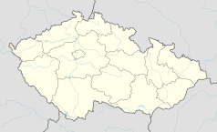
Położenie na mapie Czech (c) Karte: NordNordWest, Lizenz: Creative Commons by-sa-3.0 de | |||||
| Strona internetowa | |||||
| Portal | |||||
Ostřetín – wieś i gmina w Czechach, w powiecie Pardubice, w kraju pardubickim. Według danych z dnia 1 stycznia 2014 liczyła 946 mieszkańców[2].
Przypisy
- ↑ Města a obce online (cz.). www.mesta.obce.cz. [dostęp 2017-11-03].
- ↑ a b Počet obyvatel v obcích České republiky k 1. 1. 2014 (cz.). www.czso.cz. [dostęp 2017-11-03].
Media użyte na tej stronie
Pardubice Region.png
Autor: Afil, Licencja: CC BY-SA 3.0
Location map of Pardubice Region in the Czech Republic
Autor: Afil, Licencja: CC BY-SA 3.0
Location map of Pardubice Region in the Czech Republic
Czech Republic adm location map.svg
(c) Karte: NordNordWest, Lizenz: Creative Commons by-sa-3.0 de
Location map of the Czech Republic
(c) Karte: NordNordWest, Lizenz: Creative Commons by-sa-3.0 de
Location map of the Czech Republic
Flag of Pardubice Region.svg
Flag of Pardubice Region
Flag of Pardubice Region
Kostel Zvěstování Panny Marie v Ostřetíně.jpg
(c) Zp, CC-BY-SA-3.0
Kostel Zvěstování Panny Marie v Ostřetíně
(c) Zp, CC-BY-SA-3.0
Kostel Zvěstování Panny Marie v Ostřetíně
Flag of Ostretin.svg
Autor: (of .svg file) Zirland, Licencja: CC BY-SA 2.5
Municipal flag of Ostřetín village, Pardubice District, Czech Republic.
Autor: (of .svg file) Zirland, Licencja: CC BY-SA 2.5
Municipal flag of Ostřetín village, Pardubice District, Czech Republic.


