Pałac Kongresowy (Paryż)
 | |
| Państwo | |
|---|---|
| Miejscowość | Paryż |
| Otwarta | 1974 |
| Architekt | Guillaume Gillet |
| Liczba miejsc | |
| Stałych | Grand Amphithéâtre: 3,723 Amphithéâtre Bordeaux: 650 |
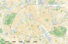
Położenie na mapie Paryża (c) Eric Gaba, Wikimedia Commons user Sting, CC BY-SA 3.0 | |
| Strona internetowa | |
Pałac Kongresowy Paryża (fran. Palais des congrès de Paris) – hala koncertowa, centrum kongresowe i galeria handlowa w Paryżu. Znajduje się w 17 dzielnicy[1]. W pobliżu znajduje się Lasek Buloński i zamożna dzielnica Neuilly-sur-Seine. Najbliższe stacje metra i kolei RER to Porte Maillot i Neuilly - Porte Maillot, dostępne z niższych poziomów budynku.
Odbył się tu 23. Konkurs Piosenki Eurowizji (1978)[2], oraz losowanie grup do turnieju głównego Mistrzostw Europy w Piłce Nożnej w 2016. W budynku znajduje się także studio telewizyjne[3].
Przypisy
- ↑ Palais des Congrès Paris, www.palaisdescongresdeparis.com [dostęp 2021-04-16].
- ↑ Paris 1978 - Eurovision Song Contest, eurovision.tv [dostęp 2020-07-09] (ang.).
- ↑ Palais des Confrès de Paris, www.palaisdescongresdeparis.com [dostęp 2021-04-16].
Media użyte na tej stronie
Autor: Superbenjamin, Licencja: CC BY-SA 4.0
Blank administrative map of France for geo-location purpose, with regions and departements distinguished. Approximate scale : 1:3,000,000
Autor: Thibault Pelloquin, Licencja: CC BY-SA 3.0
Cette carte représente l'Île de France (en jaune pâle), ses limites départementales et régionales (en traits gris) et ses principaux cours et points d'eau (en bleu). Les départements limitrophes (sont en rose-orange pâle)
(c) Eric Gaba, Wikimedia Commons user Sting, CC BY-SA 3.0
Blank land cover map of the city and department of Paris, France, as in January 2012, for geo-location purpose, with distinct boundaries for departments and arrondissements.


