Pałac Luksemburski
| ||
 | ||
| Państwo | ||
| Region | ||
| Miejscowość | Paryż | |
| Typ budynku | pałac | |
| Styl architektoniczny | barok | |
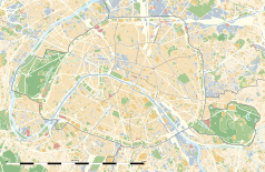
Położenie na mapie Paryża (c) Eric Gaba, Wikimedia Commons user Sting, CC BY-SA 3.0 | ||
Pałac Luksemburski (fr. Palais du Luxembourg) – pałac znajdujący się w Ogrodzie Luksemburskim w Paryżu, zaprojektowany przez Salomona de Brosse dla Marii Medycejskiej, małżonki Henryka IV. Jego budowa trwała od 1610 do 1630 roku. Na życzenie królowej projekt miał być wzorowany na pałacu Pittich we Florencji, gdzie spędziła dzieciństwo. Ostatecznie jednak powstał typowo francuski pałac z elementami włoskimi w kompozycji elewacji (filary oraz zdobienia). Budowla ma trzy kondygnacje i wysoki, charakterystyczny dla epoki dach z lukarnami.
Od 1799 roku jest siedzibą Senatu Francji.
Bibliografia
- Martina Padberg: Sztuka i architektura – Paryż. Ożarów Mazowiecki: Wydawnictwo Olesiejuk, 2009, s. 287. ISBN 978-3-7588-903-1.
Media użyte na tej stronie
(c) Eric Gaba, Wikimedia Commons user Sting, CC BY-SA 3.0
Blank land cover map of the city and department of Paris, France, as in January 2012, for geo-location purpose, with distinct boundaries for departments and arrondissements.
Autor: Superbenjamin, Licencja: CC BY-SA 4.0
Blank administrative map of France for geo-location purpose, with regions and departements distinguished. Approximate scale : 1:3,000,000
Autor: Thibault Pelloquin, Licencja: CC BY-SA 3.0
Cette carte représente l'Île de France (en jaune pâle), ses limites départementales et régionales (en traits gris) et ses principaux cours et points d'eau (en bleu). Les départements limitrophes (sont en rose-orange pâle)
Blue Shield - the Distinctive emblem for the Protection of Cultural Property. The distinctive emblem is a protective symbol used during armed conflicts. Its use is restricted under international law.
Autor: Patricia.fidi, Licencja: CC0
Unofficial (de facto) flag of the region Île-de-France in France. It was also the flag of the kingdom of France (s.XIV-XV)
Autor: Benh LIEU SONG, crane cloned out by Sanchezn, Licencja: CC BY-SA 3.0
The palace of Luxembourg, in the Luxembourg garden, Paris, at sunset.


