Lista państw świata
Lista państw świata – zawiera listę państw niepodległych oraz wykaz państw nieuznawanych, uszeregowanych w kolejności alfabetycznej pod względem nazwy krótkiej (o ile taka istnieje).
Użyte nazwy państw są formami zalecanymi przez Komisję Standaryzacji Nazw Geograficznych poza Granicami Rzeczypospolitej Polskiej.
Państwa świata
Wykaz obejmuje 194 państwa: 193 będące członkami Organizacji Narodów Zjednoczonych oraz Watykan.
| Lp. | Państwo | Mapa | Kontynent | Stolica | Powierzchnia (km²) | Liczba ludności | Gęstość zaludnienia (os./km²) |
|---|---|---|---|---|---|---|---|
| 1 | Azja | Kabul | 652 230 | 30 419 928[1] | 45,74 | ||
| 2 |  | Europa | Tirana | 28 748 | 3 195 000[2] | 111,1 | |
| 3 |  | Afryka | Algier | 2 381 741 | 34 178 188 | 14,3 | |
| 4 | Europa | Andora | 468 | 84 525 | 180,6 | ||
| 5 |  | Afryka | Luanda | 1 246 700 | 17 312 000 | 14 | |
| 6 | Ameryka Północna | Saint John’s | 435,3 | 85 420 | 196,2 | ||
| 7 | Azja | Rijad | 2 149 690 | 28 686 633 | 13,34 | ||
| 8 |  | Ameryka Południowa | Buenos Aires | 2 766 890 | 40 913 584 | 15 | |
| 9 |  | Azja | Erywań | 29 800[3] | 3 259 100[4] | 108,4 | |
| 10 | Australia i Oceania | Canberra | 7 686 850 | 22 343 203 | 2,8 | ||
| 11 | Europa | Wiedeń | 83 871 | 8 402 549 | 100,1 | ||
| 12 | Azja | Baku | 86 600 | 9 493 600[5] | 109 | ||
| 13 | Ameryka Północna | Nassau | 13 940 | 307 451 | 21 | ||
| 14 |  | Azja | Manama | 620 | 1 323 535 | 1189 | |
| 15 |  | Azja | Dhaka | 144 000 | 162 221 000 | 1099 | |
| 16 |  | Ameryka Północna | Bridgetown | 431[6] | 281 968[7] | 654 | |
| 17 | Europa | Bruksela | 30 528 | 10 584 534 | 346 | ||
| 18 |  | Ameryka Północna | Belmopan | 22 966 | 266 440 | 11,6 | |
| 19 |  | Afryka | Porto-Novo | 112 620 | 8 295 000 | 74 | |
| 20 | Azja | Thimphu | 47 000 | 682 321 | 14 | ||
| 21 | Europa | Mińsk | 207 600 | 9 474 200[8] | 46 | ||
| 22 |  | Ameryka Południowa | Sucre (stolica konstytucyjna), La Paz (siedziba rządu) | 1 098 580 | 9 248 000 | 8,4 | |
| 23 | Europa | Sarajewo | 51 129 | 4 590 310 | 86 | ||
| 24 |  | Afryka | Gaborone | 600 370 | 1 842 000 | 3 | |
| 25 | Ameryka Południowa | Brasilia | 8 511 965[9] | 201 103 330[10] | 23 | ||
| 26 | Azja | Bandar Seri Begawan | 5770 | 381 371 | 66 | ||
| 27 | Europa | Sofia | 110 910 | 7 531 000[11][12] | 67,9 | ||
| 28 | Afryka | Wagadugu | 274 200 | 15 746 232 | 57,4 | ||
| 29 |  | Afryka | Gitega | 27 830 | 8 691 000 | 312 | |
| 30 |  | Ameryka Południowa | Santiago | 756 950 | 16 601 707 | 22,1 | |
| 31 | Azja | Pekin | 9 596 960 | 1 347 374 752[13] | 140,4 | ||
| 32 | Europa | Zagrzeb | 56 542 | 4 437 460 | 79 | ||
| 33 | Azja | Nikozja | 9250 | 794 600 | 132 | ||
| 34 |  | Afryka | Ndżamena | 1 284 000 | 10 758 945[14] | 7,5 | |
| 35 |  | Europa | Podgorica | 13 812 | 672 180[15] | 48,7 | |
| 36 | Europa | Praga | 78 866 | 10 532 770[16] | 133 | ||
| 37 | Europa | Kopenhaga | 43 098,31[17] (2 210 579 z Grenlandią i Wyspami Owczymi) | 5 540 241[18] | 128,4 | ||
| 38 | Afryka | Kinszasa | 2 344 858 | 66 515 000 | 28 | ||
| 39 |  | Ameryka Północna | Roseau | 754 | 72 000 | 91,5 | |
| 40 | Ameryka Północna | Santo Domingo | 48 730 | 9 049 595 | 185 | ||
| 41 |  | Afryka | Dżibuti | 23 200[19] | 506 221[20] | 21 | |
| 42 | Afryka, Azja | Kair | 1 001 450 | 80 471 869[21] | 80 | ||
| 43 |  | Ameryka Południowa | Quito | 283 560 | 13 928 000 | 49 | |
| 44 | Afryka | Asmara | 121 320 | 5 028 000 | 41 | ||
| 45 | Europa | Tallinn | 45 226 | 1 340 122[22] | 29 | ||
| 46 |  | Afryka | Mbabane | 17 363 | 1 138 227 | 65,5 | |
| 47 | Afryka | Addis Abeba | 1 127 127 | 81 238 000 | 72 | ||
| 48 |  | Australia i Oceania | Suva | 18 272 | 849 000[23] | 46,5 | |
| 49 |  | Azja | Manila | 300 000 | 92 681 000 | 309 | |
| 50 |  | Europa | Helsinki | 338 145 | 5 313 026 | 15,71 | |
| 51 | Europa | Paryż | 675 417 | 66 000 000[24] | 98 | ||
| 52 | Afryka | Libreville | 267 667 | 1 454 867 | 5,4 | ||
| 53 | Afryka | Bandżul | 11 295 | 1 690 000 | 150 | ||
| 54 |  | Afryka | Akra | 239 460 | 23 000 000 | 96 | |
| 55 | Europa | Ateny | 131 957 | 11 216 708 | 85,01 | ||
| 56 | Ameryka Północna | Saint George’s | 344 | 89 258 | 262 | ||
| 57 | Europa/Azja | Tbilisi | 69 700[25] | 4 630 841 | 67 | ||
| 58 |  | Ameryka Południowa | Georgetown | 214 970 | 769 095 | 3,6 | |
| 59 |  | Ameryka Północna | Gwatemala | 108 890 | 12 013 907 | 119 | |
| 60 | Afryka | Konakry | 245 857 | 9 950 670 | 40,5 | ||
| 61 | Afryka | Bissau | 36 120 | 1 475 000 | 41 | ||
| 62 | Afryka | Malabo | 28 051,46 | 616 459 | 22,0 | ||
| 63 | Ameryka Północna | Port-au-Prince | 27 750 | 8 925 000[26] | 322 | ||
| 64 | Europa | Madryt | 504 645 | 47 150 819 | 93,43 | ||
| 65 |  | Europa | Amsterdam (stolica konstytucyjna), Haga (stolica administracyjna) | 41 526 | 16 509 303 | 397,6 | |
| 66 | Ameryka Północna | Tegucigalpa | 112 090 | 7 325 000 | 65 | ||
| 67 |  | Azja | Nowe Delhi | 3 287 590 | 1 166 079 217 | 354,7 | |
| 68 | Azja | Dżakarta | 1 919 440 | 242 968 342 | 124 | ||
| 69 |  | Azja | Bagdad | 438 317 | 30 399 572 | 69,54 | |
| 70 | Azja | Teheran | 1 648 195[27] | 70 495 782[27] | 43[27] | ||
| 71 |  | Europa | Dublin | 70 273 | 4 581 269[28] | 63 | |
| 72 | Europa | Reykjavík | 103 125 | 306 694[29] | 2,5 | ||
| 73 |  | Azja | Jerozolima[30][31] | 22 072 | 7 653 600[32] | 351 | |
| 74 | Ameryka Północna | Kingston | 10 991 | 2 700 000 | 245 | ||
| 75 | Azja | Tokio | 377 835 | 126 475 664[33] | 336,3 | ||
| 76 | Azja | Sana | 527 968 | 23 495 361[34] | 44 | ||
| 77 |  | Azja | Amman | 92 300 | 5 759 732 | 62 | |
| 78 | Azja | Phnom Penh | 181 040 | 13 388 910 | 75 | ||
| 79 |  | Afryka | Jaunde | 475 440 | 18 100 000 | 38 | |
| 80 | Ameryka Północna | Ottawa | 9 976 140 | 34 110 000 | 3,41 | ||
| 81 | Azja | Doha | 11 437 | 928 635 | 81 | ||
| 82 | Azja, Europa | Astana | 2 717 300 | 15 399 437 | 5,67 | ||
| 83 |  | Afryka | Nairobi | 582 650 | 37 953 840 | 68,6 | |
| 84 | Azja | Biszkek | 198 500 | 5 357 000 | 27 | ||
| 85 | Australia i Oceania | Bairiki | 811 | 103 092 | 127 | ||
| 86 |  | Ameryka Południowa | Bogota | 1 139 825[35] | 45 730 834[36] | 40,1 | |
| 87 | Afryka | Moroni | 2170 | 671 247 | 309 | ||
| 88 |  | Afryka | Brazzaville | 342 000 | 3 756 000 | 11,2 | |
| 89 | Azja | Seul | 99 720[37] | 50 062 000[37] | 500 | ||
| 90 |  | Azja | Pjongjang | 120 540 | 22 757 275[38] | 188,8 | |
| 91 | Ameryka Północna | San José | 51 100 | 4 325 000 | 85 | ||
| 92 | Ameryka Północna | Hawana | 110 860 | 11 424 000 | 103 | ||
| 93 | Azja | Kuwejt | 17 818 | 2 597 000 | 122 | ||
| 94 |  | Azja | Wientian | 236 800 | 6 521 998 | 26 | |
| 95 |  | Afryka | Maseru | 30 355 | 2 031 348 | 67 | |
| 96 |  | Azja | Bejrut | 10 452 | 3 925 502 | 375,5 | |
| 97 |  | Afryka | Monrovia | 111 370 | 3 200 000 | 29 | |
| 98 | Afryka | Trypolis | 1 759 540 | 6 310 434 | 3,6 | ||
| 99 |  | Europa | Vaduz | 160 | 34 761[39] | 215 | |
| 100 | Europa | Wilno | 65 200[40] | 3 225 346[41] | 52 | ||
| 101 |  | Europa | Luksemburg | 2586 | 474 413 | 183,45 | |
| 102 | Europa | Ryga | 64 589 | 2 224 400[42] | 35 | ||
| 103 | Europa | Skopje | 25 713 | 2 061 000 | 81 | ||
| 104 |  | Afryka | Antananarywa | 587 040 | 20 653 556 | 34,14 | |
| 105 |  | Afryka | Lilongwe | 118 480 | 13 600 000 | 115 | |
| 106 | Azja | Male | 300[43] | 396 334[43] | 1321 | ||
| 107 | Azja | Kuala Lumpur | 329 750 | 27 730 000 | 82,5 | ||
| 108 | Afryka | Bamako | 1 240 192 | 12 666 987[44] | 10,2 | ||
| 109 | Europa | Valletta | 316 | 403 532 | 1277 | ||
| 110 | Afryka | Rabat | 446 550 | 34 859 364 | 78,1 | ||
| 111 |  | Afryka | Nawakszut | 1 030 700 | 3 250 000 | 3,2 | |
| 112 |  | Afryka | Port Louis | 2045 | 1 230 602 | 601 | |
| 113 | Ameryka Północna | Meksyk | 1 972 550[45] | 112 336 538[46] | 56,9 | ||
| 114 | Australia i Oceania | Palikir | 702 | 135 000 | 171 | ||
| 115 |  | Azja | Naypyidaw | 678 500 | 53 414 374 | 78,7 | |
| 116 |  | Europa | Kiszyniów | 33 843 | 4 324 450 | 128 | |
| 117 | Europa | Monako | 1,95 | 32 796 | 16 818 | ||
| 118 | Azja | Ułan Bator | 1 564 116 | 2 736 800[47] | 1,75 | ||
| 119 |  | Afryka | Maputo | 801 590 | 21 000 000 | 26 | |
| 120 | Afryka | Windhuk | 825 418 | 2 089 000 | 2 | ||
| 121 | Australia i Oceania | Yaren | 21,3 | 14 019 | 621 | ||
| 122 | Azja | Katmandu | 140 800 | 28 635 000 | 203 | ||
| 123 |  | Europa | Berlin | 357 114,22 | 81 772 000[48] | 229 | |
| 124 | Afryka | Niamey | 1 267 000 | 15 306 252[11] | 12,1 | ||
| 125 | Afryka | Abudża | 923 768 | 154 729 000[49] | 167,5 | ||
| 126 | Ameryka Północna | Managua | 129 494 | 5 570 000 | 43 | ||
| 127 |  | Europa | Oslo | 324 220 | 4 769 000 | 15 | |
| 128 |  | Australia i Oceania | Wellington | 268 680 | 4 393 500 | 16,35 | |
| 129 |  | Azja | Maskat | 309 500 | 3 312 000 | 10,7 | |
| 130 | Azja | Islamabad | 803 940 | 176 242 949[50] | 219 | ||
| 131 | Australia i Oceania | Ngerulmud | 508 | 20 800 | 44 | ||
| 132 | Ameryka Północna | Panama | 78 200 | 3 293 000 | 42 | ||
| 133 | Australia i Oceania | Port Moresby | 462 840 | 5 932 000 | 12,8 | ||
| 134 |  | Ameryka Południowa | Asunción | 406 750 | 6 670 000 | 16,4 | |
| 135 |  | Ameryka Południowa | Lima | 1 285 220 | 29 181 000 | 23 | |
| 136 | Europa | Warszawa | 322 575[51] | 38 200 037[52] | 120,92 | ||
| 137 | Afryka | Pretoria (stolica egzekutywna) | 1 219 912 | 48 783 000 | 40 | ||
| 138 |  | Europa | Lizbona | 92 391 | 10 677 000[53] | 116 | |
| 139 | Afryka | Bangi | 622 984 | 4 370 000 | 7 | ||
| 140 | Afryka | Praia | 4033 | 499 796 | 118 | ||
| 141 | Azja, Europa | Moskwa | 17 075 400 | 142 914 136[54] | 8,4 | ||
| 142 | Europa | Bukareszt | 238 391 | 22 215 421 | 91 | ||
| 143 | Afryka | Kigali | 26 338 | 10 186 000 | 387 | ||
| 144 | Ameryka Północna | Basseterre | 261 | 38 819 | 149 | ||
| 145 | Ameryka Północna | Castries | 616 | 164 213 | 266,6 | ||
| 146 | Ameryka Północna | Kingstown | 389 | 119 000 | 307 | ||
| 147 | Ameryka Północna | San Salvador | 21 040 | 6 820 000 | 324 | ||
| 148 | Australia i Oceania | Apia | 2944 | 177 714 | 60 | ||
| 149 |  | Europa | San Marino | 61,6 | 31 817 | 487 | |
| 150 | Afryka | Dakar | 196 190 | 12 521 851 | 64 | ||
| 151 |  | Europa | Belgrad | 77 474 | 7 498 001 | 94,8 | |
| 152 | Afryka | Victoria | 455 | 86 525 | 190 | ||
| 153 |  | Afryka | Freetown | 71 740 | 6 150 000 | 86 | |
| 154 | Azja | Singapur | 692,7 | 4 608 000 | 6652 | ||
| 155 | Europa | Bratysława | 49 035 | 5 455 000 | 111 | ||
| 156 | Europa | Lublana | 20 273 | 2 039 399[55] | 99 | ||
| 157 | Afryka | Mogadiszu | 637 700 | 9 559 000 | 15 | ||
| 158 |  | Azja | Sri Dźajawardanapura Kotte | 65 610 | 20 010 000 | 320 | |
| 159 | Ameryka Północna | Waszyngton | 9 373 967 | 311 280 492[56] | 32,23 | ||
| 160 | Afryka | Chartum | 1 886 068 | 30 894 000 | 16,4 | ||
| 161 | Afryka | Dżuba | 589 745 | 8 260 490 (kwestionowana)[57] | |||
| 162 |  | Ameryka Południowa | Paramaribo | 163 270[58] | 476 000[59] | 2,9 | |
| 163 | Azja | Damaszek | 185 180 | 19 748 000 | 107 | ||
| 164 | Europa | brak oficjalnej stolicy, siedzibą rządu jest Berno | 41 290 | 7 725 200 | 186 | ||
| 165 |  | Europa | Sztokholm | 449 964 | 9 331 523 | 20 | |
| 166 | Azja | Duszanbe | 143 100[60][61] | 7 100 000 | 50 | ||
| 167 |  | Azja | Bangkok | 514 000[62] | 65 493 000[63] | 127 | |
| 168 | Afryka | Dodoma | 945 087 | 39 384 223 | 42 | ||
| 169 | Azja | Dili | 15 007 | 1 109 000 | 74 | ||
| 170 |  | Afryka | Lomé | 56 785 | 5 400 000 | 95 | |
| 171 | Australia i Oceania | Nukuʻalofa | 748 | 119 009 | 144 | ||
| 172 | Ameryka Południowa | Port-of-Spain | 5128 | 1 229 000 | 206 | ||
| 173 |  | Afryka | Tunis | 163 610 | 10 384 000 | 63,5 | |
| 174 | Azja, Europa | Ankara | 783 562 | 77 804 122 | 92 | ||
| 175 | Azja | Aszchabad | 488 100 | 5 180 000 | 11 | ||
| 176 | Australia i Oceania | Vaiaku | 26 | 12 373 | 475,9 | ||
| 177 |  | Afryka | Kampala | 236 036 | 32 369 558 | 136 | |
| 178 | Europa | Kijów | 603 700 | 45 706 126[64] | 77 | ||
| 179 |  | Ameryka Południowa | Montevideo | 176 220 | 3 477 779 (2008) | 20 | |
| 180 | Azja | Taszkent | 447 400 | 27 610 000 | 62 | ||
| 181 |  | Australia i Oceania | Port Vila | 12 189 | 243 304 | 20,0 | |
| 182 | Europa | Watykan | 0,44 | 824 | 1873 | ||
| 183 | Ameryka Południowa | Caracas | 916 445 | 30 102 382 | 32,85 | ||
| 184 | Europa | Budapeszt | 93 030 | 9 982 000[65] | 107 | ||
| 185 |  | Europa | Londyn | 244 820 | 62 222 000[11] | 254,1 | |
| 186 |  | Azja | Hanoi | 331 051,4[66] | 86 024 600[66] | 260[66] | |
| 187 |  | Europa | Rzym | 301 230 | 60 418 711[67] | 199,8 | |
| 188 |  | Afryka | Jamusukro | 322 460 | 18 373 000 | 57 | |
| 189 | Australia i Oceania | Majuro | 181 | 59 071 | 326 | ||
| 190 | Australia i Oceania | Honiara | 28 450 | 552 000 | 20 | ||
| 191 |  | Afryka | São Tomé | 1001 | 193 410 | 187 | |
| 192 | Afryka | Lusaka | 752 614 | 11 500 000 | 15,3 | ||
| 193 | Afryka | Harare | 390 580 | 12 383 000 | 32 | ||
| 194 | Azja | Abu Zabi | 83 600 | 4 621 000 | 55 |
Państwa nieuznawane (quasi-państwa, państwa de facto niepodległe)
Wykaz państw nieuznawanych (quasi-państw, państw de facto niepodległych) obejmuje kraje, które posiadają swoje terytoria, ludność i rządy sprawujące suwerenną nad nimi kontrolę, lecz nie uzyskały uznania swojej państwowości na arenie międzynarodowej lub tę państwowość uznaje niewielka liczba państw.
 Abchazja – Republika Abchazji[68][69]
 Cypr Północny – Turecka Republika Cypru Północnego[70]
 Górski Karabach – Republika Górskiego Karabachu[71][72]
 Kosowo – Republika Kosowa[73]
 Naddniestrze – Naddniestrzańska Republika Mołdawska[74][75]
 Osetia Południowa – Republika Osetii Południowej[68][76]
 Palestyna – Państwo Palestyna[77]
 Sahara Zachodnia – Saharyjska Arabska Republika Demokratyczna[78]
 Somaliland – Republika Somalilandu[79][80]
 Tajwan – Republika Chińska[81][82]
Inne podmioty prawa międzynarodowego
Stosunki dyplomatyczne na równi z państwami utrzymują również suwerenne podmioty prawa międzynarodowego (nieposiadające własnego terytorium państwowego):
 Stolica Apostolska – będąca w unii personalnej i funkcjonalnej z Watykanem
 Suwerenny Zakon Maltański.
Zobacz też
- państwo – naród – obywatelstwo
- państwo stowarzyszone
- podziały administracyjne państw świata
- terytoria autonomiczne na świecie
- spór terytorialny
- terytorium neutralne
- terytorium stowarzyszone
- terytorium zależne
Przypisy
- ↑ CIA – The World Factbook. 2011-03-22. [dostęp 2011-04-12]. [zarchiwizowane z tego adresu (2017-09-20)]. (ang.).
- ↑ Instytut statystyczny. [dostęp 2009-10-02].
- ↑ The World Factbook. [dostęp 2009-01-02]. [zarchiwizowane z tego adresu (19 lipca 2010)]. (ang.).
- ↑ Stan na dzień 1 października 2010 r. opublikowane przez Ormiański Urząd Statystyczny (National Statistical Service of Republic of Armenia (ang.)).
- ↑ CIA World Factbook – Country Comparison: Population. [dostęp 2012-09-02]. [zarchiwizowane z tego adresu (2011-09-27)].
- ↑ Dane za: CIA The World Factbook. [dostęp 2008-12-18]. [zarchiwizowane z tego adresu (14 lutego 2016)].
- ↑ Dane szacunkowe CIA na lipiec roku 2008: CIA The World Factbook. [dostęp 2008-12-18]. [zarchiwizowane z tego adresu (14 lutego 2016)]. Według szacunków ONZ, w roku 2007 Barbados liczył ok. 294 tys. mieszkańców: World Population Prospects The 2006 Revision. [dostęp 2008-12-18]. (ang.).
- ↑ Dane na 1 kwietnia 2011 roku: Национальный статистический комитет Республики Беларусь: О демографической ситуации за январь-декабрь 2010 г.. [dostęp 2011-05-07]. [zarchiwizowane z tego adresu (2009-02-10)]. (ros.).
- ↑ Dane za: CIA The World Factbook: Brazil. [dostęp 2008-12-18]. [zarchiwizowane z tego adresu (22 grudnia 2015)].
- ↑ Dane szacunkowe CIA na lipiec roku 2010: CIA The World Factbook: Brazil. [dostęp 2008-12-18]. [zarchiwizowane z tego adresu (22 grudnia 2015)]. Według szacunków ONZ, w roku 2007 Brazylia liczyła ok. 191 791 tys. mieszkańców: World Population Prospects The 2006 Revision. [dostęp 2008-12-18]. (ang.). Według szacunków Międzynarodowego Funduszu Walutowego na rok 2008, Brazylia liczyła ok. 191 870 tys. mieszkańców: Report for Selected Countries and Subjects – Brazil. [dostęp 2008-12-18].
- ↑ a b c Dane dotyczące PKB, PKB per capita, PPP, PPP per capita oraz populacji na podstawie szacunków Międzynarodowego Funduszu Walutowego na rok 2010 International Monetary Fund: World Economic Outlook Database, April 2011: United Kingdom. (ang.).
- ↑ The World Factbook szacuje liczbę mieszkańców Bułgarii w lipcu 2010 roku na ok. 7 148 800: The World Factbook. [dostęp 2010-08-08]. [zarchiwizowane z tego adresu (1 października 2016)]. (ang.)., World Gazetteer szacuje liczbę mieszkańców Bułgarii w 2010 roku na ok. 7 418 000: World Gazetteer. [dostęp 2010-08-08]. [zarchiwizowane z tego adresu (2012-02-06)]. (ang.).
- ↑ Communiqué of the National Bureau of Statistics of People’s Republic of China on Major Figures of the 2010 Population Census. stats.gov.cn. [zarchiwizowane z tego adresu (2013-11-08)]. (bez Tajwanu, z Tajwanem 1 370 536 875 os.).
- ↑ CIA: The World Factbook: Chad. [dostęp 2011-06-10]. [zarchiwizowane z tego adresu (2020-05-18)]. (ang.).
- ↑ Dane szacunkowe CIA na lipiec roku 2009: CIA The World Factbook: Montenegro. [dostęp 2009-07-15]. [zarchiwizowane z tego adresu (12 września 2009)]. Według ostatniego spisu powszechnego z 2003 roku Czarnogórę zamieszkiwało 620 145 osób.
- ↑ Dane za Český statistický úřad na 31 grudnia 2010 roku: Český statistický úřad: Population. [dostęp 2010-03-20]. [zarchiwizowane z tego adresu (31 marca 2014)]. (ang.)., CIA The World Factbook szacuje liczbę mieszkańców Czech w lipcu 2009 roku na ok. 10 211 904: The World Factbook. [dostęp 2009-09-28]. [zarchiwizowane z tego adresu (2018-12-26)]. (ang.)., World Gazetteer szacuje liczbę mieszkańców Czech w 2009 roku na ok. 10 328 267: World Gazetteer. [dostęp 2009-09-28]. [zarchiwizowane z tego adresu (2011-05-22)]. (ang.).
- ↑ Statistical Yearbook 2010, Statistics Denmark, 2010, ISBN 978-87-501-1844-2, ISSN 1601-1058 [dostęp 2010-07-12].
- ↑ Dane na 1 kwietnia 2010 roku; Danmarks Statistik: Duński Urząd Statystyczny. [dostęp 2010-07-12]. (ang.).
- ↑ Dane za: CIA The World Factbook: Djibouti. [dostęp 2008-12-22].
- ↑ Dane szacunkowe CIA na lipiec roku 2008: CIA The World Factbook: Djibouti. [dostęp 2008-12-22]. Według szacunków ONZ, w roku 2007 Dżibuti liczyło ok. 833 tys. mieszkańców: World Population Prospects The 2006 Revision. [dostęp 2008-12-22]. (ang.). Według szacunków Międzynarodowego Funduszu Walutowego na rok 2008, Dżibuti liczyło ok. 784 tys. mieszkańców: Report for Selected Countries and Subjects – Djibouti. [dostęp 2008-12-22].
- ↑ Egipt, The World Factbook – CIA. cia.gov. [zarchiwizowane z tego adresu (2019-09-30)]. (ang.).
- ↑ Dane na 1 stycznia 2011 za statistics estonia, CIA The World Factbook szacuje liczbę ludności Estonii na lipiec 2010 na 1 291 170 [1], World Gazetteer szacuje liczbę mieszkańców w 2010 roku na ok. 1 331 934 [2].
- ↑ World Population Prospects, Table A.1.
- ↑ INSEE: Bilan démographique 2011. (fr.).
- ↑ Na skutek zajęcia przez Rosję Abchazji i Osetii Południowej, Gruzja, kontroluje de facto 57 250 km² swego obszaru.
- ↑ Haiti. CIA - The World Factbook. [dostęp 2010-01-16]. [zarchiwizowane z tego adresu (2016-01-31)]. (ang.).
- ↑ a b c Statistical Centre of Iran: A Glance at Iran – Profile. [dostęp 2010-02-03]. (ang.).
- ↑ CSO Ireland – Number of Dáil members per population and percentage change 2006 to 2011 by Constituency, Year and Statistic.
- ↑ Dane na rok 2009 za: CIA. [dostęp 2009-04-09]. [zarchiwizowane z tego adresu (18 maja 2020)]. (ang.).
- ↑ Jerozolima, [w:] Encyklopedia PWN [online] [dostęp 2011-02-11].
- ↑ Kwestia stolicy Izraela jest sprawą kontrowersyjną. Siedzibą władz i konstytucyjną stolicą jest Jerozolima, jednak prawnomiędzynarodowy status tego miasta nie został dotąd uregulowany, ONZ i większość państw, w tym Polska, nie uznają de iure suwerenności Izraela nad całą Jerozolimą, dlatego większość przedstawicielstw dyplomatycznych mieści się w Tel Awiwie. Zob. listę placówek dyplomatycznych w Izraelu (Israel Science and Technology).
- ↑ Central Bureau of Statistics. [w:] Main society indicators [on-line]. 16 listopada 2010. [dostęp 2010-11-16]. (ang.).
- ↑ Centralna Agencja Wywiadowcza: The World Factbook. [dostęp 2011-04-03]. [zarchiwizowane z tego adresu (28 grudnia 2010)]. (ang.).
- ↑ People Yemen – CIA.gov. cia.gov. [zarchiwizowane z tego adresu (2016-08-06)]. (ang.).
- ↑ dane Kolumbijskiego Urzędu Statystycznego. [dostęp 2016-05-20]. [zarchiwizowane z tego adresu (2016-05-20)].
- ↑ Población Colombia 11/2010. [dostęp 2011-06-26]. [zarchiwizowane z tego adresu (2012-01-14)].
- ↑ a b The World Factbook. [dostęp 2009-12-18]. [zarchiwizowane z tego adresu (7 listopada 2017)].
- ↑ CIA – The World Factbook. [dostęp 2010-11-21]. [zarchiwizowane z tego adresu (2011-05-25)]. (ang.).
- ↑ Dane szacunkowe na lipiec 2009 roku, podane za CIA The World Factbook (Źródło:CIA) (ang.).
- ↑ Dane za CIA The World Factbook: the-world-factbook. [dostęp 2009-04-24]. [zarchiwizowane z tego adresu (13 maja 2020)]. (ang.). Inne źródła podają także powierzchnię 65 300 lub 65 303 km² np. Ambasada Republiki Litewskiej w Polsce. [dostęp 2009-04-24]. (pol.).
- ↑ Dane szacunkowe Statistikos Departamentas na maj 2011 roku wynoszą 3 225 300 (Statistikos Departamentas. [dostęp 2011-06-23]. (lit.).). CIA The World Factbook szacuje liczbę mieszkańców Litwy w lipcu 2011 na ok. 3 535 547: CIA: The World Factbook. Lithuania. [dostęp 2011-05-17]. [zarchiwizowane z tego adresu (2020-05-13)]. (ang.). World Gazetteer szacuje liczbę mieszkańców Litwy w 2010 na ok. 3 327 188: world-gazetteer.com: World Gazetteer. Lithuania. [dostęp 2011-05-17]. [zarchiwizowane z tego adresu (2012-04-17)]. (ang.).
- ↑ Dane za Latvijas Statistika na kwiecień 2011 roku: Latvijas Statistika. [dostęp 2011-04-02]. (łot.). CIA The World Factbook szacuje liczbę mieszkańców Litwy w lipcu 2010 na ok. 2 217 969: CIA: The World Factbook. Latvia. [dostęp 2011-01-09]. [zarchiwizowane z tego adresu (15 maja 2020)]. (ang.). World Gazetteer szacuje liczbę mieszkańców Litwy w 2010 na ok. 2 241 149: world-gazetteer.com: World Gazetteer. Latvia. [dostęp 2011-05-07]. [zarchiwizowane z tego adresu (2007-10-01)]. (ang.).
- ↑ a b CIA The World Factbook. [dostęp 2009-03-21]. [zarchiwizowane z tego adresu (18 września 2015)]. (ang.).
- ↑ ONZ: Total population sex in 2009. [dostęp 2009-10-03]. (ang.).
- ↑ worldatlas.com.
- ↑ INEGI – Meksykański Instytut Statystyki i Geografii.
- ↑ Social and economic situation of Mongolia (As of the preliminary result of 2009).
- ↑ Dane na listopad 2010 Statistische Ämter. [dostęp 2011-05-19]. [zarchiwizowane z tego adresu (2010-05-28)]. (niem.).
- ↑ United Nations Population Division. [dostęp 2010-01-25]. (ang.).
- ↑ Dane szacunkowe na lipiec 2009 roku, podane za CIA The World Factbook: Pakistan. [dostęp 2009-03-22]. [zarchiwizowane z tego adresu (24 maja 2020)].
- ↑ Jest to powierzchnia całkowitego terytorium Polski. Powierzchnia obszaru lądowego (łącznie z wodami śródlądowymi) – 311 888 km², powierzchnia obszaru morskich wód wewnętrznych – 2005 km², oraz morza terytorialnego – 8682 km². Powierzchnia administracyjna Polski – 312 685 km², która jest często podawana, to powierzchnia w granicach administracyjnych województw i poza obszarem lądowym obejmuje część morskich wód wewnętrznych (Zalew Wiślany, Zalew Szczeciński, obszary wód portów) [źródło: GUS].
- ↑ Główny Urząd Statystyczny: Ludność. Stan i struktura w przekroju terytorialnym (Stan w dniu 31 XII 2010 r.). [dostęp 2011-05-21].
- ↑ Dane szacunkowe na lipiec 2008 roku, podane za CIA The World Factbook (źródło: CIA) (ang.).
- ↑ Об оценке численности постоянного населения на 1 января 2010г., на 1 января 2011г. и в среднем за 2010 год.. Federalna Służba Statystyczna. [dostęp 2011-04-15]. [zarchiwizowane z tego adresu (2012-03-15)].
- ↑ Dane na 30 czerwca 2008 roku za stat.si.
- ↑ U.S. POPClock Projection. [dostęp 2010-10-09].
- ↑ Discontent over Sudan census, news24.com [dostęp 2017-11-25] (ang.).
- ↑ Dane za: CIA The World Factbook: Suriname. [dostęp 2008-12-18]. [zarchiwizowane z tego adresu (7 stycznia 2019)].
- ↑ Dane szacunkowe CIA na lipiec roku 2008: CIA The World Factbook: Suriname. [dostęp 2008-12-18]. [zarchiwizowane z tego adresu (14 lutego 2016)]. Według szacunków ONZ, w roku 2007 Surinam liczył ok. 458 tys. mieszkańców: World Population Prospects The 2006 Revision. [dostęp 2008-12-18]. (ang.). Według szacunków Międzynarodowego Funduszu Walutowego na rok 2008, Surinam liczył ok. 533 tys. mieszkańców: Report for Selected Countries and Subjects – Surinam. [dostęp 2008-12-18].
- ↑ 13 stycznia 2011 weszła w życie nowa umowa graniczna między Tadżykistanem a Chinami, w wyniku której Tadżykistan przekazał Chinom obszar ok. 1000 km² położony w słabo zaludnionym regionie Pamiru, zatem od tego dnia powierzchnia Tadżykistanu jest mniejsza niż 143 100 km². Brak aktualnych danych o powierzchni Tadżykistanu po tej zmianie.
- ↑ Tiri Tran, AP: China, Tajikistan sign border agreement. metronews.ca, 2011-01-13. [dostęp 2011-01-14]. (ang.).
- ↑ Dane za: CIA The World Factbook: Thailand. [dostęp 2008-12-22].
- ↑ Dane szacunkowe CIA na lipiec roku 2008: CIA The World Factbook: Thailand. [dostęp 2008-12-22]. Według szacunków ONZ, w roku 2007 Tajlandia liczyła ok. 63 884 tys. mieszkańców: World Population Prospects The 2006 Revision. [dostęp 2008-12-22]. (ang.). Według szacunków Międzynarodowego Funduszu Walutowego na rok 2008, Tajlandia liczyła ok. 66 398 tys. mieszkańców: Report for Selected Countries and Subjects – Thailand. [dostęp 2008-12-22].
- ↑ Dane na 1 maja 2011 roku za: Державний Комітет Статистики України: Total population, as of May 1, 2011. [dostęp 2011-07-01]. (ang.).; CIA The World Factbook szacuje liczbę ludności Ukrainy w lipcu 2011 na ok. 45,135 mln. [3]; World Gazetteer szacuje liczbę ludności Ukrainy w 2010 roku na ok. 46,018 mln. [4].
- ↑ Dane za Központi Statisztikai Hivatalt na styczeń 2011 roku: KSH. [dostęp 2011-04-20]. (węg.). CIA The World Factbook szacuje liczbę mieszkańców Węgier w lipcu 2010 roku na ok. 9 992 339: CIA: the-world-factbook. [dostęp 2011-01-07]. [zarchiwizowane z tego adresu (10 czerwca 2009)]. (ang.). World Gazetteer szacuje liczbę mieszkańców w 2010 roku na ok. 10 042 311: world-gazetteer.com. [dostęp 2011-04-20]. [zarchiwizowane z tego adresu (2011-06-28)]. (ang.).
- ↑ a b c GUS Hanoi, stan na 2009.
- ↑ ISTAT – Bilancio demografico mensile. [dostęp 2010-09-20]. [zarchiwizowane z tego adresu (2010-11-13)].
- ↑ a b Terytorium, formalnie stanowiące część Gruzji, faktycznie pozostające poza jej kontrolą. [5].
- ↑ Niepodległość Republiki Abchazji uznawana jest przez następujące państwa członkowskie ONZ: Rosja, Nikaragua, Wenezuela, Nauru, Syria.
- ↑ Uznawany wyłącznie przez Turcję, przez pozostałe państwa uznawany za część Cypru.
- ↑ „Terytorium, formalnie stanowiące część Republiki Azerbejdżanu, faktycznie pozostające poza jej kontrolą.” http://ksng.gugik.gov.pl/wykaz.php.
- ↑ Niepodległość Republiki Górskiego Karabachu nie jest uznawana przez żadne z państw członkowskich ONZ.
- ↑ Komisja Standaryzacji Nazw Geograficznych poza Granicami Rzeczypospolitej Polskiej ustaliła polską oficjalną nazwę państwa w formie Republika Kosowa [6], kraj ogłosił niepodległość od Serbii 17.02.2008, Polska uznała niepodległość Kosowa dn. 26.02.2008. Na arenie międzynarodowej część państw uznaje Kosowo za część Serbii pod administracją ONZ. Administracja międzynarodowa stosuje wyłącznie krótką nazwę, władze Serbii obok nazwy krótkiej stosują formę długą – Prowincja Autonomiczna Kosowo i Metochia. Niepodległość Kosowa uznaje 108 państw świata oraz Tajwan [7] (stan na 31 maja 2015).
- ↑ „Terytorium, formalnie stanowiące część Republiki Mołdawii, faktycznie pozostające poza jej kontrolą.” http://ksng.gugik.gov.pl/wykaz.php.
- ↑ Niepodległość Naddniestrzańskiej Republiki Mołdawskiej nie jest uznawana przez żadne z państw członkowskich ONZ.
- ↑ Niepodległość Republiki Osetii Południowej uznawana jest przez następujące państwa członkowskie ONZ: Rosja, Nikaragua, Wenezuela, Nauru, Syria.
- ↑ „Terytorium obejmujące Zachodni Brzeg i Strefę Gazy. Na mocy porozumień palestyńsko-izraelskich z Oslo w 1994 r. ustanowiono na tym obszarze Palestyńską Władzę Narodową do czasu wynegocjowania ostatecznego uregulowania pokojowego. Rezolucja Zgromadzenia Ogólnego NZ nr 67/19 z 29 listopada 2012 r. przyznała Palestynie status nieczłonkowskiego państwa-obserwatora w ONZ. Strona palestyńska oficjalnie stosuje nazwę „Państwo Palestyna”. Nazwa ta jest również stosowana przez Sekretariat ONZ. Proces uzyskiwania podmiotowości prawnomiędzynarodowej przez Palestynę nadal trwa. Polska uznała akt proklamowania Państwa Palestyna, przyjęty na XIX sesji Palestyńskiej” http://ksng.gugik.gov.pl/wykaz.php.
- ↑ „Dawne terytorium zależne Hiszpanii obecnie w znacznej części administrowane przez Maroko i włączone przezeń, jako integralna część państwa, w struktury administracyjne regionów. Część państw i organizacji, w tym Unia Afrykańska, uznaje proklamowaną tu Saharyjską Arabską Republikę Demokratyczną faktycznie kontrolującą część obszaru. ONZ uznaje Saharę Zachodnią za terytorium niesamodzielne, którego ostateczny status ma zostać określony w drodze referendum.” http://ksng.gugik.gov.pl/wykaz.php.
- ↑ „Terytorium, formalnie stanowiące część Federalnej Republiki Somalii, faktycznie pozostające poza jej kontrolą.” http://ksng.gugik.gov.pl/wykaz.php.
- ↑ Niepodległość Republiki Somalilandu nie jest uznawana przez żadne z państw członkowskich ONZ.
- ↑ Formalnie część Chin. Na arenie międzynarodowej uznawany jako państwo-reprezentant całych Chin, pod nazwą Republika Chińska, przez 14 państw (Belize, Eswatini, Gwatemala, Haiti, Honduras, Nauru, Palau, Paragwaj, Saint Kitts i Nevis, Saint Lucia, Saint Vincent i Grenadyny, Tuvalu, Watykan, Wyspy Marshalla), przez pozostałe kraje uznawany jako integralna część Chińskiej Republiki Ludowej i nazywany Tajwan (według polskiego MSZ nazwa Republika Chińska nie powinna być stosowana w Polsce). De facto stanowi osobny suwerenny organizm państwowy. Władze Tajwanu stosują zarówno nazwę oficjalną „Republika Chińska”, jak i formę skróconą „Tajwan”.
- ↑ „Nazwa „Republika Chińska” nie jest uznawana przez Polskę.” http://ksng.gugik.gov.pl/wykaz.php.
Linki zewnętrzne
- Strona o podobnej tematyce (główne źródło): The World Factbook (ang.)
- Wydział Populacji Departamentu Spraw Ekonomicznych i Socjalnych Narodów Zjednoczonych (zawiera także prognozy demograficzne dla wszystkich państw): Population Division Department of Economic and Social Affairs (ang.)
- Raport Rozwoju Ludzkości (corocznie publikowany przez Human Development Report Office w ramach Programu Narodów Zjednoczonych ds. Rozwoju): Human Development Report 2010 (ang.)
- Portal poświęcony krajom świata: Państwa świata (pol.)
- Nazwy państw w różnych językach: aby wybrać język kliknij odpowiedni przycisk na dole strony, która się otworzy (pol.)
- Oficjalny wykaz nazw państw i terytoriów zależnych: Komisji Standaryzacji Nazw Geograficznych poza Granicami Rzeczypospolitej Polskiej (pol.)
Media użyte na tej stronie
Flag of Albania
Autor: Eric Gaba (Sting - fr:Sting), Licencja: CC BY-SA 3.0
Blank administrative map of Algeria, for geo-location purposes.
Autor: Lencer, Licencja: CC BY-SA 3.0
Location map of Austria
Equirectangular projection, N/S stretching 150 %. Geographic limits of the map:
- N: 49.2° N
- S: 46.3° N
- W: 9.4° E
- E: 17.2° E
Autor: NordNordWest, Licencja: CC BY-SA 3.0 de
Location map of Bangladesh
(c) Karte: NordNordWest, Lizenz: Creative Commons by-sa-3.0 de
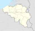
Location map of Belgium
(c) Karte: NordNordWest, Lizenz: Creative Commons by-sa-3.0 de
Location map of Belarus
Autor: NordNordWest, Licencja: CC BY-SA 3.0
Location map of Bosnia and Herzegovina
Łatwo można dodać ramkę naokoło tej grafiki
Autor: Uwe Dedering, Licencja: CC BY-SA 3.0
Location map of China.
EquiDistantConicProjection : Central parallel :
- N: 36.0° N
Central meridian :
- E: 104.0° E
Standard parallels:
- 1: 30.0° N
- 2: 42.0° N
Latitudes on the central meridian :
- top: 57.0° E
- center: 37° 29′ N
- bottom: 17.96° N
Łatwo można dodać ramkę naokoło tej grafiki
(c) Karte: NordNordWest, Lizenz: Creative Commons by-sa-3.0 de
Location map of Montenegro
(c) Karte: NordNordWest, Lizenz: Creative Commons by-sa-3.0 de
Location map of the Czech Republic
The national flag of the Democratic Republic of the Congo. Created according to the 2006 constitution : Son emblème est le drapeau bleu ciel, orné d’une étoile jaune dans le coin supérieur gauche et traversé en biais d’une bande rouge finement encadrée de jaune. (Its symbol is a sky blue flag, decorated with a yellow star in the upper left corner and crossed in the diagonal by a red strip with thin yellow borders) It seems to be identical, except for a lighter field hue, to the 1966–1971 flag.
The flag of the Dominican Republic has a centered white cross that extends to the edges. This emblem is similar to the flag design and shows a bible, a cross of gold and 6 Dominican flags. There are branches of olive and palm around the shield and above on the ribbon is the motto "Dios,Patria!, Libertad" ("God, Country, Freedom") and to amiable freedom. The blue is said to stand for liberty, red for the fire and blood of the independence struggle and the white cross symbolized that God has not forgotten his people. "Republica Dominicana". The Dominican flag was designed by Juan Pablo Duarte, father of the national Independence of Dominican Republic. The first dominican flag was sewn by a young lady named Concepción Bona, who lived across the street of El Baluarte, monument where the patriots gathered to fight for the independence, the night of February 27th, 1844. Concepción Bona was helped by her first cousin María de Jesús Pina.
(c) Karte: NordNordWest, Lizenz: Creative Commons by-sa-3.0 de
Location map of Egypt
Made by author of Xramp, first uploaded by Denelson83 as Flag of Ecuador.svg, modifications by Husunqu.
Flag of Ethiopia
Flaga Finlandii
Autor: Superbenjamin, Licencja: CC BY-SA 4.0
Blank administrative map of France for geo-location purpose, with regions and departements distinguished. Approximate scale : 1:3,000,000
(c) Karte: NordNordWest, Lizenz: Creative Commons by-sa-3.0 de
Location map of Ghana
The national and official state flag of Haiti; arms obtained from http://www.webchantier.com/. The civil flag can be found at here.
Autor: Alexrk2, Licencja: CC BY-SA 3.0
Location map Haiti with departements, Equirectangular projection, N/S stretching 105 %. Geographic limits of the map:
Autor: Pedro A. Gracia Fajardo, escudo de Manual de Imagen Institucional de la Administración General del Estado, Licencja: CC0
Flaga Hiszpanii
Autor: NordNordWest, Licencja: CC BY-SA 3.0
Location map of Spain
Equirectangular projection, N/S stretching 130 %. Geographic limits of the map:
- N: 44.4° N
- S: 34.7° N
- W: 9.9° W
- E: 4.8° E
The Flag of India. The colours are saffron, white and green. The navy blue wheel in the center of the flag has a diameter approximately the width of the white band and is called Ashoka's Dharma Chakra, with 24 spokes (after Ashoka, the Great). Each spoke depicts one hour of the day, portraying the prevalence of righteousness all 24 hours of it.
(c) Uwe Dedering z niemieckiej Wikipedii, CC BY-SA 3.0
Location map of India.
Equirectangular projection. Strechted by 106.0%. Geographic limits of the map:
- N: 37.5° N
- S: 5.0° N
- W: 67.0° E
- E: 99.0° E
bendera Indonesia
Flag of Israel. Shows a Magen David (“Shield of David”) between two stripes. The Shield of David is a traditional Jewish symbol. The stripes symbolize a Jewish prayer shawl (tallit).
Autor: NordNordWest, Licencja: CC BY-SA 3.0
Flag of Jamaica. “The sunshine, the land is green, and the people are strong and bold” is the symbolism of the colours of the flag. GOLD represents the natural wealth and beauty of sunlight; GREEN represents hope and agricultural resources; BLACK represents the strength and creativity of the people. The original symbolism, however, was "Hardships there are, but the land is green, and the sun shineth", where BLACK represented the hardships being faced.
Autor: Maximilian Dörrbecker (Chumwa), Licencja: CC BY-SA 3.0
Location map of Japan
Equirectangular projection.
Geographic limits to locate objects in the main map with the main islands:
- N: 45°51'37" N (45.86°N)
- S: 30°01'13" N (30.02°N)
- W: 128°14'24" E (128.24°E)
- E: 149°16'13" E (149.27°E)
Geographic limits to locate objects in the side map with the Ryukyu Islands:
- N: 39°32'25" N (39.54°N)
- S: 23°42'36" N (23.71°N)
- W: 110°25'49" E (110.43°E)
- E: 131°26'25" E (131.44°E)
Flag of Canada introduced in 1965, using Pantone colors. This design replaced the Canadian Red Ensign design.
Autor: Yug, Licencja: CC-BY-SA-3.0
cropped version of Carte administrative du Canada.svg for map location.
(c) Uwe Dedering z niemieckiej Wikipedii, CC BY-SA 3.0
Location map of Kenya
Equirectangular projection. Strechted by 100.0%. Geographic limits of the map:
- N: 6.0° N
- S: -5.0° N
- W: 33.0° E
- E: 43.0° E
Autor: NordNordWest, Licencja: CC BY-SA 3.0
Location map of South Korea
Flag of Laos
Flag of Liechtenstein
(c) Karte: NordNordWest, Lizenz: Creative Commons by-sa-3.0 de
Location map of Lithuania
Flag of Maldives. The colours used are Pantone 186 C for red and Pantone 348 C for green.
Flag of Namibia
The national flag of Nauru. Official Pantone colours are: PMS 280 blue, PMS 123 yellow.
(c) Karte: NordNordWest, Lizenz: Creative Commons by-sa-3.0 de
Location map of Nepal including the 7 provinces
Autor: NordNordWest, Licencja: CC BY-SA 3.0
Location map of Germany (Wp article: en:Germany)
Flag of New Zealand. Specification: http://www.mch.govt.nz/nzflag/description.html , quoting New Zealand Gazette, 27 June 1902.
(c) Karte: NordNordWest, Lizenz: Creative Commons by-sa-3.0 de
Location map of Poland
Flag of Portugal, created by Columbano Bordalo Pinheiro (1857-1929), officially adopted by Portuguese government in June 30th 1911 (in use since about November 1910). Color shades matching the RGB values officially reccomended here. (PMS values should be used for direct ink or textile; CMYK for 4-color offset printing on paper; this is an image for screen display, RGB should be used.)
Autor: Uwe Dedering, Licencja: CC BY-SA 3.0
Location map of Russia.
EquiDistantConicProjection : Central parallel :
* N: 54.0° N
Central meridian :
* E: 100.0° E
Standard parallels:
* 1: 49.0° N
* 2: 59.0° N
Made with Natural Earth. Free vector and raster map data @ naturalearthdata.com.
Because the southern Kuril islands are claimed by Russia and Japan, they are shown as disputed. For more information about this see: en:Kuril Islands dispute. These islands are since 1945 under the jurisdiction of the Russian Federation.
Flag of Rwanda. The flag ratio is 2:3 with the stripes being 2:1:1. Colors are the following officially: Pantone 299 C 2X (blue), RAL 6029 (green), RAL 1023 (yellow) and RAL 1003 (golden yellow). (As of 03/08/2010, the only color used is the Pantone 299 C, which is from here. The rest of the colors are RAL shades from here.)
Flag of Senegal
(c) Karte: NordNordWest, Lizenz: Creative Commons by-sa-3.0 de
Location map of Serbia
The flag of Navassa Island is simply the United States flag. It does not have a "local" flag or "unofficial" flag; it is an uninhabited island. The version with a profile view was based on Flags of the World and as a fictional design has no status warranting a place on any Wiki. It was made up by a random person with no connection to the island, it has never flown on the island, and it has never received any sort of recognition or validation by any authority. The person quoted on that page has no authority to bestow a flag, "unofficial" or otherwise, on the island.
Autor: Uwe Dedering, Licencja: CC BY-SA 3.0
Location map of the USA (without Hawaii and Alaska).
EquiDistantConicProjection:
Central parallel:
* N: 37.0° N
Central meridian:
* E: 96.0° W
Standard parallels:
* 1: 32.0° N
* 2: 42.0° N
Made with Natural Earth. Free vector and raster map data @ naturalearthdata.com.
Formulas for x and y:
x = 50.0 + 124.03149777329222 * ((1.9694462586094064-({{{2}}}* pi / 180))
      * sin(0.6010514667026994 * ({{{3}}} + 96) * pi / 180))
y = 50.0 + 1.6155950752393982 * 124.03149777329222 * 0.02613325650382181
      - 1.6155950752393982  * 124.03149777329222 *
     (1.3236744353715044  - (1.9694462586094064-({{{2}}}* pi / 180))
      * cos(0.6010514667026994 * ({{{3}}} + 96) * pi / 180))
Flag of South Sudan (originally of the Sudan People's Liberation Army/Movement)
Łatwo można dodać ramkę naokoło tej grafiki
(c) Karte: NordNordWest, Lizenz: Creative Commons by-sa-3.0 de
Location map of Syria. De facto situation.
(c) Karte: NordNordWest, Lizenz: Creative Commons by-sa-3.0 de
Location map of Switzerland
The national flag of Kingdom of Thailand since September 2017; there are total of 3 colours:
- Red represents the blood spilt to protect Thailand’s independence and often more simply described as representing the nation.
- White represents the religion of Buddhism, the predominant religion of the nation
- Blue represents the monarchy of the nation, which is recognised as the centre of Thai hearts.
(c) Karte: NordNordWest, Lizenz: Creative Commons by-sa-3.0 de
Location map of Ukraine
Autor: NordNordWest (dyskusja · edycje), Licencja: CC BY-SA 3.0
Location map of Hungary
(c) Karte: NordNordWest, Lizenz: Creative Commons by-sa-3.0 de
Location map of the United Kingdom
Autor: NordNordWest, Licencja: CC BY-SA 3.0
Location map of Italy (Commons photos) → en-Wikipedia Italy.
Flag of the Ivory Coast, written by Jon Harald Søby, modified by Zscout370. The colors match to what is reported at http://fotw.vexillum.com/flags/ci.html.
Flaga Naddniestrzańskiej Republiki Mołdawskiej (rewers), bez sierpa i młota
Flag of South Ossetia
Autor: Heraldry, Licencja: CC-BY-SA-3.0
North America (orthographic projection)
Autor:
- Guatemala Departments.svg: Daryona
- Mexico location map.svg: NordNordWest
- praca pochodna: Spischot
Location map of Guatemala
(c) Karte: NordNordWest, Lizenz: Creative Commons by-sa-3.0 de
Location map of Mali
Autor: NordNordWest, Licencja: CC BY-SA 3.0
Location map of Afghanistan
(c) Karte: NordNordWest, Lizenz: Creative Commons by-sa-3.0 de
Location map of Azerbaijan
Autor: Maximilian Dörrbecker (Chumwa), Licencja: CC BY-SA 3.0
Location map of Liechtenstein
Autor:
- Luxembourg adm location map.svg: NordNordWest
- derivative work: Jann
Location map of Luxembourg
Autor: Addicted04, Licencja: CC BY-SA 3.0
Location map of Honduras.
Geographic limits of the map:
* West : 89.50 W
* East : 83.00 W
* North : 16.70 N
* South : 12.80 N
Autor: NordNordWest, Licencja: CC BY-SA 3.0 de
Location map of Uzbekistan
(c) Karte: NordNordWest, Lizenz: Creative Commons by-sa-3.0 de
Location map of Finland
Autor: NordNordWest, Licencja: CC BY-SA 3.0
Location map of Papua New Guinea
Autor: NordNordWest, Licencja: CC BY-SA 3.0
Location map of Saudi Arabia
Autor: NordNordWest, Licencja: CC BY-SA 3.0
Location map of New Zealand
(c) Karte: NordNordWest, Lizenz: Creative Commons by-sa-3.0 de
Location map of Zambia
(c) Uwe Dedering z niemieckiej Wikipedii, CC BY-SA 3.0
Location map of Namibia
Equirectangular projection. Strechted by 108.0%. Geographic limits of the map:
- N: -16.4° N
- S: -29.6° N
- W: 11.0° E
- E: 25.8° E
Autor: NordNordWest, Licencja: CC BY-SA 3.0
Location map of Turkmenistan
Autor: Maximilian Dörrbecker (Chumwa), Licencja: CC BY-SA 3.0
Location map of Malta
(c) Uwe Dedering z niemieckiej Wikipedii, CC BY 3.0
Location map of Nigeria
Equirectangular projection. Geographic limits of the map:
- N: 14° N
- S: 4° N
- W: 2° E
- E: 15° E
(c) Karte: NordNordWest, Lizenz: Creative Commons by-sa-3.0 de
Location map of Ethiopia
(c) Karte: NordNordWest, Lizenz: Creative Commons by-sa-3.0 de
Location map of Lesotho
Mapa Saint Vincent i Grenadynów na podstawie CIA World Factbook
Autor: Martin23230, Licencja: CC BY-SA 3.0
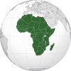
Orthographic map of Africa
(c) Karte: NordNordWest, Lizenz: Creative Commons by-sa-3.0 de
Location map of North Korea
Autor: Eric Gaba (Sting - fr:Sting), Licencja: CC BY-SA 3.0
Blank administrative map of Chad as since the 2008-02 reform of the Regions, for geo-location purposes.
Autor: NordNordWest, Licencja: CC BY-SA 3.0
Location map of the North Macedonia
Autor: Uwe Dedering, Licencja: CC BY-SA 3.0
Location map of Malaysia.
Equirectangular projection. Strechted by 100.0%. Geographic limits of the map:
* N: 8.0° N
* S: 0.0° N
* W: 99.0° E
* E: 120.0° E
Made with Natural Earth. Free vector and raster map data @ naturalearthdata.com.
(c) Karte: NordNordWest, Lizenz: Creative Commons by-sa-3.0 de
Location map of Tajikistan
Autor: Eric Gaba (Sting - fr:Sting), Licencja: CC BY-SA 3.0
Blank administrative map of Morocco, for geo-location purposes.
(c) Karte: NordNordWest, Lizenz: Creative Commons by-sa-3.0 de
Location map of Gambia
(c) Karte: NordNordWest, Lizenz: Creative Commons by-sa-3.0 de
Location map of Paraguay
Autor: Uwe Dedering, Licencja: CC BY-SA 3.0
Location map of Gabon Equirectangular projection. Geographic limits of the map:
   * N: 2.5° N
   * S: 4° S
   * W: 8° E
   * E: 15° E
Made with Natural Earth. Free vector and raster map data @ naturalearthdata.com.
Autor: User:Gvf, Licencja: CC BY 2.5
Location map of Congo. N 3.736, S -5.760, W 10.290, E 19.126
Autor: Nightstallion (original)
Zscout370 (most recent), Licencja: CC0
Flag of Tuvalu.
Autor: Eric Gaba (Sting - fr:Sting), Licencja: CC BY-SA 3.0
Blank administrative map of Vanuatu in Oceania, for geo-location purposes.
Autor: NordNordWest, Licencja: CC BY-SA 3.0
Location map of Trinidad and Tobago
Map of Seychelles
(c) Uwe Dedering z niemieckiej Wikipedii, CC BY-SA 3.0
Location map of Côte d'Ivoire Equirectangular projection.
Strechted by 101%. Geographic limits of the map:
- N: 11° N
- S: 4° N
- W: 9° W
- E: 2° W
Mapka Monako z CIA Factbook
Autor: NordNordWest, Licencja: CC BY 3.0
Location map of the Philippines
Autor: See File history below for details., Licencja: CC0
The Flag of Dominica.
Autor: NordNordWest, Licencja: CC BY-SA 3.0 de
Location map of the United Arab Emirates in Persian Gulf
Autor: Uwe Dedering, Licencja: CC BY-SA 3.0
Location map of Liberia Equirectangular projection. Strechted by 101.0%. Geographic limits of the map:
- N: 8.8° N
- S: 4.0° N
- W: -11.8° E
- E: -7.0° E
Autor: NordNordWest and OpenStreetMap contributors, Licencja: CC BY-SA 2.0
Location map of Bahrain
(c) Karte: NordNordWest, Lizenz: Creative Commons by-sa-3.0 de
Location map of Latvia
(c) Uwe Dedering z niemieckiej Wikipedii, CC BY 3.0
Location map of Democratic Republic of the Congo
Equirectangular projection. Strechted by 100.0%. Geographic limits of the map:
- N: 6.0° N
- S: -14.0° N
- W: 11.0° E
- E: 32.0° E
Made with Natural Earth. Free vector and raster map data @ naturalearthdata.com.
A new map with the 26 provinces (since 2015) is available here.Autor: Alexrk2, Licencja: CC BY-SA 3.0
Location map Dominican Republic with Provinces, Equirectangular projection, N/S stretching 105 %. Geographic limits of the map:
Autor: Uwe Dedering, Licencja: CC BY-SA 3.0
Location map of Myanmar. Equirectangular projection. Strechted by 105.0%. Geographic limits of the map: * N: 29.0° N * S: 9.0° N * W: 92.0° E * E: 102.0° E Made with Natural Earth. Free vector and raster map data @ naturalearthdata.com.
(c) Eric Gaba – Wikimedia Commons user: Sting, CC BY-SA 4.0
Blank map of Costa Rica for geo-location purpose.
Note: The Isla del Coco, out of the map, is not shown.
Scale: 1:1,856,000 (accuracy: 464 m).
Equirectangular projection centered on 9°30'N – 84°15'W, WGS84 datum
Geographic limits of the map:
* West: 86°30'W
* East: 82°W
* North: 11°30'N
* South: 7°30'N
Please do not replace the simplified code by a version created with Inkscape or another vector graphics editor❗
Autor: NordNordWest, Licencja: CC BY-SA 3.0 de
Location map of the Central African Republic
Autor: Eric Gaba (Sting - fr:Sting), Licencja: CC BY-SA 3.0
Blank administrative map of Somalia, for geo-location purposes.
Autor: Ch1902, Licencja: CC BY-SA 3.0
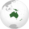
Orthographic map of the Australasian part of Oceania: Australia, New Guinea, Island Melanesia, New Zealand the Maluccas east of the Weber Line.
(c) Karte: NordNordWest, Lizenz: Creative Commons by-sa-3.0 de
Location map of Albania
Flag of Mauritania, adopted in 2017. The National Assembly added red stripes to the top and bottom edges to represent “the blood shed by the martyrs of independence”.
(c) Karte: NordNordWest, Lizenz: Creative Commons by-sa-3.0 de
Location map of Equatorial Guinea
Autor: Uwe Dedering, Licencja: CC BY-SA 3.0
Location map of Burkina Faso Equirectangular projection. Strechted by 102%. Geographic limits of the map:
  * N: 15.5° N
  * S: 9° N
  * W: 6° W
  * E: 3° E
Made with Natural Earth. Free vector and raster map data @ naturalearthdata.com.
Autor: Uwe Dedering, Licencja: CC BY-SA 3.0
Location map of Vietnam.
Equirectangular projection. Strechted by 104 %. Geographic limits of the map:
- N: 24.0° N
- S: 8.0° N
- W: 101.8° E
- E: 110.3° E
Paracel Islands (map between). Equirectangular projection. Stretched by 52%. Geographic limits of the map:
- N: 17°15′ N
- S: 15°45′ N
- W: 111°00′ E
- E: 113°00′ E
Spratly Islands (map below). Equirectangular projection. Stretched by 41.6%. Geographic limits of the map:
- N: 12°00' N
- S: 6°12' N
- W: 111°30' E
- E: 117°20' E
Autor: Eric Gaba (Sting - fr:Sting), Licencja: CC BY-SA 3.0
Blank administrative map of Andorra with parishes boundaries for geo-location purpose.
Note: Dotted lines are boundaries estimated from very small scale reference maps.
(c) Aotearoa z polskiej Wikipedii, CC-BY-SA-3.0
Mapa Sfederowanych Stanów Mikronezji. Autor Aotearoa
Map of the Saint Kitts and Nevis
(c) Karte: NordNordWest, Lizenz: Creative Commons by-sa-3.0 de
Location map of Kazakhstan
Autor:
Location map of Barbados. Geographic limits of the map:
- N: 13.349° N
- S: 13.034° N
- W: 59.690° W
- E: 59.399° W
(c) Karte: NordNordWest, Lizenz: Creative Commons by-sa-3.0 de
Location map of East Timor
(c) Karte: NordNordWest, Lizenz: Creative Commons by-sa-3.0 de
Location map of Armenia
Autor: Uwe Dedering, Licencja: CC BY-SA 3.0
Location map of Sri Lanka.
Equirectangular projection. Strechted by 101.0%. Geographic limits of the map:
- N: 10.2° N
- S: 5.5° N
- W: 79.2° E
- E: 82.3° E
Autor: NordNordWest, Licencja: CC BY 3.0
Location map of Guinea-Bissau
Autor: NordNordWest, Licencja: CC BY-SA 3.0 de
Location map of South Sudan
(c) Karte: NordNordWest, Lizenz: Creative Commons by-sa-3.0 de
Location map of Pakistan
Autor: Carport, Licencja: CC BY-SA 2.0
Location map of Niger
Equirectangular projection, N/S stretching. Geographic limits of the map:
- N: 24° N
- S: 11° N
- W: 1° W
- E: 17° E
(c) Lencer, CC BY-SA 3.0
Location map of Greece
Equirectangular projection, N/S stretching 120 %. Geographic limits of the map:
- N: 42.0° N
- S: 34.6° N
- W: 19.1° E
- E: 29.9° E
Flag of Abkhazia
Autor: Uwe Dedering, Licencja: CC BY-SA 3.0
Location map of Indonesia.
Equirectangular projection. Stretched by 100.0%. Geographic limits of the map:
- N: 6.5° N
- S: -11.5° N
- W: 94.5° E
- E: 141.5° E
The proportions of this flag are 3:2; however, there is no official definition for the correct proportions and also 5:3 is widely used.
Mapka Kiribati z CIA Factbook
Mongolia location map v2
Autor: Ten SVG Ten herb zawiera elementy, które zostały zaczerpnięte lub zaadaptowane z tego Ten herb:, Licencja: CC0
Emblem of Papacy and Holy See
Flag of São Tomé and Príncipe
Autor: NordNordWest, Licencja: CC BY-SA 3.0
Location map of El Salvador
Autor: Alexrk2, Licencja: CC BY-SA 3.0
Location map of Nicaragua with Departamentos, Equirectangular projection, N/S stretching 100 %. Geographic limits of the map:
(c) Karte: NordNordWest, Lizenz: Creative Commons by-sa-3.0 de
Location map of Tunisia
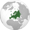
Map of Europe. The continental boundary to Asia as indicated is the standard convention following the Caucasus crest, the Ural River and the Urals Mountains to the Sea of Kara
Autor: NordNordWest, Licencja: CC BY-SA 3.0
Location map of São Tomé and Príncipe
Autor:
- Argentina_location_map.svg: NordNordWest
- Uruguay_departments_blank.svg: NielsF|talk/overleg/discussion/discussione 22:08, 23 November 2006 (UTC)
- derivative work: Spischot (talk)
Location map of Uruguay
Autor: Uwe Dedering, Licencja: CC BY-SA 3.0
Location map of Iran.
Equirectangular projection. Stretched by 118.0%. Geographic limits of the map:
* N: 40.0° N
* S: 24.5° N
* W: 43.5° E
* E: 64.0° E
Made with Natural Earth. Free vector and raster map data @ naturalearthdata.com.
Autor: Eric Gaba (Sting - fr:Sting), Licencja: CC BY-SA 3.0
Blank administrative map of Mauritania, for geo-location purposes.
Autor: User:darkvador, Licencja: CC BY-SA 3.0
Location map Vatican City, Equirectangular projection, N/S stretching 130 %. Geographic limits of the map:
Autor: by Luan
South America (orthographic projection)
(c) Karte: NordNordWest, Lizenz: Creative Commons by-sa-3.0 de
Location map of Estonia
(c) Karte: NordNordWest, Lizenz: Creative Commons by-sa-3.0 de
Location map of Oman
(c) Karte: NordNordWest, Lizenz: Creative Commons by-sa-3.0 de
Location map of Guinea
(c) Uwe Dedering z niemieckiej Wikipedii, CC BY-SA 3.0
Location map of Mauritius
Equirectangular projection. Stretched by 106.0%. Geographic limits of the map:
- N: -19.7° N
- S: -20.6° N
- W: 57.21° E
- E: 57.91° E
Autor: Alexrk, Licencja: CC BY-SA 3.0
Location map of Panama
Equirectangular projection. Geographic limits of the map:
- N: 10.28° N
- S: 6.79° N
- W: 83.56° W
- O: 76.64° W


