Palais de la découverte
| ||
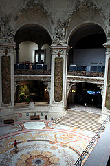
 Wejście do Palais de la Découverte | ||
| Państwo | ||
| Miejscowość | Paryż | |
| Data założenia | 1937 | |
| Zakres zbiorów | muzeum nauki | |
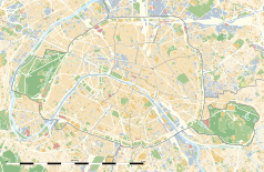
Położenie na mapie Paryża (c) Eric Gaba, Wikimedia Commons user Sting, CC BY-SA 3.0 | ||
Palais de la découverte (fr. pałac odkryć) – centrum nauki w Paryżu mieszczące się w Grand Palais.
Wystawa osiągnięć nauki została otwarta w 1937 roku podczas międzynarodowej wystawy sztuki i techniki w Paryżu. W 1938 Rząd Francuski przekształcił wystawę w muzeum.
W roku 1937 na Międzynarodowej Wystawie Sztuki i Techniki (Exposition Internationale des Arts et Techniques dans la Vie Moderne), w budynku który obecnie zajmuje Palais de la découverte w pawilonie meteorologicznym zespół kierowany przez Henri Bénarda pokazał eksperymenty obrazujące powstanie rolek konwekcyjnych ważnych w opisie chmur cirrocumulus, altocumulus oraz stratocumulus.
Zobacz też
Linki zewnętrzne
Media użyte na tej stronie
(c) Eric Gaba, Wikimedia Commons user Sting, CC BY-SA 3.0
Blank land cover map of the city and department of Paris, France, as in January 2012, for geo-location purpose, with distinct boundaries for departments and arrondissements.
Autor: Superbenjamin, Licencja: CC BY-SA 4.0
Blank administrative map of France for geo-location purpose, with regions and departements distinguished. Approximate scale : 1:3,000,000
Autor: Thibault Pelloquin, Licencja: CC BY-SA 3.0
Cette carte représente l'Île de France (en jaune pâle), ses limites départementales et régionales (en traits gris) et ses principaux cours et points d'eau (en bleu). Les départements limitrophes (sont en rose-orange pâle)
Autor: Jean-noël Lafargue - www.hyperbate.com, Licencja: FAL
Musée de la découverte, Paris (the main hall)


