Park Narodowy „Ikara-Góry Flindersa”
 Urwisko Rawnsley Bluff, zewnętrzna ściana Wikpena Pound od strony południowej. | |
| Państwo | |
|---|---|
| Data utworzenia | |
| Powierzchnia | 91200 ha |
| Strona internetowa | |
Park Narodowy „Ikara-Góry Flindersa”[1], dawniej: Park Narodowy Gór Flindersa (ang. Ikara-Flinders Ranges National Park) – park narodowy położony w południowo-wschodniej części stanu Australia Południowa w Australii. Utworzony w 1945. Park obejmuje powierzchnię 912 km2, Park pokrywa część masywu górskiego Gór Flindersa.
Centralną część parku tworzy Wilpena Pound gigantyczny "amfiteatr" o powierzchni 80 kilometrów kwadratowych.
Przypisy
- ↑ Polski egzonim uchwalony na 105. posiedzeniu KSNG.
Zobacz też
Linki zewnętrzne
- Strona oficjalna Parku. environment.sa.gov.au. [zarchiwizowane z tego adresu (2013-04-25)]. (ang.)
Media użyte na tej stronie
Shiny green button/marker widget.
Autor: , Licencja: CC BY-SA 3.0
Relief map of Australia, including the borders of the states of the Commonwealth of Australia
Autor: self, Licencja: CC-BY-SA-3.0
Rawnsley Bluff, south face of Wilpena Pound
Autor: Tentotwo, Licencja: CC BY-SA 3.0
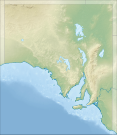
Location map of South Australia, Australia
Equidistant cylindrical projection, latitude of true scale 31.27° S (equivalent to equirectangular projection with N/S stretching 117 %). Geographic limits of the map:
- N: 25.6° S
- S: 38.5° S
- W: 128.5° E
- E: 141.5° E


