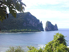
Park Narodowy Samoa Amerykańskiego
| ||
| park narodowy | ||
| Państwo | ||
| Terytorium nieinkorporowane | ||
| Data utworzenia | 6 grudnia 1947 | |
| Powierzchnia | 36.42 km² | |
| Odwiedzający | 17 919 (2013)[1] | |
| Strona internetowa | ||
Park Narodowy Samoa Amerykańskiego (National Park of American Samoa) – park narodowy obejmujący trzy wyspy Samoa Amerykańskie – Tutuila, Ofu-Olosega i Ta‘ū. W parku znajduje się wiele raf koralowych i lasów deszczowych. Założony został 31 października 1988 roku[2].
Powierzchnia parku wynosi 4250 ha, z czego 1030 ha stanowią wody[3].
Jest to jedyny park narodowy Stanów Zjednoczonych leżący na południowej półkuli.
Przypisy
- ↑ Sprawozdania roczne - podsumowanie liczby odwiedzających (ang.). National Park Service. [dostęp 2014-08-24].
- ↑ Public Law No: 100-571 (ang.). Library of Congress: THOMAS, 1988-10-31. [dostęp 2009-01-30].
- ↑ US National Park Service: General Management Plan 1997
Media użyte na tej stronie
The flag of Navassa Island is simply the United States flag. It does not have a "local" flag or "unofficial" flag; it is an uninhabited island. The version with a profile view was based on Flags of the World and as a fictional design has no status warranting a place on any Wiki. It was made up by a random person with no connection to the island, it has never flown on the island, and it has never received any sort of recognition or validation by any authority. The person quoted on that page has no authority to bestow a flag, "unofficial" or otherwise, on the island.
Shiny green button/marker widget.
Autor: Uwe Dedering, Licencja: CC BY-SA 3.0
Relief location map of Oceania.
- Projection: Lambert azimuthal equal-area projection.
- Area of interest:
- N: 35.0° N
- S: -55.0° N
- W: 110.0° E
- E: 230.0° E (This is -130° E)
- Projection center:
- NS: -10.0° N
- WE: 170.0° E
- GMT projection: -JA170/-5/20c
- GMT region: -R79.58168799459713/-44.42200097096855/-120.83787447194456/33.90289238708686r
- GMT region for grdcut: -R80.0/-63.0/260.0/39.0r
- Relief: SRTM30plus.
- Made with Natural Earth. Free vector and raster map data @ naturalearthdata.com.
(c) Eric Guinther z angielskojęzycznej Wikipedii, CC-BY-SA-3.0
Looking across Vatia Bay towards Pola Tai, Tutuila, American Samoa; National Park of American Samoa


