Parki narodowe na Filipinach
Parki narodowe Filipin (fil. Pambansang Liwasan ng Pilipinas) – miejsca o wartości historycznej lub przyrodniczej przeznaczone do ochrony i zrównoważonego wykorzystania utworzone przez Departament Środowiska i Zasobów Naturalnych w ramach zintegrowanej narodowej ustawy o systemie obszarów chronionych z 1992 roku[1]. W 2012 roku było na Filipinach 240 obszarów chronionych, z których 35 zostało zakwalifikowanych jako parki narodowe[2].
Największym parkiem narodowym Filipin jest Park Narodowy Mounts Iglit-Baco o powierzchni 75 455 ha, natomiast najmniejszym jest Park Narodowy MacArthur Landing, którego powierzchnia wynosi zaledwie 6,78 ha. Dla porównania parkiem narodowym w Polsce może zostać obszar chroniony o powierzchni nie mniejszej niż 1000 ha.
Miejsce światowego dziedzictwa UNESCO lub część miejsca światowego dziedzictwa UNESCO
| Nazwa | Prowincja | Powierzchnia (ha) | Data założenia |
|---|---|---|---|
| Park Narodowy Aurora Memorial | Aurora, Nueva Ecija | 5676 | 1937 |
| Park Narodowy Balbalasang-Balbalan | Kalinga | 1338 | 1972 |
| Park Narodowy Bangan Hill | Nueva Vizcaya | 13,90 | 1995 |
| Park Narodowy Bataan | Bataan | 23688 | 1945 |
| Park Narodowy Biak-na-Bato | Bulacan | 2117 | 1937 |
| Park Narodowy Bulabog Putian | Iloilo | 854,33 | 1961 |
| Park Narodowy Caramoan | Camarines Sur | 347 | 1938 |
| Park Narodowy Cassamata | Abra | 57 | 1974 |
| Park Narodowy Fuyot Springs | Isabela | 819 | 1938 |
| Park Narodowy Guadalupe Mabugnao Mainit Hot Spring | Cebu | 57,50 | 1972 |
| Park Narodowy Hundred Islands | Pangasinan | 1676,30 | 1940 |
| Park Narodowy Kuapnit Balinsasayao | Leyte | 364 | 1937 |
| Park Narodowy Lake Butig | Lanao del Sur | 68 | 1965 |
| Park Narodowy Lake Dapao | Lanao del Sur | 1500 | 1965 |
| Park Narodowy Libmanan Caves | Camarines Sur | 19,40 | 1934 |
| Park Narodowy Luneta | Metro Manila | 16,24 | 1955 |
| Park Narodowy MacArthur Landing | Leyte | 6,78 | 1977 |
| Park Narodowy Mado Hot Spring | Cotabato | 48 | 1939 |
| Park Narodowy Minalungao | Nueva Ecija | 2018 | 1967 |
| Park Narodowy Mount Arayat | Pampanga | 3715,23 | 1933 |
| Park Narodowy Mount Dajo | Sulu | 213,35 | 1938 |
| Park Narodowy Mount Data | Cordillera | 5512 | 1936 |
| Park Narodowy Mounts Iglit-Baco | Mindoro Occidental | 75455 | 1969 |
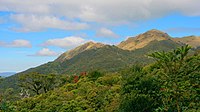
| Park Narodowy Mount Pulag | Cordillera, Nueva Vizcaya | 11550 | 1987 |
| Park Narodowy Naujan Lake | Mindoro Oriental | 21655 | 1956 |
| Park Narodowy Northern Luzon Heroes Hill | Ilocos Sur | 1316 | 1963 |
| Park Narodowy Olongapo Naval Base Perimeter | Zambales | 9,04 | 1968 |
| Park Narodowy Pagsanjan Gorge | Laguna | 152,64 | 1939 |
| Park Narodowy Pantuwaraya Lake | Lanao del Sur | 20 | 1965 |
| Park Narodowy Paoay Lake | Ilocos Norte | 340 | 1969 |
| Park Narodowy Quezon Memorial | Region Stołeczny | 22,70 | 1975 |
| Park Narodowy Rungkunan | Lanao del Sur | 947[3] | 1965 |
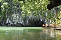
| Park Narodowy Rzeki Podziemnej Puerto Princesa | Palawan | 22202 | 1999 |
| Park Narodowy Sacred Mountain | Lanao del Sur | 94 | 1965 |
| Park Narodowy Salikata | Lanao del Sur | 1055[4] | 1965 |
Przypisy
- ↑ National Integrated Protected Areas System Act of 1992. Department of Environment and Natural Resources. [dostęp 2012-06-11]. [zarchiwizowane z tego adresu (4 maja 2013)]. (ang.).
- ↑ Establishing and Managing Protected Areas. Department of Environment and Natural Resources – Protected Areas and Wildlife Bureau. [dostęp 2012-06-11]. [zarchiwizowane z tego adresu (17 kwietnia 2012)]. (ang.).
- ↑ Philippines National PA. ASEAN Centre for Biodiversity, 2004. [dostęp 2014-01-10]. [zarchiwizowane z tego adresu (2014-01-10)]. (ang.).
- ↑ Philippines National PA. ASEAN Centre for Biodiversity, 2004. [dostęp 2014-01-10]. [zarchiwizowane z tego adresu (2014-01-10)]. (ang.).
Media użyte na tej stronie
Autor: Miguel raul, Licencja: CC BY-SA 3.0
Hundred Island, Alaminos, Pangasinan, PH
Mount Natib is a massive stratovolcano at the northern end of the Bataan Peninsula, south of Pinatubo volcano. The summit of the volcano, seen here from the WNW, is truncated by a 6 x 7 km caldera. The age of the latest eruption is not known, but is considered to be late Pleistocene or Holocene. Five thermal areas are found in the summit region.
Autor: Carlo Jose Garcia https://www.flickr.com/photos/carlo_garcia/, Licencja: CC BY-SA 3.0
- Matukad Island Aerial View, Camarines Sur
Autor: Angeles624, Licencja: CC-BY-SA-3.0
Madlum, San Miguel, Bulacan Hanging Bridge and Sitio Madlum River in Barangay Sibul Springs, beside Biak-na-Bato, San Miguel, Bulacan; Madlum 15° 10.212N 121° 04.973E ; Bulacan State U officials dismissed due to the August 19, 2014 drowning of 7 students; the Madlum Cave to reach Mount Manalmon huge white boulders, beside Mount Gola farther left, is Mount Arayat in Pampanga; Bridge Load Limit, 10 persons, Presidential Proclamation No. 401, April 11, 1989, Madlum Caves, Bayukbok I Cave and Bayukbok II Cave parts of the Biak-na-Bato National Park, Republic of Biak-na-Bato protected areas IUCN category V (protected landscape/seascape), Breast-shaped hill Mount Susong Dalaga and Tilandong Falls are also popular attractions inside the 658.8497 hectares Park under the jurisdiction and located in Doña Remedios Trinidad, Bulacan and San Miguel, Bulacan along the Sibul Springs-BiaknaBato, San Miguel, Bulacan Farm to Market Road interconnecting with and from the Salangan-Santa Rita Bata-Santa Rita Matanda-San Juan-Tibagan-Pulong Bayabas-Pacalag, San Miguel-Buhol na Mangga, San Ildefonso, Bulacan National Road (accessed along and from the Maharlika Highway (Cagayan Valley Road, San Miguel, Bulacan section) of the Pan-Philippine Highway, also known as the Maharlika "Nobility/freeman" Highway or Asian Highway 26, Cagayan Valley Road).


