Perstorp
 Widok z peronu stacji w Perstorpie | |
| Państwo | |
|---|---|
| Region | |
| Gmina | Perstorp |
| Powierzchnia | 5,76[1] km² |
| Populacja (2018) • liczba ludności • gęstość | 6068[1] 1054[1] os./km² |
| Nr kierunkowy | (+46) 435 |
| Kod pocztowy | 284 3x |
| Strona internetowa | |
| Portal | |
Perstorp – miejscowość (tätort) w południowej Szwecji, w regionie administracyjnym (län) Skania. Siedziba władz (centralort) gminy Perstorp.
W 2015 roku Perstorp liczył 5847 mieszkańców[2].
Położenie
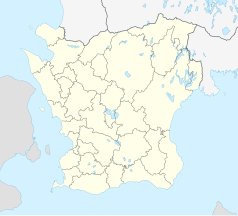
Miejscowość jest położona ok. 25 km na zachód od Hässleholmu, w prowincji historycznej (landskap) Skania. Przez Perstorp przebiega droga krajowa nr 21 (Riksväg 21; Kristianstad – Helsingborg) oraz linia kolejowa Skånebanan (Kristianstad – Hässleholm – Helsingborg).
Demografia
Liczba ludności tätortu Perstorp w latach 1960–2015[3]:
Gospodarka
Perstorp jest znany z założonych w 1881 roku zakładów chemicznych Perstorp AB[4].
Przypisy
- ↑ a b c Statistiska tätorter 2018; befolkning, landareal, befolkningstäthet (szw.). Statistikmyndigheten SCB, 2020-03-20. [dostęp 2020-09-08]. [zarchiwizowane z tego adresu (2020-03-24)].
- ↑ Statistiska centralbyrån: Tätorter 2015; befolkning, landareal, andel som överlappas av fritidshusområden (szw.). [dostęp 2017-01-03]. [zarchiwizowane z tego adresu (2017-11-07)].
- ↑ Statistiska centralbyrån: Landareal per tätort, folkmängd och invånare per kvadratkilometer. Vart femte år 1960 - 2015 (szw.). [dostęp 2017-01-03]. [zarchiwizowane z tego adresu (2018-01-20)].
- ↑ Perstorp: Site Perstorp (ang.). [dostęp 2017-01-03].
Media użyte na tej stronie
Autor: moonhouse and Grafis, Licencja: CC BY 2.0
Perstorp, view from the station towards the hotel, "Perstorps Brukshotell"
(c) Lokal_Profil, CC BY-SA 2.5
This coat of arms was drawn based on its blazon which – being a written description – is free from copyright. Any illustration conforming with the blazon of the arms is considered to be heraldically correct. Thus several different artistic interpretations of the same coat of arms can exist. The design officially used by the armiger is likely protected by copyright, in which case it cannot be used here.
Individual representations of a coat of arms, drawn from a blazon, may have a copyright belonging to the artist, but are not necessarily derivative works.
Autor: Erik Frohne, Licencja: CC BY 3.0
Location map of Scania (Skåne) in Sweden
Equirectangular projection, N/S stretching 179 %. Geographic limits of the map:
- N: 56° 37' N
- S: 55° 12' N
- W: 12° 12' E
- E: 15° 00' E


