Phewa Tal
 Widok na jezioro od strony południowej, w tle masyw górski Annapurny | |
| Położenie | |
| Państwo | |
|---|---|
| Wysokość lustra | 793 m n.p.m. |
| Morfometria | |
| Powierzchnia | 4,43 km² |
| Głębokość • średnia • maksymalna |
|
| Objętość | 46 mln m³ |
Położenie na mapie Nepalu  (c) Karte: NordNordWest, Lizenz: Creative Commons by-sa-3.0 de | |
Phewa Tal (nep. फेवा ताल, Phēvā tāla) – jezioro w środkowym Nepalu, w Dolinie Pokhary, drugie pod względem wielkości jezioro w kraju[1]. Na jego wschodnim brzegu położone jest miasto Pokhara[2].
Powierzchnia jeziora wynosi około 4,43 km², pojemność – około 46 mln m³, średnia głębokość – 8,6 m, maksymalna – 19 m. Lustro wody znajduje się na wysokości 793 m n.p.m. Jezioro zasilane jest wodami kilku strumieni, powierzchnia zlewiska wynosi 123 km²[1]. Jest to jezioro monomiktyczne ciepłe[2].
Jezioro wykorzystywane jest do celów rekreacyjnych, rybołówstwa, irygacji pól oraz jako źródło wody pitnej i energii wodnej[2]. Stanowi jedną z najliczniej odwiedzanych atrakcji turystycznych Nepalu[1].
- Phewa Tal


 © Vyacheslav Argenberg / http://www.vascoplanet.com/, CC BY 4.0
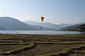 © Vyacheslav Argenberg / http://www.vascoplanet.com/, CC BY 4.0
 © Vyacheslav Argenberg / http://www.vascoplanet.com/, CC BY 4.0
Przypisy
- ↑ a b c Shailendra Pokharel, Conservation of Phewa Lake of Pokhara, Nepal, Research Center for Sustainability and Environment, Shiga University, s. 2 [dostęp 2019-04-19] [zarchiwizowane z adresu 2016-03-03] (ang.).
- ↑ a b c Lake Phewa (ang.). W: World Lake Database [on-line]. International Lake Environment Committee (ILEC). [dostęp 2019-04-19]. [zarchiwizowane z tego adresu (2019-04-19)].
Media użyte na tej stronie


Legenda jezioro.gif
Autor: Tzugaj, Licencja: CC0
znak graficzny do map, ukazujący przykładowe jezioro
Autor: Tzugaj, Licencja: CC0
znak graficzny do map, ukazujący przykładowe jezioro
Phewa lake, Pokhara.jpg
Autor: Jmhullot, Licencja: CC BY-SA 3.0
After a night in Kathmandu, our next stop towards Upper Mustang is Pokhara, just an half-hour flight from Katmandu with gorgeous views on the Himalayas all along (sit on the right of the aircraft). Pokhara is the second largest city of Nepal but, unlike the capital Kathmandu, it is quite loosely built up and still has much green space. The tourist district is along the north shore of Phewa lake. The Annapurna range on the north is only about 28 km away from the lake, and the lake is famous for the reflection of mount Machhapuchhre and other mountain peaks of the Annapurna and Dhaulagiri ranges on its surface.
Nepal rel location map.svg
(c) Karte: NordNordWest, Lizenz: Creative Commons by-sa-3.0 de
Location map of Nepal including the 7 provinces
(c) Karte: NordNordWest, Lizenz: Creative Commons by-sa-3.0 de
Location map of Nepal including the 7 provinces

Pokhara-Phewasee-02-Terrassen-2013-gje.jpg
Autor: Gerd Eichmann, Licencja: CC BY-SA 4.0
Lake Phewa in Pokhara in Nepal
Autor: Gerd Eichmann, Licencja: CC BY-SA 4.0
Lake Phewa in Pokhara in Nepal

Phewa Lake 2, Nepal.jpg
© Vyacheslav Argenberg / http://www.vascoplanet.com/, CC BY 4.0
Phewa Lake, Fewa Lake. Pokhara, Nepal.
© Vyacheslav Argenberg / http://www.vascoplanet.com/, CC BY 4.0
Phewa Lake, Fewa Lake. Pokhara, Nepal.

Pokhara, Phewa Lake 2, Nepal.jpg
© Vyacheslav Argenberg / http://www.vascoplanet.com/, CC BY 4.0
Phewa Lake. Pokhara, Nepal.
© Vyacheslav Argenberg / http://www.vascoplanet.com/, CC BY 4.0
Phewa Lake. Pokhara, Nepal.

Pokhara, Phewa Lake 3, Nepal.jpg
© Vyacheslav Argenberg / http://www.vascoplanet.com/, CC BY 4.0
Phewa Lake. Pokhara, Nepal.
© Vyacheslav Argenberg / http://www.vascoplanet.com/, CC BY 4.0
Phewa Lake. Pokhara, Nepal.

Pokhara-Phewasee-52-Boote-2015-gje.jpg
Autor: Gerd Eichmann, Licencja: CC BY-SA 4.0
Boats on the Phewa Lake in Pokhara
Autor: Gerd Eichmann, Licencja: CC BY-SA 4.0
Boats on the Phewa Lake in Pokhara

Pokhara-Phewasee-64-Boot-2015-gje.jpg
Autor: Gerd Eichmann, Licencja: CC BY-SA 4.0
Boats on the Phewa Lake in Pokhara
Autor: Gerd Eichmann, Licencja: CC BY-SA 4.0
Boats on the Phewa Lake in Pokhara

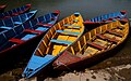
Pokhara-Phewasee-56-Boote-2015-gje.jpg
Autor: Gerd Eichmann, Licencja: CC BY-SA 4.0
Boats on the Phewa Lake in Pokhara
Autor: Gerd Eichmann, Licencja: CC BY-SA 4.0
Boats on the Phewa Lake in Pokhara