Piaski (Trzebinia)
| ||||
| ||||
| Państwo | ||||
|---|---|---|---|---|
| Województwo | ||||
| Powiat | chrzanowski | |||
| Gmina | Trzebinia | |||
| Miasto | Trzebinia | |||
| Strefa numeracyjna | (+48) 32 | |||
| Tablice rejestracyjne | KCH | |||
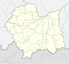
Położenie na mapie Polski (c) Karte: NordNordWest, Lizenz: Creative Commons by-sa-3.0 de | ||||
| 50°11′33,1″N 19°28′18,8″E/50,192528 19,471889 | ||||
| Portal | ||||
Piaski – osiedle miasta Trzebinia, w powiecie chrzanowskim, w województwie małopolskim.
Media użyte na tej stronie
Poland adm location map.svg
(c) Karte: NordNordWest, Lizenz: Creative Commons by-sa-3.0 de
Location map of Poland
(c) Karte: NordNordWest, Lizenz: Creative Commons by-sa-3.0 de
Location map of Poland
Lesser Poland Voivodeship location map.svg
Autor: SANtosito, Licencja: CC BY-SA 4.0
Location map of Lesser Poland Voivodeship, Poland. Geographic limits of the map:
Autor: SANtosito, Licencja: CC BY-SA 4.0
Location map of Lesser Poland Voivodeship, Poland. Geographic limits of the map:
- N: 50.59 N
- S: 49.07 N
- W: 18.92 E
- E: 21.55 E


