Pic la Selle
 | |
| Państwo | |
|---|---|
| Położenie | Croix-des-Bouquets↗ |
| Pasmo | Chaîne de la Selle |
| Wysokość | 2680 m n.p.m. |
| Wybitność | 2650 m |
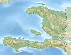
Pic la Selle - szczyt w pasmie Chaîne de la Selle. Leży na wyspie Haiti, w państwie Haiti, blisko granicy z Dominikaną. Znajduje się na terenie Parku Narodowego La Visite (Parc National La Visite). Jest najwyższym szczytem państwa Haiti, ale nie wyspy. Najwyższym szczytem wyspy jest Pico Duarte w Dominikanie.
Linki zewnętrzne
Media użyte na tej stronie
The national and official state flag of Haiti; arms obtained from http://www.webchantier.com/. The civil flag can be found at here.
Black up-pointing triangle ▲, U+25B2 from Unicode-Block Geometric Shapes (25A0–25FF)
Autor: Original by User:Uwe Dedering. Cropped by User:Andrew Dalby, Licencja: CC BY-SA 3.0
Greater Antilles relief location map. Equirectangular projection. Stretched by 106.0%
Autor: Alexrk2, Licencja: CC BY-SA 3.0
Physical Location map Haiti with departements, Equirectangular projection, N/S stretching 105 %. Geographic limits of the map:


