Place Charles-de-Gaulle
| 8., 16. i 17. dzielnica Paryża | |
 Widok placu z lotu ptaka | |
| Państwo | |
|---|---|
| Miejscowość | |
| Długość | 241 m |
| Poprzednie nazwy | Place de l'Étoile |
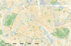
Położenie na mapie Paryża (c) Eric Gaba, Wikimedia Commons user Sting, CC BY-SA 3.0 | |
Położenie na mapie Île-de-France (c) Eric Gaba, Wikimedia Commons user Sting, CC BY-SA 3.0 | |
Place Charles-de-Gaulle, historycznie znany jako Place de l'Étoile (pl. plac Gwiazdy) – rondo znajdujące się w Paryżu, między 8., 16. i 17. dzielnicą. W centrum placu znajduje się Łuk Triumfalny.
Opis placu
Plac Charles-de-Gaulle jest drugim co do wielkości w Paryżu po placu Zgody. Dawniej nazywano go placem Gwiazdy, z powodu dwunastu alej, do niego prowadzących i tworzących gwiazdę. W 1970 po śmierci generała de Gaulle'a plac został przemianowany na jego cześć, jednak dawna nazwa placu jest bardziej rozpowszechniona.
Lista alej:
- avenue de Wagram;
- avenue Mac-Mahon;
- avenue Carnot;
- avenue de la Grande-Armée;
- avenue Foch;
- avenue Victor-Hugo;
- avenue Kléber;
- avenue d'Iéna;
- avenue Marceau;
- avenue des Champs-Élysées;
- avenue de Friedland;
- avenue Hoche.
Na placu mieści się Łuk Triumfalny, budowany w latach 1806–1836 w celu uczczenia zwycięstw Napoleona[1].
Zobacz też
Przypisy
- ↑ Paris sous toutes ses longueurs. Paris.fr. [dostęp 2022-10-01]. (fr.).
Linki zewnętrzne
Media użyte na tej stronie
(c) Eric Gaba, Wikimedia Commons user Sting, CC BY-SA 3.0
Blank land cover map of the city and department of Paris, France, as in January 2012, for geo-location purpose, with distinct boundaries for departments and arrondissements.
Autor: Superbenjamin, Licencja: CC BY-SA 4.0
Blank administrative map of France for geo-location purpose, with regions and departements distinguished. Approximate scale : 1:3,000,000
(c) Eric Gaba, Wikimedia Commons user Sting, CC BY-SA 3.0
Blank administrative map of the region of Île-de-France, France, as in January 2015, for geo-location purpose, with distinct boundaries for regions, departments and arrondissements.
Crossroads with a major road ahead.
Autor:
Map of the Place Charles de Gaulle, Paris, France.


