Place Jean-Marais
| 18. dzielnica | |
 | |
| Państwo | |
|---|---|
| Miejscowość | |
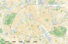
Położenie na mapie Paryża (c) Eric Gaba, Wikimedia Commons user Sting, CC BY-SA 3.0 | |
Położenie na mapie Île-de-France (c) Eric Gaba, Wikimedia Commons user Sting, CC BY-SA 3.0 | |
| 48°53′12″N 2°20′29″E/48,886667 2,341389 | |
Place Jean-Marais – plac położony w 18. dzielnicy Paryża, obok Kościoła Saint Pierre de Montmartre niedaleko Place du Tertre, na szczycie wzgórza Montmartre.
Plac nazwany został imieniem aktora Jean Marais 26 kwietnia 2006 roku. Na inauguracji obecni byli Daniel Vaillant, mer 18. dzielnicy Paryża, Christophe Caresche oraz Michou[1].
Przypisy
- ↑ Jean Marais has his « place » in Paris. parishotelsandtales.com. [zarchiwizowane z tego adresu (2008-05-18)]. – Paris Hotels and Tales
Linki zewnętrzne
- Philippe Bordier, Une place Jean Marais à Montmartre, dixhuitinfo.com, 2008 [dostęp 2011-12-14] [zarchiwizowane z adresu 2012-06-03].
- Place Jean Marais – Montmartre Quarter – Paris, France na stronie webshots
Media użyte na tej stronie
Autor: Superbenjamin, Licencja: CC BY-SA 4.0
Blank administrative map of France for geo-location purpose, with regions and departements distinguished. Approximate scale : 1:3,000,000
(c) Eric Gaba, Wikimedia Commons user Sting, CC BY-SA 3.0
Blank administrative map of the region of Île-de-France, France, as in January 2015, for geo-location purpose, with distinct boundaries for regions, departments and arrondissements.
Crossroads with a major road ahead.
(c) Eric Gaba, Wikimedia Commons user Sting, CC BY-SA 3.0
Blank land cover map of the city and department of Paris, France, as in January 2012, for geo-location purpose, with distinct boundaries for departments and arrondissements.
Autor: Chabe01, Licencja: CC BY-SA 4.0
Place Jean Marais, Paris.


