Playa del Carmen
 | |||
| |||
| Państwo | |||
|---|---|---|---|
| Stan | |||
| Gmina | |||
| Prawa miejskie | 1937 | ||
| Alkad | Carlos Joaquín González | ||
| Wysokość | 15 m n.p.m. | ||
| Populacja (2010) • liczba ludności |
| ||
| Nr kierunkowy | 984 | ||
| Kod pocztowy | 77710 – 77720 | ||
| Tablice rejestracyjne | 23 | ||
| Strona internetowa | |||
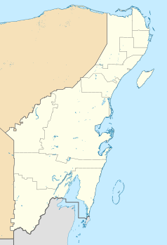
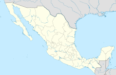
Playa del Carmen – miasto i siedziba gminy Solidaridad położone w północnej części meksykańskiego stanu Quintana Roo. Po miastach Cancún i Chetumal jest to trzecie pod względem wielkości miasto w tym stanie. Miasto leży na wybrzeżu Morza Karaibskiego. Leży naprzeciwko San Miguel de Cozumel największego miasta na wyspie Cozumel z którym ma połączenie promowe.
Przypisy
- ↑ Principales resultados por localidad 2010 (ITER) (hiszp.). Instituto Nacional de Estadística, Geografía e Informática.. [dostęp 2015-08-03].
Bibliografia
- Encyklopedia gmin Meksyku (hiszp.). [dostęp 2009-11-22].
Miasta partnerskie
Zobacz też
Media użyte na tej stronie
The flag of Navassa Island is simply the United States flag. It does not have a "local" flag or "unofficial" flag; it is an uninhabited island. The version with a profile view was based on Flags of the World and as a fictional design has no status warranting a place on any Wiki. It was made up by a random person with no connection to the island, it has never flown on the island, and it has never received any sort of recognition or validation by any authority. The person quoted on that page has no authority to bestow a flag, "unofficial" or otherwise, on the island.
Autor: Addicted04 (talk), Licencja: CC BY-SA 3.0
Location Map of Quintana Roo. EPSG:3857 projection, Geographic limits of the map:
- N: 21.70° N
- S: 17.70° N
- W: 89.40° W
- E: 86.50° W
Coat of arms of Quintana Roo
Autor: Ayutamiento Solidaridad, Licencja: CC BY 2.5
Situation Playa del Carmen


