Ploërmel
| miejscowość i gmina | |||||
 Urząd miasta w Ploërmel | |||||
| |||||
| Państwo | |||||
|---|---|---|---|---|---|
| Region | |||||
| Departament | |||||
| Okręg | |||||
| Kod INSEE | 56165 | ||||
| Powierzchnia | 58,44 km² | ||||
| Populacja (2016) • liczba ludności |
| ||||
| Kod pocztowy | 56800 | ||||
| Portal | |||||
Ploërmel (bret. Ploermael) – miejscowość i gmina we Francji, w regionie Bretania, w departamencie Morbihan. W 2016 roku populacja ówczesnej gminy wynosiła 10 117 mieszkańców[1].
Dnia 1 stycznia 2019 roku połączono dwie wcześniejsze gminy: Monterrein oraz Ploërmel. Siedzibą gminy została miejscowość Ploërmel, a nowa gmina przyjęła jej nazwę[2].
W Ploërmel znajduje się pomnik Jana Pawła II, którego autorem jest rosyjski rzeźbiarz, gruzińskiego pochodzenia Zurab Cereteli. Pomnik ten stał się znany na świecie z powodu związanych z nim kontrowersji, ponieważ we francuskim prawie od 1905 roku obowiązuje rozdział Kościoła i państwa. Zakazuje ono umieszczania symboli religijnych w miejscach publicznych. Niezgodny z prawem był nie sam pomnik, lecz krzyż, symbol religii chrześcijańskiej, który swoim układem i wymiarami ma charakter ostentacyjny. Dopiero w czerwcu 2018 roku kontrowersje zakończyły się zakupem przez diecezję posągu i jego przemieszczeniem o 30 metrów na grunty nabyte przez diecezję, w sąsiedztwie prywatnej katolickiej uczelni Sacré-Cœur[3][4].
Miasta partnerskie
Ploërmel współpracuje z sześcioma zagranicznymi miejscowościami na zasadzie partnerstwa miast[5]:
 Kolbuszowa
 Apensen
 Cobh
Cobh Gorseinon
 Llwchwr(ang.)
 Dabola
Przypisy
- ↑ Populations légales 2016 (fr.). INSEE. [dostęp 2020-04-26].
- ↑ Arrêté portant création de la commune nouvelle de Ploërmel (fr.). morbihan.gouv.fr. [dostęp 2020-04-26].
- ↑ Ploërmel gardera sa statue de Jean-Paul II (fr.). Le Figaro. [dostęp 2020-04-26].
- ↑ Statue du Pape Jean-Paul II à Ploërmel: fin de la polémique (fr.). France 3 Bretagne. [dostęp 2020-04-26].
- ↑ Échanges et partenariats internationaux (fr.). ploermel.bzh. [dostęp 2021-06-29].
Media użyte na tej stronie
Autor: Superbenjamin, Licencja: CC BY-SA 4.0
Blank administrative map of France for geo-location purpose, with regions and departements distinguished. Approximate scale : 1:3,000,000
Autor: Eric Gaba (Sting - fr:Sting), Licencja: CC BY-SA 3.0
Blank administrative map of the region of Bretagne, France, for geo-location purpose, with distinct boundaries for regions, departments and arrondissements.
Autor: Celbusro, Licencja: CC BY-SA 3.0
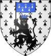
Blason français de la ville de Ploërmel (Morbihan) : D’hermines au léopard lionné de sable couronné d’azur tenant de sa patte dextre une bannière du même chargée de cinq mouchetures d’hermine d’argent ordonnées trois et deux.
Autor: Ville de Ploermel, Licencja: CC BY 3.0
Drapeau de la ville de Ploermel Bretagne
Autor: Ville de Ploërmel, Licencja: CC BY-SA 4.0
This building is indexed in the base Mérimée, a database of architectural heritage maintained by the French Ministry of Culture, under the reference IA00010244
Autor: Eric Gaba (Sting - fr:Sting), Licencja: CC BY-SA 3.0
Blank administrative map of the department of Morbihan, France, for geo-location purpose, with distinct boundaries for regions, departments and arrondissements.


