Plymouth (Montserrat)
| ||
Plymouth po erupcji | ||
| Państwo | ||
| Terytorium zamorskie | ||
| Populacja • liczba ludności | 0 | |
| Portal | ||
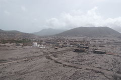
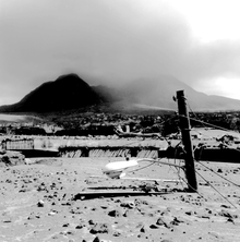
Plymouth – oficjalna stolica Montserratu. W 1997 całkowicie zniszczona w wyniku erupcji wulkanu Soufrière Hills. Obecnie ruiny miasta znajdują się w strefie niedostępnej dla mieszkańców, a faktyczną stolicą terytorium jest Brades.
Media użyte na tej stronie
Blank administrative map of Montserrat for geo-location purpose, with parishes boundaries.
Autor: Gary Mark Smith , Licencja: CC BY-SA 3.0
Ash piled streetlamp high on the Streets of Plymouth (1999). Photo by Gary Mark Smith.
(c) Xb-70 at the English Wikipedia, CC-BY-SA-3.0
A picture taken in July of 2006 from a helicopter showing the damage from the 1996 eruption to Plymouth, Montserrat.


