Podział administracyjny Grenlandii
Od 1 stycznia 2009 Grenlandia podzielona jest na cztery gminy[1] (Park Narodowy Grønlands oraz baza lotnicza Thule są obszarami niemunicypalnymi).
| mapa | herb | nazwa | nazwa w j. grenlandzkim | zaludnienie | powierzchnia | gęstość zaludnienia |
|---|---|---|---|---|---|---|
 | Qeqqata | Qeqqata Kommunia | 9627 | 115 500 | 0,08 | |
 | Sermersooq | Kommuneqarfik Sermersooq | 20 998 | 635 600 | 0,03 | |
 | Qaasuitsup | Qaasuitsup Kommunia | 17 867 | 660 000 | 0,03 | |
 | Kujalleq | Kommune Kujalleq | 7 755 | 32 000 | 0,24 | |
| obszary niemunicypalne | ||||||
| Park Narodowy Grenlandii | Kalaallit Nunaanni nuna eqqissisimatitaq | 31 | 972 000 | 0,00003 | ||
| Thule Air Base | 189[2] | |||||
Podział administracyjny Grenlandii przed 2009 rokiem
Zobacz też
Przypisy
- ↑ Statistics Greenland, Greenland in Figures, 2010.
- ↑ Bevölkerungsstatistik 2007. statgreen.gl. [zarchiwizowane z tego adresu (2007-11-24)]..
Media użyte na tej stronie
Kujalleq coa.PNG
(c) Domaleixo z angielskiej Wikipedii, CC BY-SA 3.0
Coat of arms of the new Kujalleq municipality in Greenland. Emerson
(c) Domaleixo z angielskiej Wikipedii, CC BY-SA 3.0
Coat of arms of the new Kujalleq municipality in Greenland. Emerson
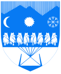
Qaasuitsup-coat-of-arms.svg
Autor: , Licencja: CC BY 3.0
Coat of Arms of the Qaasuitsup Municipality (established 2009/01/01), Greenland. SVG version.
Autor: , Licencja: CC BY 3.0
Coat of Arms of the Qaasuitsup Municipality (established 2009/01/01), Greenland. SVG version.
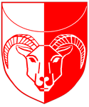
Qeqqata-coat-of-arms.svg
Autor:
Coat of Arms of the Qeqqata Municipality (established 2009/01/01), Greenland. SVG version.
Autor:
- derivative work: Algkalv (talk)
- Qeqqata.PNG: Domaleixo
Coat of Arms of the Qeqqata Municipality (established 2009/01/01), Greenland. SVG version.
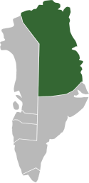
Qaasuitsup Kommunia locator map.svg
Autor: NordNordWest, Licencja: CC-BY-SA-3.0
Locator map of Qaasuitsup Kommunia, Greenland
Autor: NordNordWest, Licencja: CC-BY-SA-3.0
Locator map of Qaasuitsup Kommunia, Greenland
Kommune Kujalleq locator map.svg
Autor: NordNordWest, Licencja: CC-BY-SA-3.0
Locator map of Kommune Kujalleq, Greenland
Autor: NordNordWest, Licencja: CC-BY-SA-3.0
Locator map of Kommune Kujalleq, Greenland
Sermersooq-coat-of-arms.png
(c) User:Domaleixo, CC BY-SA 3.0
Coat of arms of the new Sermersooq municipality in Greenland. Emerson
(c) User:Domaleixo, CC BY-SA 3.0
Coat of arms of the new Sermersooq municipality in Greenland. Emerson
Kommuneqarfik Sermersooq locator map.svg
Autor: NordNordWest, Licencja: CC-BY-SA-3.0
Locator map of Kommuneqarfik Sermersooq, Greenland
Autor: NordNordWest, Licencja: CC-BY-SA-3.0
Locator map of Kommuneqarfik Sermersooq, Greenland
Greenland National Park locator map.svg
Autor: NordNordWest, Licencja: CC-BY-SA-3.0
Locator map of Greenland's National Park
Autor: NordNordWest, Licencja: CC-BY-SA-3.0
Locator map of Greenland's National Park
Qeqqata Kommunia locator map.svg
Autor: NordNordWest, Licencja: CC-BY-SA-3.0
Locator map of Qeqqata Kommunia, Greenland
Autor: NordNordWest, Licencja: CC-BY-SA-3.0
Locator map of Qeqqata Kommunia, Greenland
Greenland-municipalities-2009.svg
Administrative divisions of Greenland since 2009/01/01, with municipal centers marked with numbers.
Administrative divisions of Greenland since 2009/01/01, with municipal centers marked with numbers.


