Poniatowice (przystanek kolejowy)
| Państwo | |
|---|---|
| Województwo | |
| Miejscowość | Poniatowice |
| Data otwarcia | 1871 |
| Poprzednie nazwy | Pontwitz[1] |
| Dane techniczne | |
| Liczba peronów | 1 |
| Liczba krawędzi peronowych | 1 |
| Kasy | |
| Linie kolejowe | |
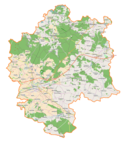
Położenie na mapie Polski (c) Karte: NordNordWest, Lizenz: Creative Commons by-sa-3.0 de | |
| Portal | |
Poniatowice – przystanek kolejowy w Poniatowicach, w województwie dolnośląskim, w Polsce. Znajduje się na linii 181. Herby Nowe – Oleśnica.
Przypisy
Linki zewnętrzne
- Poniatowice w Ogólnopolskiej Bazie Kolejowej – bazakolejowa.pl
| Poniatowice | ||
| Linia 181. Herby Nowe – Oleśnica (137,558 km) | ||
odległość: 3,411 km | odległość: 4,524 km | |
Media użyte na tej stronie
Oleśnica (gmina wiejska w województwie dolnośląskim) location map.png
Autor: Smat, Licencja: CC BY-SA 2.0
Location map.
Autor: Smat, Licencja: CC BY-SA 2.0
Location map.
Poland adm location map.svg
(c) Karte: NordNordWest, Lizenz: Creative Commons by-sa-3.0 de
Location map of Poland
(c) Karte: NordNordWest, Lizenz: Creative Commons by-sa-3.0 de
Location map of Poland
Lower Silesian Voivodeship location map.svg
Autor: SANtosito, Licencja: CC BY-SA 4.0
Location map of [[:en:Lower Silesian Voivodeship]Lower Silesian Voivodeship]], Poland. Geographic limits of the map:
Autor: SANtosito, Licencja: CC BY-SA 4.0
Location map of [[:en:Lower Silesian Voivodeship]Lower Silesian Voivodeship]], Poland. Geographic limits of the map:
- N: 51.9134 N
- S: 49.9809 N
- W: 14.7603 E
- E: 17.9091 E
POL województwo dolnośląskie flag.svg
Flaga województwa dolnośląskiego
Flaga województwa dolnośląskiego
BSicon KBHFl.svg
head station, track to the left
head station, track to the left
BSicon KBHFaq.svg
head station, track to the left
head station, track to the left
BSicon STRq.svg
Straight line aqross (according to naming convention, name + modifier)
Straight line aqross (according to naming convention, name + modifier)
BSicon BHFq.svg
station at track aqross
station at track aqross
BSicon KBHFr.svg
head station, track to the right
head station, track to the right
BSicon KBHFeq.svg
head station, track to the right
head station, track to the right


