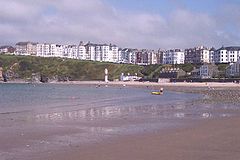
Port Erin
| ||
 Port Erin, widok z morza | ||
| Państwo | ||
| Dependencja królewska | ||
| Okręg | Rushen | |
| Nr kierunkowy | 01624 | |
| Kod pocztowy | IM9 | |
Port Erin (manx Purt Chiarn) – miasto na południowo-zachodnim wybrzeżu wyspy Man; 3 500 mieszkańców (2006).
Media użyte na tej stronie
Isle of Man location map.svg
Autor:
Location map of the Isle of Man, showing sheadings as well as local authorities (towns, villages, districts, parishes).
Autor:
- IsleOfMan_SheadingsAndParishes-en.svg: Sémhur
- derivative work: Entlinkt (talk)
Location map of the Isle of Man, showing sheadings as well as local authorities (towns, villages, districts, parishes).
Geographic limits of the map:
- W: -4° 58' 0"
- E: -4° 7' 0"
- S: 54° 0' 0"
- N: 54° 27' 30"


