Port Glasgow
| ||
(c) Thomas Nugent, CC BY-SA 2.0 | ||
| Państwo | ||
| Kraj | ||
| Hrabstwo | Inverclyde | |
| Populacja (2001) • liczba ludności | 16 617 | |
| Nr kierunkowy | 01475 | |
| Kod pocztowy | PA14 | |
Położenie na mapie Inverclyde Contains Ordnance Survey data © Crown copyright and database right, CC BY-SA 3.0 | ||
Położenie na mapie Wielkiej Brytanii (c) Karte: NordNordWest, Lizenz: Creative Commons by-sa-3.0 de | ||
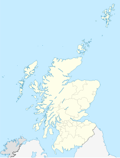
Położenie na mapie Szkocji | ||
| Strona internetowa | ||
| Portal | ||
Port Glasgow (gael. Port Ghlaschu) – drugie pod względem wielkości miasto w Inverclyde w Szkocji. Pierwotnie było małą wioską znaną jako Newark.
Media użyte na tej stronie
(c) Karte: NordNordWest, Lizenz: Creative Commons by-sa-3.0 de
Location map of the United Kingdom
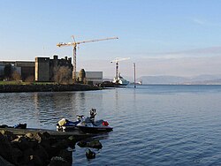
(c) Thomas Nugent, CC BY-SA 2.0
Port Glasgow View of the Town Building and war memorial from Coronation park. The steep slope in the background is typical Port Glasgow.
Contains Ordnance Survey data © Crown copyright and database right, CC BY-SA 3.0
Blank map of Inverclyde, UK with the following information shown:
- Administrative borders
- Coastline, lakes and rivers
- Roads and railways
- Urban areas
Equirectangular map projection on WGS 84 datum, with N/S stretched 175%
Geographic limits:
- West: 4.92W
- East: 4.58W
- North: 55.98N
- South: 55.79N
Autor: Dave souza, Licencja: CC BY-SA 2.5
Corner turrets at Newark Castle, Port Glasgow, and windows in the short west wing connecting the mansion to the gatehouse.
(c) User:Dave souza, CC BY-SA 2.5
Newark Castle, Port Glasgow and Ferguson Shipbuilders, the last shipyard on the Lower Clyde
(c) Eric Gaba, NordNordWest, CC BY-SA 3.0
Location map of Scotland, United Kingdom


