Port lotniczy Ćennaj
 Zdjęcie satelitarne portu | |||||
| Państwo | |||||
|---|---|---|---|---|---|
| Miejscowość | Ćennaj | ||||
| Typ | cywilne | ||||
| Właściciel | Airports Authority of India | ||||
| Kod IATA | MAA | ||||
| Kod ICAO | VOMM | ||||
| Wysokość | 10 m n.p.m. | ||||
| Statystyki ruchu (2018) | |||||
| Liczba pasażerów | 22 543 822 | ||||
| Cargo | 270 608 t | ||||
| Liczba operacji | 115 865 | ||||
| Drogi startowe | |||||
| |||||
Położenie na mapie Indii | |||||
Port lotniczy Ćennaj – lotnisko położony w dzielnicy Meenambakkam, 7 km na południe od Ćennaju. Jest 3. co do wielkości portem lotniczym Indii.
Terminale
Port lotniczy Ćennaj posiada 2 terminale: krajowy Kamaraj i międzynarodowy Anna.
Terminal Kamaraj (krajowy)
- Air India (Delhi)
- Air India Express (Bombaj, Trichy)
- IndiGo Airlines (Bengaluru, Delhi, Hyderabad, Jaipur, Kalkuta, Bombaj)
- SpiceJet (Ahmedabad, Bagdogra, Coimbatore, Delhi, Hyderabad, Jaipur, Kalkuta, Bombaj, Pune)
Terminal Anna (międzynarodowy)
- Air Arabia (Szardża)
- Air France (Paryż-Charles de Gaulle)
- Air India (Bangkok-Suvarnabhumi, Dammam)
- Air India Express (Kolombo, Dubaj, Kuala Lumpur, Singapur)
- Air Mauritius (Mauritius)
- British Airways (Londyn-Heathrow)
- Cathay Pacific (Hongkong)
- Emirates (Dubaj)
- Etihad Airways (Abu Zabi)
- Garuda Indonesia (Dżakarta, Medan)
- Gulf Air (Bahrajn)
- IndiGo Airlines (Kuwejt )
- Kuwait Airways (Kuwejt)
- Lufthansa (Frankfurt, Monachium)
- Malaysia Airlines (Kuala Lumpur)
- Oman Air (Maskat)
- Qatar Airways (Doha)
- Saudi Arabian Airlines (Dammam, Dżudda, Rijad)
- Singapore Airlines (Singapur)
- SriLankan Airlines (Kolombo)
- Thai Airways International (Bangkok-Suvarnabhumi, Dubaj)
- Tiger Airways (Singapur)
Przypisy
Media użyte na tej stronie
The Flag of India. The colours are saffron, white and green. The navy blue wheel in the center of the flag has a diameter approximately the width of the white band and is called Ashoka's Dharma Chakra, with 24 spokes (after Ashoka, the Great). Each spoke depicts one hour of the day, portraying the prevalence of righteousness all 24 hours of it.
Symbol lotniska do legendy mapy
Autor: PlaneMad, Licencja: CC BY 2.5
Aerial view of w:Chennai International Airport, Tamil Nadu, India.
(c) Uwe Dedering z niemieckiej Wikipedii, CC BY-SA 3.0
Location map of India.
Equirectangular projection. Strechted by 106.0%. Geographic limits of the map:
- N: 37.5° N
- S: 5.0° N
- W: 67.0° E
- E: 99.0° E
Autor: Maximilian Dörrbecker (Chumwa), Licencja: CC BY-SA 3.0
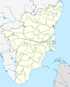
Location map of Tamil Nadu
Autor:
This Image was created by User:PlaneMad.
|
Chennai locator map. Map of Chennai city and Chennai metropolitan area, with major roads, railways and water bodies. Coordinates: top=13.295, bottom=12.844, left=80.00, right=80.3575.


