Port lotniczy Abidżan
| Państwo | |||
|---|---|---|---|
| Miejscowość | |||
| Typ | cywilne/wojskowe | ||
| Właściciel | AERIA | ||
| Kod IATA | ABJ | ||
| Kod ICAO | DIAP | ||
| Wysokość | 29 m n.p.m. | ||
| Statystyki ruchu (2017) | |||
| Liczba pasażerów | 2 070 000[1] | ||
| Drogi startowe | |||
| |||
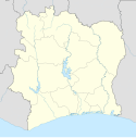
Położenie na mapie Wybrzeża Kości Słoniowej | |||
| Strona internetowa | |||
Port lotniczy Abidżan (ang. Félix-Houphouët-Boigny International Airport lub Port Bouët Airport, kod IATA: ABJ, kod ICAO: DIAP) – największy port lotniczy Wybrzeża Kości Słoniowej, położony w południowo-wschodniej części Abidżanu, w gminie miejskiej Port-Bouët. Jest hubem dla narodowego przewoźnika Air Côte d'Ivoire.
Linie lotnicze i połączenia
| Linia Lotnicza | Kierunek |
|---|---|
| Africa World Airlines | |
| Air Algerie | |
| Air Burkina |
|
| Air Côte d'Ivoire |
|
| Air France | |
| Air Senegal | |
| ASKY Airlines | |
| Brussels Airlines | |
| Camair-Co | |
| CEIBA Intercontinental | |
| Corsair International | Sezonowo: |
| EgyptAir | |
| Emirates | |
| Ethiopian Airlines | |
| Kenya Airways | |
| Mauritania Airlines | |
| Med-View Airline | |
| Middle East Airlines | |
| Royal Air Maroc | |
| RwandAir | |
| TAAG Angola Airlines | |
| TAP Portugal | |
| Trans Air Congo | |
| Tunisair | |
| Turkish Airlines |
Przypisy
- ↑ Romuald Ngueyap, Trafic record : L'Aéroport International d'Abidjan a accueilli plus de deux millions de passagers en 2017, www.afrique-sur7.fr, 9 lutego 2018 [dostęp 2019-01-31] (fr.).
- ↑ Africa World Airlines continues its regional expansion with maiden Accra-Abidjan flight, voyagesafriq.com [dostęp 2020-04-13] (ang.).
- ↑ Air Senegal outlines proposed regional network from late-Sep 2018 | Routesonline, www.routesonline.com [dostęp 2020-04-13] (ang.).
- ↑ Camair-Co adds Dakar flight from June 2018 | Routesonline, www.routesonline.com [dostęp 2020-04-13] (ang.).
- ↑ EGYPTAIR - EGYPTAIR to resume its flights to Abidjan via Accra starting the 20TH of Jun 2019, www.egyptair.com [dostęp 2020-04-13] (ang.).
- ↑ Ethiopian New York service changes from mid-June 2019 | Routesonline, www.routesonline.com [dostęp 2020-04-13] (ang.).
- ↑ Mauritiania Airlines adds Conakry – Abidjan sector from Nov 2019 | Routesonline, www.routesonline.com [dostęp 2020-04-13] (ang.).
- ↑ Istanbul's New Airport Is A Hot Beautiful Mess | One Mile at a Time, onemileatatime.com [dostęp 2020-04-13] (ang.).
Media użyte na tej stronie
Flag of the Ivory Coast, written by Jon Harald Søby, modified by Zscout370. The colors match to what is reported at http://fotw.vexillum.com/flags/ci.html.
Symbol lotniska do legendy mapy
Flag of Senegal
The national flag of the Democratic Republic of the Congo. Created according to the 2006 constitution : Son emblème est le drapeau bleu ciel, orné d’une étoile jaune dans le coin supérieur gauche et traversé en biais d’une bande rouge finement encadrée de jaune. (Its symbol is a sky blue flag, decorated with a yellow star in the upper left corner and crossed in the diagonal by a red strip with thin yellow borders) It seems to be identical, except for a lighter field hue, to the 1966–1971 flag.
Please do not replace the simplified code by a version created with Inkscape or another vector graphics editor❗
Flag of Ethiopia
The flag of Navassa Island is simply the United States flag. It does not have a "local" flag or "unofficial" flag; it is an uninhabited island. The version with a profile view was based on Flags of the World and as a fictional design has no status warranting a place on any Wiki. It was made up by a random person with no connection to the island, it has never flown on the island, and it has never received any sort of recognition or validation by any authority. The person quoted on that page has no authority to bestow a flag, "unofficial" or otherwise, on the island.
Flag of Mauritania, adopted in 2017. The National Assembly added red stripes to the top and bottom edges to represent “the blood shed by the martyrs of independence”.
Flag of Rwanda. The flag ratio is 2:3 with the stripes being 2:1:1. Colors are the following officially: Pantone 299 C 2X (blue), RAL 6029 (green), RAL 1023 (yellow) and RAL 1003 (golden yellow). (As of 03/08/2010, the only color used is the Pantone 299 C, which is from here. The rest of the colors are RAL shades from here.)
Flag of Portugal, created by Columbano Bordalo Pinheiro (1857-1929), officially adopted by Portuguese government in June 30th 1911 (in use since about November 1910). Color shades matching the RGB values officially reccomended here. (PMS values should be used for direct ink or textile; CMYK for 4-color offset printing on paper; this is an image for screen display, RGB should be used.)
(c) Uwe Dedering z niemieckiej Wikipedii, CC BY-SA 3.0
Location map of Côte d'Ivoire Equirectangular projection.
Strechted by 101%. Geographic limits of the map:
- N: 11° N
- S: 4° N
- W: 9° W
- E: 2° W
Autor: © Bourrichon (talk) - fr:Bourrichon, Licencja: CC BY-SA 3.0
Location map of Abidjan for geolocalisation purpose.


