Port lotniczy Algier
 | |||||
| Państwo | |||||
|---|---|---|---|---|---|
| Miejscowość | |||||
| Typ | cywilne | ||||
| Właściciel | Egsa | ||||
| Kod IATA | ALG | ||||
| Kod ICAO | DAAG | ||||
| Wysokość | 16 m n.p.m. | ||||
| Statystyki ruchu (2018) | |||||
| Liczba pasażerów | 7 900 000 | ||||
| Drogi startowe | |||||
| |||||
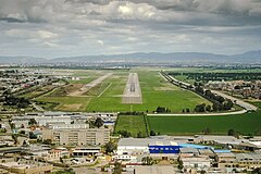
Port lotniczy Algier – międzynarodowy port lotniczy położony 29 km na południowy wschód od centrum Algieru. Jest największym portem lotniczym w Algierii i jednym z największych w Afryce.
Linie lotnicze i połączenia
Przypisy
- ↑ Air Algerie S20 domestic sectors addition | Routesonline, www.routesonline.com [dostęp 2020-04-13] (ang.).
- ↑ Air Algerie adds El Bayadh – Mecheria service in S20 | Routesonline, www.routesonline.com [dostęp 2020-04-13] (ang.).
- ↑ Tassili Airlines adds new domestic routes in March 2020 | Routesonline, www.routesonline.com [dostęp 2020-04-13] (ang.).
Linki zewnętrzne
Media użyte na tej stronie
Symbol lotniska do legendy mapy
Flag of the Ivory Coast, written by Jon Harald Søby, modified by Zscout370. The colors match to what is reported at http://fotw.vexillum.com/flags/ci.html.
Autor: Pedro A. Gracia Fajardo, escudo de Manual de Imagen Institucional de la Administración General del Estado, Licencja: CC0
Flaga Hiszpanii
Flag of Senegal
Flag of Portugal, created by Columbano Bordalo Pinheiro (1857-1929), officially adopted by Portuguese government in June 30th 1911 (in use since about November 1910). Color shades matching the RGB values officially reccomended here. (PMS values should be used for direct ink or textile; CMYK for 4-color offset printing on paper; this is an image for screen display, RGB should be used.)
Please do not replace the simplified code by a version created with Inkscape or another vector graphics editor❗
Łatwo można dodać ramkę naokoło tej grafiki
Autor: Poudou99, Licencja: CC BY 3.0
Aéroport Houari Boumediene, Dar El Beida, Alger, Algérie (nouvel aérogare, zone d'embarquement 1)
Autor: Mikey641 and OpenStreetMap contributors, Licencja: CC BY-SA 2.0
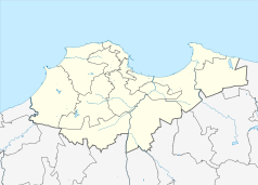
Location map of Algiers Province, Algeria
Autor: Eric Gaba (Sting - fr:Sting), Licencja: CC BY-SA 3.0
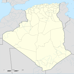
Blank administrative map of Algeria, for geo-location purposes.
Flag of Mauritania, adopted in 2017. The National Assembly added red stripes to the top and bottom edges to represent “the blood shed by the martyrs of independence”.
Autor: Ercan Karakas, Licencja: GFDL
On final approach to RWY09 at Algiers Airport


