Port lotniczy Antwerpia
 | |||||
| Państwo | |||||
|---|---|---|---|---|---|
| Miejscowość | |||||
| Typ | cywilne | ||||
| Właściciel | Antwerp Airport Authority | ||||
| Kod IATA | ANR | ||||
| Kod ICAO | EBAW | ||||
| Wysokość | 12 m n.p.m. | ||||
| Statystyki ruchu (2010[1]) | |||||
| Liczba pasażerów | 162 840 | ||||
| Drogi startowe | |||||
| |||||
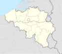
Położenie na mapie Belgii (c) Karte: NordNordWest, Lizenz: Creative Commons by-sa-3.0 de | |||||
| Strona internetowa | |||||
Port lotniczy Antwerpia – port lotniczy położony w Antwerpii, w Belgii.
Linie lotnicze i połączenia[2]
| Linia lotnicza | Kierunek |
|---|---|
| Flybe | |
| Jetairfly |
|
| VLM Airlines |
Przypisy
- ↑ http://www.antwerp-airport.be/contentpage_en.php?p=nieuws
- ↑ antwerpairport.aero, www.antwerpairport.aero [dostęp 2018-08-01] [zarchiwizowane z adresu 2018-08-01].
- ↑ UBM (UK) Ltd. 2018, VLM Airlines adds Manchester service from Oct 2018, „Routesonline” [dostęp 2018-08-01] (ang.).
Media użyte na tej stronie
(c) Karte: NordNordWest, Lizenz: Creative Commons by-sa-3.0 de
Location map of Belgium
Symbol lotniska do legendy mapy
Autor: Pedro A. Gracia Fajardo, escudo de Manual de Imagen Institucional de la Administración General del Estado, Licencja: CC0
Flaga Hiszpanii
Łatwo można dodać ramkę naokoło tej grafiki
Autor: Ad Meskens, Licencja: CC BY-SA 3.0
Terminal of Antwerp International Airport also known as Deurne Airport.
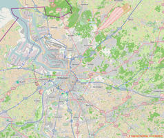
Autor: Contributors of OpenStreetMap, Licencja: CC BY-SA 2.0
Map of Greater Antwerp area
Geographic limits of the map:
- N 51.393°
- W 4.178°
- E 4.756°
- Z 51.089°
Autor: Milenioscuro, Licencja: CC BY-SA 3.0
Location map of Antwep province, Belgium


