Port lotniczy Barnauł
 | |||
| Państwo | |||
|---|---|---|---|
| Kraj | |||
| Miejscowość | Barnauł | ||
| Typ | cywilne | ||
| Kod IATA | BAX | ||
| Kod ICAO | UNBB | ||
| Wysokość | 255 m n.p.m. | ||
| Drogi startowe | |||
| |||
| Strona internetowa | |||
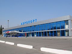
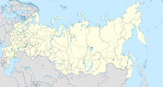
Port lotniczy Barnauł (IATA: BAX, ICAO: UNBB) – port lotniczy położony 15 kilometrów na zachód od Barnaułu, w Rosji.
Linie lotnicze i połączenia
| Linia lotnicza | Kierunek |
|---|---|
| Aerofłot | |
| Globus | |
| Nordwind Airlines |
|
| Orenair |
|
| Rossiya | |
| RusLine | |
| S7 Airlines | |
| UTair | |
| UTair Express | |
| Razem: 15 kierunków w 5 krajach | |
Linki zewnętrzne
Media użyte na tej stronie
Autor: Uwe Dedering, Licencja: CC BY-SA 3.0
Location map of Russia.
EquiDistantConicProjection : Central parallel :
* N: 54.0° N
Central meridian :
* E: 100.0° E
Standard parallels:
* 1: 49.0° N
* 2: 59.0° N
Made with Natural Earth. Free vector and raster map data @ naturalearthdata.com.
Because the southern Kuril islands are claimed by Russia and Japan, they are shown as disputed. For more information about this see: en:Kuril Islands dispute. These islands are since 1945 under the jurisdiction of the Russian Federation.
Symbol lotniska do legendy mapy
The national flag of Kingdom of Thailand since September 2017; there are total of 3 colours:
- Red represents the blood spilt to protect Thailand’s independence and often more simply described as representing the nation.
- White represents the religion of Buddhism, the predominant religion of the nation
- Blue represents the monarchy of the nation, which is recognised as the centre of Thai hearts.
Autor:
Autor: Виктор В, Licencja: CC BY-SA 2.0
Positional map of the Altai Territory
The projection is equiangular.
The standard parallel is 52°30'N.
Template parameters (edge coordinates):


