Port lotniczy El Hierro
 | |||
| Państwo | |||
|---|---|---|---|
| Wspólnota autonomiczna | |||
| Miejscowość | Valverde, El Hierro, | ||
| Typ | cywilne | ||
| Właściciel | AENA | ||
| Kod IATA | VDE | ||
| Kod ICAO | GCHI | ||
| Strefa czasowa | UTC 0 | ||
| Wysokość | 32 m n.p.m. | ||
| Statystyki ruchu (2017[1]) | |||
| Liczba pasażerów | 199 382 | ||
| Cargo | 66 t | ||
| Liczba operacji | 4190 | ||
| Drogi startowe | |||
| |||
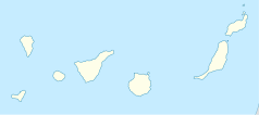
Port lotniczy El Hierro – port lotniczy położony 9 km na północny wschód od Valverde, na wyspie el Hierro na Wyspach Kanaryjskich (Hiszpania).
Przypisy
Bibliografia
Media użyte na tej stronie
Flag of Spain.svg
Autor: Pedro A. Gracia Fajardo, escudo de Manual de Imagen Institucional de la Administración General del Estado, Licencja: CC0
Flaga Hiszpanii
Autor: Pedro A. Gracia Fajardo, escudo de Manual de Imagen Institucional de la Administración General del Estado, Licencja: CC0
Flaga Hiszpanii
Flag of the Canary Islands (simple).svg
Simple version of the Canary flag
Simple version of the Canary flag
Legenda lotnisko.svg
Symbol lotniska do legendy mapy
Symbol lotniska do legendy mapy
Spain Canary Islands location map.svg
Autor: NordNordWest, Licencja: CC BY-SA 3.0
Location map of the Canary Islands, Spain
Autor: NordNordWest, Licencja: CC BY-SA 3.0
Location map of the Canary Islands, Spain
El Hierro Airport terminal-El Hierro.jpg
Autor: Pepelopex, Licencja: CC BY-SA 3.0
El Hierro Airport terminal in Valverde (El Hierro, Canary Islands. Spain).
Autor: Pepelopex, Licencja: CC BY-SA 3.0
El Hierro Airport terminal in Valverde (El Hierro, Canary Islands. Spain).
Atlantic Ocean laea location map.svg
Autor: Tentotwo, Licencja: CC BY-SA 3.0
Relief location map of Atlantic_Ocean.
Autor: Tentotwo, Licencja: CC BY-SA 3.0
Relief location map of Atlantic_Ocean.
- Projection: Lambert azimuthal equal-area projection.
- Area of interest:
- N: 70.0° N
- S: -70.0° N
- W: -95.0° E
- E: 25.0° E
- Projection center:
- NS: 0.0° N
- WE: -35.0° E
- GMT projection: -JA-35.0/0.0/180/19.998266666666666c
- GMT region: -R-147.58842045747764/-48.58942183011819/77.58842045747762/48.589421830118205r
- Land, shoreline and borders: 1:110m Natural Earth Datasets


