Port lotniczy Glasgow-Prestwick
(c) Raymond Okonski, CC BY-SA 2.0 | |||||
| Państwo | |||||
|---|---|---|---|---|---|
| Miejscowość | |||||
| Typ | cywilne | ||||
| Data otwarcia | 1934 | ||||
| Kod IATA | PIK | ||||
| Kod ICAO | EGPK | ||||
| Wysokość | 20 m n.p.m. | ||||
| Statystyki ruchu (2015[1]) | |||||
| Liczba pasażerów | 610 837 | ||||
| Liczba operacji | 4 264 | ||||
| Drogi startowe | |||||
| |||||
Położenie na mapie South Ayrshire Contains Ordnance Survey data © Crown copyright and database right, CC BY-SA 3.0 | |||||
Położenie na mapie Wielkiej Brytanii (c) Karte: NordNordWest, Lizenz: Creative Commons by-sa-3.0 de | |||||
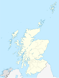
Położenie na mapie Szkocji | |||||
| Strona internetowa | |||||
Port lotniczy Glasgow-Prestwick (ang.: Glasgow Prestwick International Airport, kod IATA: PIK, kod ICAO: EGPK) – międzynarodowe lotnisko obsługujące tanie linie lotnicze, położone w Prestwick, 46 km od centrum Glasgow.
Dojazd z i do centrum Glasgow zapewnia połączenie kolejowe (przystanek Prestwick International Airport, czas podróży ok. 45 minut, pociągi kursują w dni robocze co pół godziny, w dni wolne co godzinę, w nocy brak połączeń) oraz kilka linii autobusowych kursujących również w nocy. Pasażerowie z ważnymi rezerwacjami na lot otrzymują 50% zniżki na dojazd z i do jakiejkolwiek stacji kolejowej na terenie Szkocji (należy przedstawić wydrukowane potwierdzenie rezerwacji lotu konduktorowi lub w kasie kolejowej).
Przy terminalu znajduje się krótko- i długoterminowy parking samochodowy, w obrębie terminalu liczne punkty handlowe i gastronomiczne.
Linie lotnicze i kierunki lotów
| Linia lotnicza | Kierunek |
|---|---|
| Ryanair |
Sezonowo: |
Cargo
| Linia lotnicza | Kierunek |
|---|---|
| Air France Cargo | |
| Cargolux | |
| Cargolux Italia | |
| Volga-Dnepr |
Przypisy
- ↑ Datasets | UK Civil Aviation Authority, www.caa.co.uk [dostęp 2017-11-26] (ang.).
Linki zewnętrzne
- Oficjalna strona portu lotniczego Glasgow-Prestwick. gpia.co.uk. [zarchiwizowane z tego adresu (2016-08-05)]. (ang.)
Media użyte na tej stronie
(c) Karte: NordNordWest, Lizenz: Creative Commons by-sa-3.0 de
Location map of the United Kingdom
(c) Eric Gaba, NordNordWest, CC BY-SA 3.0
Location map of Scotland, United Kingdom
Icon representing a decrease, consisting of a red-colored, down-pointing triangle.
Symbol lotniska do legendy mapy
Autor: Pedro A. Gracia Fajardo, escudo de Manual de Imagen Institucional de la Administración General del Estado, Licencja: CC0
Flaga Hiszpanii
Flag of Portugal, created by Columbano Bordalo Pinheiro (1857-1929), officially adopted by Portuguese government in June 30th 1911 (in use since about November 1910). Color shades matching the RGB values officially reccomended here. (PMS values should be used for direct ink or textile; CMYK for 4-color offset printing on paper; this is an image for screen display, RGB should be used.)
The flag of Navassa Island is simply the United States flag. It does not have a "local" flag or "unofficial" flag; it is an uninhabited island. The version with a profile view was based on Flags of the World and as a fictional design has no status warranting a place on any Wiki. It was made up by a random person with no connection to the island, it has never flown on the island, and it has never received any sort of recognition or validation by any authority. The person quoted on that page has no authority to bestow a flag, "unofficial" or otherwise, on the island.
Contains Ordnance Survey data © Crown copyright and database right, CC BY-SA 3.0
Blank map of South Ayrshire, UK with the following information shown:
- Administrative borders
- Coastline, lakes and rivers
- Roads and railways
- Urban areas
Equirectangular map projection on WGS 84 datum, with N/S stretched 170%
Geographic limits:
- West: 5.25W
- East: 4.33W
- North: 55.65N
- South: 54.95N
(c) Raymond Okonski, CC BY-SA 2.0
Prestwick International Airport [PIK] The marketing guys say naming the airport 'Pure Dead Brilliant' (A Glasgow Colloquial expression) makes them seem 'hip'. Everyone else thinks they're stupid! Although he didn't set foot inside this terminal building, this was the closest Elvis Presley got to placing his foot on Scottish soil. He never made it to England....


