Port lotniczy Gran Canaria
 LPA | |||||
| Państwo | |||||
|---|---|---|---|---|---|
| Wspólnota autonomiczna | |||||
| Miejscowość | |||||
| Typ | cywilne | ||||
| Właściciel | Aena | ||||
| Kod IATA | LPA | ||||
| Kod ICAO | GCLP | ||||
| Strefa czasowa | UTC 0 | ||||
| Wysokość | 23 m n.p.m. | ||||
| Statystyki ruchu (2019[1]) | |||||
| Liczba pasażerów | 13 261 405 | ||||
| Cargo | 19 628 t | ||||
| Liczba operacji | 126 452 | ||||
| Drogi startowe | |||||
| |||||
Port lotniczy Gran Canaria (Aeropuerto de Gran Canaria) – międzynarodowy port lotniczy położony na wyspie Gran Canaria, 18 km na południe od Las Palmas de Gran Canaria. Jeden z największych portów lotniczych Hiszpanii. W 2008 obsłużył ponad 10,2 mln pasażerów.
Linie lotnicze i połączenia
Przypisy
- ↑ Zarchiwizowana kopia. [dostęp 2018-06-12]. [zarchiwizowane z tego adresu (2018-06-12)].
- ↑ Boka flyg - här hittar och bokar du din nästa flygresa | TUI.se, www.tui.se [dostęp 2020-04-13].
- ↑ Iniciamos los vuelos interislas Canarias - Billete 996, billete996.aireuropa.com [dostęp 2020-04-13] (hiszp.).
- ↑ Routemap - Atlantic Airways, www.atlanticairways.com [dostęp 2020-04-13] (ang.).
- ↑ Binter adds Santander / Vitoria service in S20 | Routesonline, www.routesonline.com [dostęp 2020-04-13] (ang.).
- ↑ Bilety lotnicze, bilety czarterowe i rejsowe, tanie loty krajowe i międzynarodowe - rezerwacja online | ITAKA, biletylotnicze.itaka.pl [dostęp 2020-04-13] (pol.).
- ↑ CanaryFly adds Gran Canaria – Santa Cruz de la Palma from Nov 2019 | Routesonline, www.routesonline.com [dostęp 2020-04-13] (ang.).
- ↑ Check-in | Canaryfly.es, www.canaryfly.es [dostęp 2020-04-13] (hiszp.).
- ↑ Condor W20 Berlin operations as of 22JAN20 | Routesonline, www.routesonline.com [dostęp 2020-04-13] (ang.).
- ↑ Corendon Airlines S20 Network expansion | Routesonline, www.routesonline.com [dostęp 2020-04-13] (ang.).
- ↑ Corendon Airlines- the best and cheapest flight tickets, www.corendonairlines.com [dostęp 2020-04-13] [zarchiwizowane z adresu 2019-02-15] (ang.).
- ↑ Corendon Dutch adds new sectors from Maastricht from April 2019 | Routesonline, www.routesonline.com [dostęp 2020-04-13] (ang.).
- ↑ Eurowings scales back Berlin expansion in 1Q18 | Routesonline, www.routesonline.com [dostęp 2020-04-13] (ang.).
- ↑ Tui schickt Freebird Europe nach Leipzig/Halle – Airbus A320 wird in Schkeuditz stationiert, www.lvz.de [dostęp 2020-04-13] (niem.).
- ↑ Iberia plans additional CRJ1000 routes from Leon in S18 | Routesonline, www.routesonline.com [dostęp 2020-04-13] (ang.).
- ↑ Jet2.com Adds Birmingham Routes in S17 | Routesonline, www.routesonline.com [dostęp 2020-04-13] (ang.).
- ↑ https://www.jet2.com/timetable
- ↑ Ryanair route map | Our European destinations, www.laudamotion.com [dostęp 2020-04-13] (ang.).
- ↑ TUIfly S19 network additions as of 25MAR19 | Routesonline, www.routesonline.com [dostęp 2020-04-13] (ang.).
- ↑ TUIfly Nordic adds Norrkoping – Gran Canaria service from Dec 2019 | Routesonline, www.routesonline.com [dostęp 2020-04-13] (ang.).
- ↑ Vueling adds Gran Canaria – Marrakech service from July 2020 | Routesonline, www.routesonline.com [dostęp 2020-04-13] (ang.).
- ↑ Wizz Air expands UK network | Travel Weekly, www.travelweekly.co.uk [dostęp 2020-04-13].
Media użyte na tej stronie
Autor: NordNordWest, Licencja: CC BY-SA 3.0
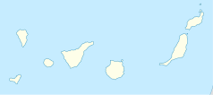
Location map of the Canary Islands, Spain
Autor: Tentotwo, Licencja: CC BY-SA 3.0
Relief location map of Atlantic_Ocean.
- Projection: Lambert azimuthal equal-area projection.
- Area of interest:
- N: 70.0° N
- S: -70.0° N
- W: -95.0° E
- E: 25.0° E
- Projection center:
- NS: 0.0° N
- WE: -35.0° E
- GMT projection: -JA-35.0/0.0/180/19.998266666666666c
- GMT region: -R-147.58842045747764/-48.58942183011819/77.58842045747762/48.589421830118205r
- Land, shoreline and borders: 1:110m Natural Earth Datasets
Autor: Pedro A. Gracia Fajardo, escudo de Manual de Imagen Institucional de la Administración General del Estado, Licencja: CC0
Flaga Hiszpanii
Symbol lotniska do legendy mapy
Flag of Portugal, created by Columbano Bordalo Pinheiro (1857-1929), officially adopted by Portuguese government in June 30th 1911 (in use since about November 1910). Color shades matching the RGB values officially reccomended here. (PMS values should be used for direct ink or textile; CMYK for 4-color offset printing on paper; this is an image for screen display, RGB should be used.)
Flag of Senegal
Flag of Mauritania, adopted in 2017. The National Assembly added red stripes to the top and bottom edges to represent “the blood shed by the martyrs of independence”.
Flaga Finlandii
Autor: User:Hecki2, Licencja: CC-BY-SA-3.0
Gran Canaria Airport (LPA), International Terminal building. (Gran Canaria, Canary Islands, Spain).
Simple version of the Canary flag


