Port lotniczy Hawarden
(c) Dennis Turner, CC BY-SA 2.0 | |||
| Państwo | |||
|---|---|---|---|
| Miejscowość | Broughton and Bretton koło Hawarden, Walia | ||
| Typ | cywilne | ||
| Kod IATA | CEG | ||
| Kod ICAO | EGNR | ||
| Strefa czasowa | UTC 0 | ||
| Statystyki ruchu (2011[1]) | |||
| Liczba operacji | 18 911 | ||
| Drogi startowe | |||
| |||
Położenie na mapie Flintshire Contains Ordnance Survey data © Crown copyright and database right, CC BY-SA 3.0 | |||
Położenie na mapie Wielkiej Brytanii (c) Karte: NordNordWest, Lizenz: Creative Commons by-sa-3.0 de | |||
Port lotniczy Hawarden (IATA: CEG, ICAO: EGNR) – port lotniczy znajdujący się w Broughton and Bretton koło Hawarden, w Walii (Wielka Brytania).
Przypisy
Bibliografia
Media użyte na tej stronie
(c) Karte: NordNordWest, Lizenz: Creative Commons by-sa-3.0 de
Location map of the United Kingdom
Autor: NordNordWest, Licencja: CC BY-SA 3.0
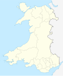
Location map of Wales, United Kingdom
Symbol lotniska do legendy mapy
Contains Ordnance Survey data © Crown copyright and database right, CC BY-SA 3.0
Blank map of Flintshire, UK with the following information shown:
- Administrative borders
- Coastline, lakes and rivers
- Roads and railways
- Urban areas
Equirectangular map projection on WGS 84 datum, with N/S stretched 165%
Geographic limits:
- West: 3.42W
- East: 2.90W
- North: 53.40N
- South: 53.05N
(c) Dennis Turner, CC BY-SA 2.0
Hawarden Airport. Beyond the former RAF Guardroom is the Airfield previously used by the Royal Air Force and now part of the huge Aircraft factory complex.


