Port lotniczy Hobart
| Państwo | |||
|---|---|---|---|
| Miejscowość | |||
| Kod IATA | HBA | ||
| Kod ICAO | YMHB | ||
| Wysokość | 4 m n.p.m. | ||
| Statystyki ruchu (2007[1]) | |||
| Liczba pasażerów | 1 620 000 | ||
| Liczba operacji | 18 690 | ||
| Drogi startowe | |||
| |||
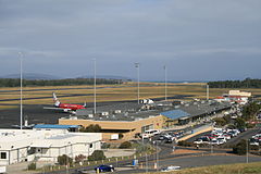
Port lotniczy Hobart (ang. Hobart International Airport, kod ICAO: YMHB, kod IATA: HBA) – międzynarodowy port lotniczy Tasmanii, położony we wschodniej części miasta Hobart. Otwarty w 1956, zastąpił lotnisko Cambridge Aerodrome. Od 1990 wycofany z użytku rejsowego dla pasażerów międzynarodowego ruchu lotniczego, jednak linia lotnicza Skytraders w dalszym ciągu prowadzi regularne loty na Antarktydę w ramach Australian Antarctic Division. Zarząd portu utrzymuje sprawną kontrolę paszportową, na żądanie z wyprzedzeniem. Obecnie lotnisko obsługuje ponad 20 tysięcy operacji lotniczych rocznie[2].
Linie lotnicze i kierunki lotów
- Australian air Express (Launceston, Melbourne-Tullamarine [cargo])
- Jetstar Airways (Melbourne-Tullamarine, Sydney)
- Qantas (Melbourne-Tullamarine, Sydney)
- Skytraders (Casey na Antarktydzie)
- Tasair (Burnie, Devonport)
- Tiger Airways Australia (Adelaide (od 1 marca[3]), Melbourne-Tullamarine)
- Virgin Blue (Adelaide, Brisbane, Canberra (od 6 kwietnia 2009[4]), Melbourne-Tullamarine, Sydney)
Statystyczne średnie pogodowe
| Miesiąc | Sty | Lut | Mar | Kwi | Maj | Cze | Lip | Sie | Wrz | Paź | Lis | Gru | Roczna |
|---|---|---|---|---|---|---|---|---|---|---|---|---|---|
| Średnie temperatury w dzień [°C] | 22.4 | 22.3 | 20.7 | 18.1 | 15.2 | 12.9 | 12.4 | 13.4 | 15.3 | 17.3 | 18.9 | 20.6 | 17,5 |
| Średnie temperatury w nocy [°C] | 12.0 | 12.0 | 10.7 | 8.7 | 6.6 | 4.6 | 4.1 | 4.6 | 6.0 | 7.5 | 9.1 | 10.7 | 8,0 |
| Opady [mm] | 41.6 | 36.6 | 36.1 | 43.0 | 34.5 | 30.1 | 44.1 | 46.8 | 41.2 | 47.7 | 42.9 | 54.2 | 498,6 |
| Źródło: Bureau of Meteorology[5] {{{accessdate}}} | |||||||||||||
Przypisy
- ↑ http://www.hobartairpt.com.au/images/HIAPLAnnualReport2007.pdf
- ↑ 2007/08 Annual report. Hobart International Airport, 2007/08. [dostęp 2009-02-10]. [zarchiwizowane z tego adresu (2009-07-06)].
- ↑ Tiger Airways announces new routes from Adelaide (en). [dostęp 2009-02-12]. [zarchiwizowane z tego adresu (2008-12-10)].
- ↑ VIRGIN BLUE undertakes phase two of aircraft redeployment strategy (en). [dostęp 2009-02-12]. [zarchiwizowane z tego adresu (2011-03-05)].
- ↑ Climate Data. BoM. [dostęp 2008-02-14].
Linki zewnętrzne
Media użyte na tej stronie
Symbol lotniska do legendy mapy
Autor: NordNordWest, Licencja: CC BY-SA 3.0 de
Location map of Tasmania, Australia
(c) YSSYguy z angielskiej Wikipedii, CC BY 3.0
A view of the terminal and apron of Hobart Airport, taken from the hill where the Control Tower is located.
Autor: Run to the hills, cos the end of the world is soon!, Licencja: CC BY-SA 4.0
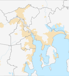
Location map of Hobart in Australia, showing only municipality boundaries


