Port lotniczy Kajenna-Félix Eboué
 | |||
| Państwo | |||
|---|---|---|---|
| Departament zamorski | |||
| Miejscowość | |||
| Typ | cywilne | ||
| Kod IATA | CAY | ||
| Kod ICAO | SOCA | ||
| Wysokość | 8 m n.p.m. | ||
| Statystyki ruchu (2010[1]) | |||
| Liczba pasażerów | 423 849 | ||
| Cargo | 4494 t | ||
| Liczba operacji | 9645 | ||
| Drogi startowe | |||
| |||
Port lotniczy Kajenna–Félix Eboué (fr. Aéroport de Cayenne – Félix Eboué, do 2012: Port lotniczy Cayenne-Rochambeau)– największy port lotniczy Gujany Francuskiej, zlokalizowany w stolicy – Kajennie.
Od 2012 lotnisko nosi imię Félixa Éboué[2]
Linie lotnicze i połączenia
| Linia lotnicza | Kierunek |
|---|---|
| Air Caraïbes | |
| Air France | |
| Air Guyane Express | |
| Azul Linhas Aéreas | |
| Norwegian Air Shuttle | Sezonowo: |
| Surinam Airways |
Przypisy
- ↑ Zarchiwizowana kopia. [dostęp 2011-06-07]. [zarchiwizowane z tego adresu (2012-02-29)].
- ↑ Arrêté du 4 janvier 2012 portant changement de dénomination de l'aérodrome de Cayenne-Rochambeau (Guyane), www.legifrance.gouv.fr [dostęp 2021-10-19].
Media użyte na tej stronie
Symbol lotniska do legendy mapy
The flag of Navassa Island is simply the United States flag. It does not have a "local" flag or "unofficial" flag; it is an uninhabited island. The version with a profile view was based on Flags of the World and as a fictional design has no status warranting a place on any Wiki. It was made up by a random person with no connection to the island, it has never flown on the island, and it has never received any sort of recognition or validation by any authority. The person quoted on that page has no authority to bestow a flag, "unofficial" or otherwise, on the island.
Autor: Eric Gaba (Sting - fr:Sting), Licencja: CC BY-SA 3.0
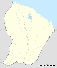
Blank administrative map of the region and department of the French Guiana, France, for geo-location purpose, with arrondissements boundaries.
Autor: Didwin973, Licencja: CC BY-SA 3.0
Rochambeau international airport's new control tower


