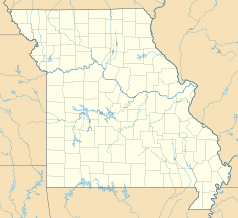
Port lotniczy Kansas City
 | |||||||
| Państwo | |||||||
|---|---|---|---|---|---|---|---|
| Stan | |||||||
| Miejscowość | |||||||
| Typ | cywilne | ||||||
| Data otwarcia | 1956 | ||||||
| Kod IATA | MCI | ||||||
| Kod ICAO | KMCI | ||||||
| Wysokość | 312,7 m n.p.m. | ||||||
| Statystyki ruchu (2007) | |||||||
| Liczba pasażerów | 11 300 000 | ||||||
| Liczba operacji | 178 466 | ||||||
| Drogi startowe | |||||||
| |||||||
| Strona internetowa | |||||||
Port lotniczy Kansas City (IATA: MCI, ICAO: KMCI) – międzynarodowy port lotniczy położony 24 km na północny zachód od centrum Kansas City, w hrabstwie Platte, w stanie Missouri, w Stanach Zjednoczonych.
Linie lotnicze i połączenia
Terminal A
- Air Canada
- Air Canada Jazz (Toronto-Pearson)
- AirTran Airways (Atlanta, Fort Myers, Miami, Orlando)
- Great Lakes Airlines (Burlington (IA), Denver, Dodge City, Garden City, Great Bend, Hays, Manhattan, Salina)
- Island Air (Grand Island, Harrison, Hot Springs, Joplin)
- Midwest Airlines Gates A19 – A30 (Boston, Los Angeles, Milwaukee, Nowy Jork-LaGuardia, Orlando, San Diego, San Francisco, Seattle/Tacoma, Tampa [seazonowo], Waszyngton-Reagan)
- Midwest Connect obsługiwane przez SkyWest (Austin, Madison, Pittsburgh, San Antonio)
- United Airlines (Chicago-O'Hare, Denver)
- United Express obsługiwane przez GoJet Airlines (Waszyngton-Dulles)
- United Express obsługiwane przez Mesa Airlines (Chicago-O'Hare)
- United Express obsługiwane przez Shuttle America (Chicago-O'Hare, Waszyngton-Dulles)
- United Express obsługiwane przez SkyWest (Chicago-O'Hare, Denver)
- US Airways (Charlotte, Phoenix)
- US Airways Express obsługiwane przez Air Wisconsin (Charlotte, Filadelfia, Waszyngton-Reagan)
- US Airways Express obsługiwane przez Mesa Airlines (Charlotte, Phoenix)
- US Airways Express obsługiwane przez PSA Airlines (Charlotte, Filadelfia)
- US Airways Express obsługiwane przez Republic Airlines (Filadelfia, Waszyngton-Reagan)
Terminal B
- Delta Air Lines (Atlanta, Salt Lake City)
- Delta Connection obsługiwane przez Atlantic Southeast Airlines (Cincinnati)
- Delta Connection obsługiwane przez Comair (Cincinnati)
- Delta Connection obsługiwane przez ExpressJet (Salt Lake City)
- Delta Connection obsługiwane przez SkyWest (Salt Lake City)
- Southwest Airlines (Albuquerque, Baltimore/Waszyngton, Chicago-Midway, Dallas-Love, Denver, Fort Lauderdale, Indianapolis, Las Vegas, Los Angeles, Nashville, Oakland, Oklahoma City, Ontario, Orlando, Phoenix, Portland (OR), St. Louis, Sacramento, San Diego, Seattle/Tacoma, Tampa, Tulsa)
Terminal C
- American Airlines (Chicago-O'Hare, Dallas/Fort Worth)
- American Eagle Airlines (Raleigh/Durham)
- Continental Airlines (Houston-Intercontinental, Newark)
- Continental Express obsługiwane przez Chautauqua Airlines (Houston-Intercontinental)
- Continental Express obsługiwane przez ExpressJet Airlines (Cleveland, Houston-Intercontinental, Newark)
- ExpressJet Airlines (Jacksonville (FL), Nowy Orlean, Ontario, Tucson)
- Frontier Airlines (Cancún, Denver, Puerto Vallarta [sezonowo])
- Northwest Airlines (Detroit, Memphis, Minneapolis/St. Paul)
- Northwest Airlink obsługiwane przez Mesaba Airlines (Minneapolis/St. Paul)
- Northwest Airlink obsługiwane przez Pinnacle Airlines (Detroit, Indianapolis, Minneapolis/St. Paul)
Media użyte na tej stronie
Autor: Alexrk2, Licencja: CC BY 3.0
Ta mapa została stworzona za pomocą GeoTools.
Autor: Uwe Dedering, Licencja: CC BY-SA 3.0
Location map of the USA (without Hawaii and Alaska).
EquiDistantConicProjection:
Central parallel:
* N: 37.0° N
Central meridian:
* E: 96.0° W
Standard parallels:
* 1: 32.0° N
* 2: 42.0° N
Made with Natural Earth. Free vector and raster map data @ naturalearthdata.com.
Formulas for x and y:
x = 50.0 + 124.03149777329222 * ((1.9694462586094064-({{{2}}}* pi / 180))
      * sin(0.6010514667026994 * ({{{3}}} + 96) * pi / 180))
y = 50.0 + 1.6155950752393982 * 124.03149777329222 * 0.02613325650382181
      - 1.6155950752393982  * 124.03149777329222 *
     (1.3236744353715044  - (1.9694462586094064-({{{2}}}* pi / 180))
      * cos(0.6010514667026994 * ({{{3}}} + 96) * pi / 180))
The flag of Navassa Island is simply the United States flag. It does not have a "local" flag or "unofficial" flag; it is an uninhabited island. The version with a profile view was based on Flags of the World and as a fictional design has no status warranting a place on any Wiki. It was made up by a random person with no connection to the island, it has never flown on the island, and it has never received any sort of recognition or validation by any authority. The person quoted on that page has no authority to bestow a flag, "unofficial" or otherwise, on the island.
Symbol lotniska do legendy mapy
FAA diagram for Kansas City International Airport (MCI) in Kansas City, Missouri, United States.
Warning: this diagram contains material which is subject to change, do not use for navigation.


