Port lotniczy Kisz
 | |||
| Państwo | |||
|---|---|---|---|
| Miejscowość | |||
| Typ | cywilne | ||
| Kod IATA | KIH | ||
| Kod ICAO | OIBK | ||
| Strefa czasowa | UTC +3:30 | ||
| Wysokość | 31 m n.p.m. | ||
| Drogi startowe | |||
| |||
| Strona internetowa | |||
Port lotniczy Kisz (IATA: KIH, ICAO: OIBK) – port lotniczy położony na wyspie Kisz, w Iranie.
Linie lotnicze i połączenia
- Aria Air (Teheran-Mehrabad)
- Caspian Airlines (Teheran-Mehrabad)
- Eram Air (Teheran-Mehrabad)
- Iran Air (Teheran-Mehrabad, Kuwejt, Dubaj)
- Iran Air Tours (Meszhed, Sziraz, Teheran-Mehrabad)
- Iran Aseman Airlines (Sziraz)
- Iranian Airlines (Teheran-Mehrabad)
- Kish Air (Abadan, Dubaj, Isfahan, Meszhed, Sziraz, Teheran-Mehrabad, Abu Zabi)
- Mahan Airlines (Kerman, Teheran-Mehrabad)
Przypisy
Linki zewnętrzne
Media użyte na tej stronie
Autor: Uwe Dedering, Licencja: CC BY-SA 3.0
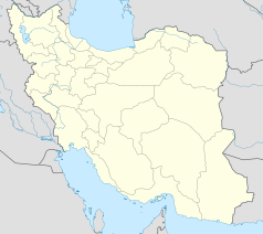
Location map of Iran.
Equirectangular projection. Stretched by 118.0%. Geographic limits of the map:
* N: 40.0° N
* S: 24.5° N
* W: 43.5° E
* E: 64.0° E
Made with Natural Earth. Free vector and raster map data @ naturalearthdata.com.
Symbol lotniska do legendy mapy
Autor: Shahram Sharifi, Licencja: CC BY-SA 4.0
Overview of Kish International Airport with a parked McDonnell Douglas MD-82 (DC-9-82) belonging to Taban Airline.


