Port lotniczy Kursk
(c) Mil.ru, CC BY 4.0 | |||
| Państwo | |||
|---|---|---|---|
| Obwód | |||
| Miejscowość | |||
| Typ | cywilne/wojskowe | ||
| Kod IATA | URS | ||
| Kod ICAO | UUOK | ||
| Wysokość | 209 m n.p.m. | ||
| Drogi startowe | |||
| |||
| Strona internetowa | |||
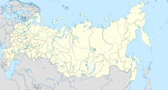
Port lotniczy Kursk (IATA: URS, ICAO: UUOK) – port lotniczy położony 7 km na wschód od Kurska, w obwodzie kurskim, w Rosji.
Media użyte na tej stronie
Autor: Uwe Dedering, Licencja: CC BY-SA 3.0
Location map of Russia.
EquiDistantConicProjection : Central parallel :
* N: 54.0° N
Central meridian :
* E: 100.0° E
Standard parallels:
* 1: 49.0° N
* 2: 59.0° N
Made with Natural Earth. Free vector and raster map data @ naturalearthdata.com.
Because the southern Kuril islands are claimed by Russia and Japan, they are shown as disputed. For more information about this see: en:Kuril Islands dispute. These islands are since 1945 under the jurisdiction of the Russian Federation.
Symbol lotniska do legendy mapy
Flag of Arms of Kursk oblast.
(c) Mil.ru, CC BY 4.0
This file comes from the websites (mil.ru, минобороны.рф) of the Ministry of Defence of the Russian Federation and is copyrighted.
This file is licenced under the Creative Commons Attribution 4.0 Licence.
In short: you are free to distribute and modify the file as long as you attribute Mil.ru.
Autor: Nzeemin, Licencja: CC BY-SA 2.0
Outline map of Kursk Oblast, Russia.


