Port lotniczy Manchester
 Terminal 2 Manchester Airport | |||||
| Państwo | |||||
|---|---|---|---|---|---|
| Miejscowość | |||||
| Typ | cywilne | ||||
| Właściciel | Manchester Airports Group, PLC | ||||
| Data otwarcia | 1938 | ||||
| Kod IATA | MAN | ||||
| Kod ICAO | EGCC | ||||
| Strefa czasowa | UTC 0 | ||||
| Wysokość | 78 m n.p.m. | ||||
| Statystyki ruchu (2015[1]) | |||||
| Liczba pasażerów | 23 136 047 | ||||
| Liczba operacji | 173 165 | ||||
| Drogi startowe | |||||
| |||||
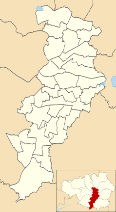
Położenie na mapie Manchesteru Contains Ordnance Survey data © Crown copyright and database right, CC BY-SA 3.0 | |||||
Położenie na mapie Wielkiej Brytanii (c) Karte: NordNordWest, Lizenz: Creative Commons by-sa-3.0 de | |||||
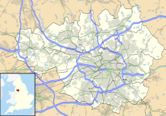
Położenie na mapie Wielkiego Manchesteru Contains Ordnance Survey data © Crown copyright and database right, CC BY-SA 3.0 | |||||
| Strona internetowa | |||||
Manchester Airport (kod ICAO: EGCC, kod IATA: MAN) − lotnisko cywilne w Manchesterze (osada Ringway) w Wielkiej Brytanii.
Lotnisko znajduje się w odległości około 14 km na południowy zachód od centrum Manchesteru. W skład portu wchodzą trzy terminale pasażerskie i terminal towarowy. Dochodzą do niego autostrada M56 (łącząca Manchester i Liverpool), linia kolejowa i drogi lokalne. Jest to trzeci co do wielkości port lotniczy w Wielkiej Brytanii, po londyńskich Heathrow i Gatwick.
Historia
W 1928 roku w dzielnicy Manchesteru (Barton) wybrano miejsce na zbudowanie lotniska miejskiego, które otwarto w 1930 roku (później było znane jako Barton Aerodrome i obecnie City Airport Manchester). W 1938 roku uruchomiono nowe większe lotnisko w Ringway, dokąd przeniesiono ruch pasażerski, które przemianowano później na Manchester Airport. Podczas II wojny światowej istniała tam baza lotnictwa wojskowego RAF Ringway. W 1951 pas został przedłużony z 1280 metrów do 1798 metrów. W 1974 roku Ringway zostało włączone w obręb Manchesteru. W 1995 roku lotnisko obsłużyło 15 milionów pasażerów. W 2004 roku posłanka Margaret Beckett z brytyjskiego rządu oficjalnie otworzyła stację kolejową na lotnisku. Pod koniec roku 2004 lotnisko miało rekordową liczbę pasażerów – 20 milionów.
Linie lotnicze i połączenia
World Freight Terminal
| Linia lotnicza | Kierunek |
|---|---|
| DHL Aviation | |
| FedEx Express | |
| Lufthansa Cargo |
Przypisy
- ↑ Datasets | UK Civil Aviation Authority, www.caa.co.uk [dostęp 2017-11-26] (ang.).
- ↑ Air Arabia Maroc launches Agadir base from Oct 2017 :: Routesonline, www.routesonline.com [dostęp 2018-03-25] (ang.).
- ↑ Flights with TUI | Thomson now TUI Airways, www.tui.co.uk [dostęp 2018-03-25] (ang.).
- ↑ airmalta resumes Manchester service from May 2018 :: Routesonline, www.routesonline.com [dostęp 2018-03-25] (ang.).
- ↑ British Airways adds new London City / Manchester routes in W17 :: Routesonline, www.routesonline.com [dostęp 2018-03-25] (ang.).
- ↑ British Airways Launch New Dublin-Manchester Route, www.dublinairport.com [dostęp 2018-03-25] (ang.).
- ↑ British Airways expands services at London City – Travel News, www.travel-news.co.uk [dostęp 2018-03-25] (ang.).
- ↑ British Airways - Launch Of Seven New Routes From Manchester, mediacentre.britishairways.com [dostęp 2018-03-25] (ang.).
- ↑ ADS Advance - BA extends services from Manchester Airport, www.adsadvance.co.uk [dostęp 2019-10-07].
- ↑ easyJet adds new routes in W17 :: Routesonline, www.routesonline.com [dostęp 2018-03-25] (ang.).
- ↑ EasyJet to fly 20 new routes out of UK next year | C&IT, www.citmagazine.com [dostęp 2018-03-25].
- ↑ Neue Strecken - Buchen - Eurowings, www.eurowings.com [dostęp 2018-03-25] (niem.).
- ↑ Flybe Timetable, www.flybe.com [dostęp 2018-03-25] (ang.).
- ↑ Twitter, mobile.twitter.com [dostęp 2018-03-25].
- ↑ Flights to Corsica | Fly To Calvi, Bastia, Figari, www.corsica.co.uk [dostęp 2018-03-25] (ang.).
- ↑ Iraqi Airways Manchester service changes from Oct 2017 :: Routesonline, www.routesonline.com [dostęp 2018-03-25] (ang.).
- ↑ New Routes and Airline News | Manchester Airport, www.manchesterairport.co.uk [dostęp 2018-03-25] (ang.).
- ↑ New Routes 2018 - Loganair, www.loganair.co.uk [dostęp 2018-03-25] [zarchiwizowane z adresu 2019-02-06] (ang.).
- ↑ Route Map - PrimeraAir, primeraair.co.uk [dostęp 2018-05-17] [zarchiwizowane z adresu 2018-08-19] (ang.).
- ↑ Ryanair Announces $300m Additional Investment With 3 New Aircraft At Manchester | Ryanair's Corporate Website, corporate.ryanair.com [dostęp 2018-03-25] (ang.).
- ↑ Saudia adds seasonal Riyadh – Manchester route in S17 :: Routesonline, www.routesonline.com [dostęp 2018-03-25] (ang.).
- ↑ Thomas Cook first holiday provider to relaunch flights to Tunisia | Travel News | Travel | Express.co.uk, www.express.co.uk [dostęp 2018-03-25] (ang.).
- ↑ UBM (UK) Ltd. 2018, Thomas Cook UK suspends Manchester – Boston in S19, „Routesonline” [dostęp 2018-08-18] (ang.).
- ↑ Thomas Cook schedules Manchester – Cape Town Jan 2018 launch :: Routesonline, www.routesonline.com [dostęp 2018-03-25] (ang.).
- ↑ Thomas Cook Airlines S18 new market additions :: Routesonline, www.routesonline.com [dostęp 2018-03-25] (ang.).
- ↑ Thomas Cook Airlines UK - 17 new routes, seven new own-brand hotels for Summer 2018 on sale, thomascookairlinesuk-newsroom.condor.com [dostęp 2018-03-25] [zarchiwizowane z adresu 2017-03-24] (niem.).
- ↑ Thomas Cook to launch new US route from Manchester, www.travelmole.com [dostęp 2018-03-25] (ang.).
- ↑ Thomas Cook UK adds Manchester – Santa Clara from May 2018 :: Routesonline, www.routesonline.com [dostęp 2018-03-25] (ang.).
- ↑ Thomas Cook Airlines UK - Seattle Calling - Thomas Cook Airlines announce new Manchester to Seattle Route for Summer 2018, thomascookairlinesuk-newsroom.condor.com [dostęp 2018-03-25] [zarchiwizowane z adresu 2017-07-21] (niem.).
- ↑ Thomas Cook Airlines widens reach – The Sun, www.thesun.co.uk [dostęp 2018-03-25] (ang.).
- ↑ New for Summer 2017 – Flights to Croatia, www.titan-airways.com [dostęp 2018-03-25].
- ↑ Charter Flight Timetables | Manchester Airport, www.manchesterairport.co.uk [dostęp 2018-03-25] (ang.).
- ↑ Flight Timetable | TUI Airways, www.tui.co.uk [dostęp 2018-03-25] (ang.).
- ↑ Virgin Atlantic Adds Manchester - New York Service from May 2017 :: Routesonline, www.routesonline.com [dostęp 2018-03-25] (ang.).
Linki zewnętrzne
- Oficjalna strona (ang.)
- Opis i historia lotniska (ang.)
Media użyte na tej stronie
(c) Karte: NordNordWest, Lizenz: Creative Commons by-sa-3.0 de
Location map of the United Kingdom
Icon representing an increase, consisting of a green-colored, up-pointing triangle.
Symbol lotniska do legendy mapy
Autor: Pedro A. Gracia Fajardo, escudo de Manual de Imagen Institucional de la Administración General del Estado, Licencja: CC0
Flaga Hiszpanii
The flag of Navassa Island is simply the United States flag. It does not have a "local" flag or "unofficial" flag; it is an uninhabited island. The version with a profile view was based on Flags of the World and as a fictional design has no status warranting a place on any Wiki. It was made up by a random person with no connection to the island, it has never flown on the island, and it has never received any sort of recognition or validation by any authority. The person quoted on that page has no authority to bestow a flag, "unofficial" or otherwise, on the island.
Flag of Portugal, created by Columbano Bordalo Pinheiro (1857-1929), officially adopted by Portuguese government in June 30th 1911 (in use since about November 1910). Color shades matching the RGB values officially reccomended here. (PMS values should be used for direct ink or textile; CMYK for 4-color offset printing on paper; this is an image for screen display, RGB should be used.)
Flag of Israel. Shows a Magen David (“Shield of David”) between two stripes. The Shield of David is a traditional Jewish symbol. The stripes symbolize a Jewish prayer shawl (tallit).
Łatwo można dodać ramkę naokoło tej grafiki
Flaga Finlandii
The flag of the Dominican Republic has a centered white cross that extends to the edges. This emblem is similar to the flag design and shows a bible, a cross of gold and 6 Dominican flags. There are branches of olive and palm around the shield and above on the ribbon is the motto "Dios,Patria!, Libertad" ("God, Country, Freedom") and to amiable freedom. The blue is said to stand for liberty, red for the fire and blood of the independence struggle and the white cross symbolized that God has not forgotten his people. "Republica Dominicana". The Dominican flag was designed by Juan Pablo Duarte, father of the national Independence of Dominican Republic. The first dominican flag was sewn by a young lady named Concepción Bona, who lived across the street of El Baluarte, monument where the patriots gathered to fight for the independence, the night of February 27th, 1844. Concepción Bona was helped by her first cousin María de Jesús Pina.
The Flag of India. The colours are saffron, white and green. The navy blue wheel in the center of the flag has a diameter approximately the width of the white band and is called Ashoka's Dharma Chakra, with 24 spokes (after Ashoka, the Great). Each spoke depicts one hour of the day, portraying the prevalence of righteousness all 24 hours of it.
Flag of Jamaica. “The sunshine, the land is green, and the people are strong and bold” is the symbolism of the colours of the flag. GOLD represents the natural wealth and beauty of sunlight; GREEN represents hope and agricultural resources; BLACK represents the strength and creativity of the people. The original symbolism, however, was "Hardships there are, but the land is green, and the sun shineth", where BLACK represented the hardships being faced.
The national flag of Kingdom of Thailand since September 2017; there are total of 3 colours:
- Red represents the blood spilt to protect Thailand’s independence and often more simply described as representing the nation.
- White represents the religion of Buddhism, the predominant religion of the nation
- Blue represents the monarchy of the nation, which is recognised as the centre of Thai hearts.
Autor: MilborneOne, Licencja: CC BY-SA 2.5
Terminal 2 at Manchester International Airport, Manchester, England.
Contains Ordnance Survey data © Crown copyright and database right, CC BY-SA 3.0
Map of Manchester, Greater Manchester, UK with electoral wards shown.
Equirectangular map projection on WGS 84 datum, with N/S stretched 165%
Geographic limits:
- West: 2.33W
- East: 2.13W
- North: 53.55N
- South: 53.33N
The flag of Aruba
Contains Ordnance Survey data © Crown copyright and database right, CC BY-SA 3.0
Map of Greater Manchester, UK with the following information shown:
- Administrative borders
- Coastline, lakes and rivers
- Roads and railways
- Urban areas
The data includes both primary routes and railway lines.
Equirectangular map projection on WGS 84 datum, with N/S stretched 165%
Geographic limits:
- West: 2.80W
- East: 1.90W
- North: 53.70N
- South: 53.32N


