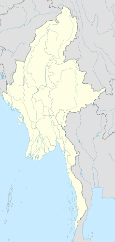
Port lotniczy Mandalaj
| Państwo | |||
|---|---|---|---|
| Miejscowość | Mandalaj | ||
| Typ | cywilne | ||
| Właściciel | Myanma Airways | ||
| Kod IATA | MDL | ||
| Kod ICAO | VYMD | ||
| Wysokość | 91 m n.p.m. | ||
| Drogi startowe | |||
| |||
Port lotniczy Mandalaj – międzynarodowy port lotniczy położony w Mandalaj, w Mjanmie. Jest drugim co do wielkości birmańskim portem lotniczym.
Linie lotnicze i połączenia
- Air Bagan (Heho, Myitkyina, Nyaung-U, Tachilek, Rangun)
- Air Mandalay (Heho, Nyaung-U, Rangun)
- China Eastern Airlines (Kunming)
- Myanma Airways (Bhamo, Kalemyo, Kengtung, Khamti, Myitkyina, Pakokku, Tachilek, Rangun)
- Yangon Airways (Heho, Kengtung, Nyaung-U, Tachilek, Rangun)
Media użyte na tej stronie
Legenda lotnisko.svg
Symbol lotniska do legendy mapy
Symbol lotniska do legendy mapy
Myanmar location map.svg
Autor: Uwe Dedering, Licencja: CC BY-SA 3.0
Location map of Myanmar. Equirectangular projection. Strechted by 105.0%. Geographic limits of the map: * N: 29.0° N * S: 9.0° N * W: 92.0° E * E: 102.0° E Made with Natural Earth. Free vector and raster map data @ naturalearthdata.com.
Autor: Uwe Dedering, Licencja: CC BY-SA 3.0
Location map of Myanmar. Equirectangular projection. Strechted by 105.0%. Geographic limits of the map: * N: 29.0° N * S: 9.0° N * W: 92.0° E * E: 102.0° E Made with Natural Earth. Free vector and raster map data @ naturalearthdata.com.
Mandalay International Airport.jpg
(c) Wagaung z angielskojęzycznej Wikipedii, CC-BY-SA-3.0
Mandalay International Airport, as viewed from the carpark.
(c) Wagaung z angielskojęzycznej Wikipedii, CC-BY-SA-3.0
Mandalay International Airport, as viewed from the carpark.


