Port lotniczy Mirny
 | |||
| Państwo | |||
|---|---|---|---|
| Republika | |||
| Miejscowość | |||
| Typ | cywilne | ||
| Właściciel | |||
| Kod IATA | MJZ | ||
| Kod ICAO | UERR | ||
| Strefa czasowa | UTC +9/+10 | ||
| Wysokość | 352 m n.p.m. | ||
| Drogi startowe | |||
| |||
Port lotniczy Mirny (IATA: MJZ, ICAO: UERR) – port lotniczy położony 4 km na wschód od Mirny, w Jakucji, w Rosji.
Kierunki lotów i linie lotnicze
| Linia lotnicza | Kierunek |
|---|---|
| Ałrosa | |
| Angara Airlines | |
| NordStar | |
| S7 Airlines | |
| Ural Airlines | |
| Yakutia Airlines |
Przypisy
- ↑ Great Circle Mapper
- ↑ https://angara.aero/docs/schedule.pdf
- ↑ S7 Airlines Adds Novosibirsk Domestic Routes in S15 :: Routesonline, www.routesonline.com [dostęp 2017-11-15] (ang.).
- ↑ Ural Airlines Adds New Domestic Routes from May/June 2015 :: Routesonline, www.routesonline.com [dostęp 2017-11-15] (ang.).
Linki zewnętrzne
Media użyte na tej stronie
Autor: Uwe Dedering, Licencja: CC BY-SA 3.0
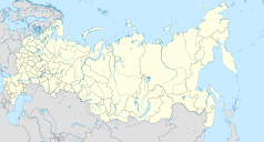
Location map of Russia.
EquiDistantConicProjection : Central parallel :
* N: 54.0° N
Central meridian :
* E: 100.0° E
Standard parallels:
* 1: 49.0° N
* 2: 59.0° N
Made with Natural Earth. Free vector and raster map data @ naturalearthdata.com.
Because the southern Kuril islands are claimed by Russia and Japan, they are shown as disputed. For more information about this see: en:Kuril Islands dispute. These islands are since 1945 under the jurisdiction of the Russian Federation.
Symbol lotniska do legendy mapy
Flag of Sakha
Autor:
- Позиционная_карта_Якутии.jpg: проекцию изменил.
Oryginalnym przesyłającym był Виктор В z rosyjskiej Wikipedii
- Russia_edcp_location_map.svg: Uwe Dedering
- derivative work: Odysseus1479 (talk)
Location map of Yakutia, Russian Federation.
Autor: Igor Dvurekov, Licencja: CC BY-SA 3.0
Aerial view of Mirny city, Mir mine and Mirny Airport


