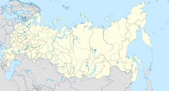
Port lotniczy Ocha
| Państwo | |||
|---|---|---|---|
| Obwód | |||
| Miejscowość | Nowostrojka k/ Ochy | ||
| Typ | cywilne | ||
| Kod IATA | OHH | ||
| Kod ICAO | UHSH | ||
| Strefa czasowa | UTC +12/+13 | ||
| Wysokość | 60 m n.p.m. | ||
| Drogi startowe | |||
| |||
Port lotniczy Ocha (IATA: OHH, ICAO: UHSH) – port lotniczy położony we wsi Nowostrojka, koło miasta Ocha w obwodzie sachalińskim, w Rosji.
Linki zewnętrzne
Media użyte na tej stronie
Autor: Uwe Dedering, Licencja: CC BY-SA 3.0
Location map of Russia.
EquiDistantConicProjection : Central parallel :
* N: 54.0° N
Central meridian :
* E: 100.0° E
Standard parallels:
* 1: 49.0° N
* 2: 59.0° N
Made with Natural Earth. Free vector and raster map data @ naturalearthdata.com.
Because the southern Kuril islands are claimed by Russia and Japan, they are shown as disputed. For more information about this see: en:Kuril Islands dispute. These islands are since 1945 under the jurisdiction of the Russian Federation.
Symbol lotniska do legendy mapy
Позиционная карта Сахалинской области
Равноугольная проекция, растяжение - 160%. Координаты краёв:
- север - 55.0° С
- юг - 43.0° С
- восток - 157.0° В
- запад - 141.0° В


