Port lotniczy Pietropawłowsk Kamczacki
 | |||||||
| Państwo | |||||||
|---|---|---|---|---|---|---|---|
| Kraj | |||||||
| Miejscowość | |||||||
| Typ | cywilne | ||||||
| Właściciel | Petropavlovsk-Kamchatsky Air Enterprise | ||||||
| Kod IATA | PKC | ||||||
| Kod ICAO | UHPP | ||||||
| Wysokość | 40 m n.p.m. | ||||||
| Drogi startowe | |||||||
| |||||||
Port lotniczy Pietropawłowsk Kamczacki (IATA: PKC, ICAO: UHPP) – port lotniczy położony w Jelizowie (niespełna 30 km na północny zachód od Pietropawłowska Kamczackiego), w Kraju Kamczackim, w Rosji.
Kierunki lotów i linie lotnicze
| Linia lotnicza | Kierunek |
|---|---|
| Aerofłot | |
| Aerofłot (obsługiwane przez Aurora) | |
| Aerofłot (obsługiwane przez Rossija) | |
| Pegas Fly | Sezonowe czartery: |
| Petropavlovsk-Kamchatsky Air Enterprise |
|
| S7 Airlines | |
| S7 Airlines (obsługiwane przez Globus | |
| Yakutia Airlines | Sezonowo: |
Przypisy
- ↑ Aurora adds Yuzhno-Sakhalinsk – Petropavlovsk-Kamchatsky route from Dec 2016 :: Routesonline, www.routesonline.com [dostęp 2017-11-26] (ang.).
Linki zewnętrzne
Media użyte na tej stronie
Autor: Uwe Dedering, Licencja: CC BY-SA 3.0
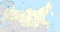
Location map of Russia.
EquiDistantConicProjection : Central parallel :
* N: 54.0° N
Central meridian :
* E: 100.0° E
Standard parallels:
* 1: 49.0° N
* 2: 59.0° N
Made with Natural Earth. Free vector and raster map data @ naturalearthdata.com.
Because the southern Kuril islands are claimed by Russia and Japan, they are shown as disputed. For more information about this see: en:Kuril Islands dispute. These islands are since 1945 under the jurisdiction of the Russian Federation.
Symbol lotniska do legendy mapy
The flag of Navassa Island is simply the United States flag. It does not have a "local" flag or "unofficial" flag; it is an uninhabited island. The version with a profile view was based on Flags of the World and as a fictional design has no status warranting a place on any Wiki. It was made up by a random person with no connection to the island, it has never flown on the island, and it has never received any sort of recognition or validation by any authority. The person quoted on that page has no authority to bestow a flag, "unofficial" or otherwise, on the island.
Autor: Nzeemin, Licencja: CC BY-SA 3.0
Административная карта Камчатского края (Россия).
- Координаты для GMT: -R148.26/179.26/48.27/67.73
- Инструменты: GMT, Inkscape
Autor: Alexander Mishin, Licencja: CC BY-SA 3.0
An Ilyushin Il-96-300 of Aeroflot at Petropavlovsk-Kamchatskiy Yelizovo Airport with Koryaksky volcano in the background
Flag of Kamchatka Krai
Autor: Kamczadałka, Licencja: CC BY-SA 3.0
lotnisko Pietropawłowsk Kamczacki położone w miejscowości Jelizowo


