Port lotniczy Sion
 | |||||
| Państwo | |||||
|---|---|---|---|---|---|
| Kanton | |||||
| Miejscowość | |||||
| Typ | cywilne | ||||
| Kod IATA | SIR | ||||
| Kod ICAO | LSGS | ||||
| Wysokość | 483 m n.p.m. | ||||
| Drogi startowe | |||||
| |||||
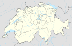
Położenie na mapie Szwajcarii (c) Karte: NordNordWest, Lizenz: Creative Commons by-sa-3.0 de | |||||
Port lotniczy Sion – szwajcarski port lotniczy położony 2,5 km na południowy zachód od Sion, stolicy kantonu Valais. Jedyne lotnisko w Szwajcarii, użytkowane wspólnie przez lotnictwo cywilne i wojskowe.
Posiada jeden pas startowy utwardzony o długości 2000 m i szerokości 40 m oraz jeden pas trawiasty o długości 660 m i szerokości 30 m. Jest portem międzynarodowym i posiada stały posterunek celny. Obsługuje głównie loty biznesowe i turystyczne. Niewielką część ruchu pasażerskiego stanowią loty czarterowe na trasach do Londynu i na Korsykę.
Kierunki lotów i linie lotnicze
| Linia Lotnicza | Kierunek |
|---|---|
| Air Glaciers | Sezonowo: |
| flyBAIR | Sezonowo:
|
| Swiss International Air Lines | Sezonowo: |
Bibliografia
Media użyte na tej stronie
(c) Karte: NordNordWest, Lizenz: Creative Commons by-sa-3.0 de
Location map of Switzerland
Symbol lotniska do legendy mapy
Autor: Pedro A. Gracia Fajardo, escudo de Manual de Imagen Institucional de la Administración General del Estado, Licencja: CC0
Flaga Hiszpanii
Flag of Canton of Valais (Switzerland). The black contours around the stars and along the division of the field are not usually seen in cantonal flags and are an artefact of this representation reflecting the image used for the pdf of the federal Fahnenreglement of 2007.
Autor: Carsten Steger, Licencja: CC BY-SA 4.0
Aerial image of the Sion airport
Autor: Abaddon1337, Licencja: CC BY-SA 3.0
Fork from media:Karte Kanton Wallis Bezirke 2010.png for geolocalisation


