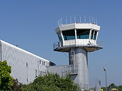
Port lotniczy Southampton
(c) Roy Gray, CC BY-SA 2.0 | |||
| Państwo | |||
|---|---|---|---|
| Miejscowość | |||
| Właściciel | BAA Limited | ||
| Kod IATA | SOU | ||
| Kod ICAO | EGHI | ||
| Strefa czasowa | UTC 0 | ||
| Wysokość | 13 m n.p.m. | ||
| Statystyki ruchu (2015[1]) | |||
| Liczba pasażerów | 1 789 470 | ||
| Liczba operacji | 39 379 | ||
| Drogi startowe | |||
| |||
Położenie na mapie Hampshire Contains Ordnance Survey data © Crown copyright and database right, CC BY-SA 3.0 | |||
Położenie na mapie Wielkiej Brytanii (c) Karte: NordNordWest, Lizenz: Creative Commons by-sa-3.0 de | |||
| Strona internetowa | |||
Southampton Airport (IATA: SOU, ICAO: EGHI) – międzynarodowy port lotniczy zlokalizowany w dzielnicy Southampton, Eastleigh. W 2006 roku z lotniska skorzystało 1,9 miliona pasażerów.
Do marca 2020 r. lotnisko w Southampton było hubem linii lotniczych Flybe.
Linie lotnicze i połączenia
| Linia lotnicza[2][3] | Kierunek[2] |
|---|---|
| Aurigny Air Services[4] | |
| Blue Islands[5] | |
| Eastern Airways[6] | |
| easyJet Switzerland | Sezonowo: |
| KLM[8] | |
| Loganair[9] |
Galeria
Embraer 190 w malowaniu Flybe na lotnisku w Southampton
- (c) Chris Gunns, CC BY-SA 2.0
Widok na płytę postojową lotniska, w rzędzie stoją samoloty w malowaniu Flybe
Samolot linii lotniczych Eastern Airways startuje z lotniska Southampton
- (c) Peter Facey, CC BY-SA 2.0
Bombardier Q 400 linii lotniczych Flybe startuje z lotniska w Southampton
Przypisy
- ↑ Datasets | UK Civil Aviation Authority, www.caa.co.uk [dostęp 2017-11-26] (ang.).
- ↑ a b Linie lotnicze i kierunki lotów pochodzą ze strony lotniska. Stan na październik 2020
- ↑ Airlines | Southampton Airport, www.southamptonairport.com [dostęp 2020-10-15].
- ↑ a b c Aurigny | Southampton Airport, www.southamptonairport.com [dostęp 2020-10-15].
- ↑ a b c d e Blue Islands | Southampton Airport, www.southamptonairport.com [dostęp 2020-10-15].
- ↑ a b c d e f g Eastern Airways | Southampton Airport, www.southamptonairport.com [dostęp 2020-10-15].
- ↑ Easyjet to launch routes from Southampton - Business Traveller – The leading magazine for frequent flyers, www.businesstraveller.com [dostęp 2018-04-13] (ang.).
- ↑ a b KLM | Southampton Airport, www.southamptonairport.com [dostęp 2020-10-15].
- ↑ a b c d Loganair | Southampton Airport, www.southamptonairport.com [dostęp 2020-10-15].
Media użyte na tej stronie
Contains Ordnance Survey data © Crown copyright and database right, CC BY-SA 3.0
Map of Hampshire, UK with the following information shown:
- Administrative borders
- Coastline, lakes and rivers
- Roads and railways
- Urban areas
Equirectangular map projection on WGS 84 datum, with N/S stretched 155%
Geographic limits:
- West: 2.01W
- East: 0.68W
- North: 51.41N
- South: 50.68N
(c) Karte: NordNordWest, Lizenz: Creative Commons by-sa-3.0 de
Location map of the United Kingdom
Icon representing a decrease, consisting of a red-colored, down-pointing triangle.
Symbol lotniska do legendy mapy
(c) Roy Gray, CC BY-SA 2.0
Southampton Airport Control Tower. Southampton Airport
(c) Chris Gunns, CC BY-SA 2.0
Southampton Airport, early morning
(c) Peter Facey, CC BY-SA 2.0
Southampton Airport looking E. Looking E from short term car park roof. Shows Flybe aircraft taking off on middle section of the runway with airport radar behind. Taxiway in foreground.


