Port lotniczy Svea
| |||
 | |||
| Państwo | |||
| Terytorium zależne | |||
| Miejscowość | Sveagruva, Svalbard | ||
| Typ | cywilne | ||
| Kod ICAO | ENSA | ||
| Strefa czasowa | UTC +1 | ||
| Wysokość | 8 m n.p.m. | ||
| Drogi startowe | |||
|---|---|---|---|
| |||
Port lotniczy Svea (norw.: Svea lufthavn, ang.: Svea Airport, kod ICAO: ENSA) – port lotniczy zlokalizowany w Sveagruva w Svalbardzie (terytorium Norwegii).
Bibliografia
Media użyte na tej stronie
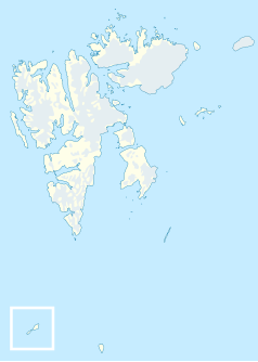
Autor: NordNordWest, Licencja: CC BY-SA 3.0
Location map of Svalbard, Norway
Symbol lotniska do legendy mapy
Autor: Bjoertvedt, Licencja: CC BY-SA 3.0
Image taken from airplane, of the mining settlement "Sveagruva" ("Svea") in Central Spitsbergen, situated South of the Bragamzavågen bay.
Autor: source file by Tentotwo, Licencja: CC BY-SA 3.0
Location Map of the Arctic Ocean
- Projection: Azimuthal equidistant projection.
- Area of interest:
- N: 90.0° N
- S: 70.0° N
- W: -180.0° E
- E: 180.0° E
- Projection center:
- NS: 90° N
- WE: 0° E


